
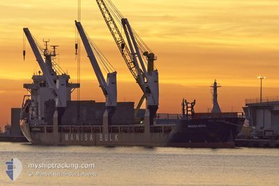
MANISA SOFIA
Cargo
Current Trip
ESGND
| Time Travelled | 4 days |
|---|---|
| Remaining Time | --- |
| Distance Travelled | 177.88 nm |
| Remaining Distance | --- |
| AVG Speed | 9.7 Knots |
| MAX Speed | 13.4 Knots |
| AVG Wind | 13.5 knots |
| MAX Wind | 25.8 knots |
| MIN Temp | 18°C / 64.4°F |
| MAX Temp | 21°C / 69.8°F |
| Draught | 6 m |
| Position Received | 22 h, 49 m ago |
Current Position
| Longitude | -16.48868° |
|---|---|
| Latitude | 28.04060° |
| Status | Under way using engine |
| Speed | 8.2 Knots |
| Course | 301.9° |
| Area | North Atlantic Ocean |
| Station | T-AIS |
| Position Received | 22 h, 49 m ago |
Information
The current position of MANISA SOFIA is in North Atlantic Ocean with coordinates 28.04060° / -16.48868° as reported on 2025-06-06 15:02 by AIS to our vessel tracker app. The vessel's current speed is 8.2 Knots
The vessel MANISA SOFIA (IMO: 9428396, MMSI: 255802580) is a Cargo It's sailing under the flag of [PT] Portugal.
In this page you can find informations about the vessels current position, last detected port calls, and current voyage information. If the vessels is not in coverage by AIS you will find the latest position.
The current position of MANISA SOFIA is detected by our AIS receivers and we are not responsible for the reliability of the data. The last position was recorded while the vessel was in Coverage by the Ais receivers of our vessel tracking app.
The current draught of MANISA SOFIA as reported by AIS is 6 meters
Weather
| Temperature | 20.6°C / 69.08°F |
|---|---|
| Wind Speed | 5 knots |
| Direction | 95° E |
| Pressure | 1019.2 hPa |
| Humidity | 76 % |
| Cloud Coverage | 7 % |
Featured Company
Last Port Calls
| Port | Arrival | Departure | Time In Port |
|---|---|---|---|
| 2025-05-31 08:56 | 2025-06-02 21:27 | 2 d | |
| 2025-05-25 17:16 | 2025-05-27 20:24 | 2 d | |
| 2025-05-21 17:37 | 2025-05-23 11:42 | 1 d | |
| 2025-04-23 20:43 | 2025-04-24 18:00 | 21 h | |
| 2025-04-08 12:12 | 2025-04-11 03:15 | 2 d | |
| 2025-04-02 07:33 |
Last Trips
| Origin | Departure | Destination | Arrival | Distance | |
|---|---|---|---|---|---|
| 2025-05-27 21:24 | 2025-05-31 09:56 | 43.82 nm | |||
| 2025-05-23 12:42 | 2025-05-25 18:16 | 59.55 nm | |||
| 2025-04-24 20:00 | 2025-05-21 18:37 | 1710.50 nm | |||
| 2025-04-11 06:15 | 2025-04-23 22:43 | 2434.52 nm | |||
| 2025-04-02 09:33 | 2025-04-08 15:12 | 523.32 nm |
Events
| Time | Event | Details | Position / Dest | Info |
|---|---|---|---|---|
| 2025-06-06 16:28 | STOP Moving | 7.36 nm, North East of PUERTO DE GUINCHO |
28.07741 / -16.48996
ESGND
|
Speed: Course: 44° |
| 2025-06-06 15:10 | Status Changed | Default Under way using engine |
28.04516 / -16.49633
ESGND
|
Speed: 8.2 kn Course: 301.9° |
| 2025-06-06 15:02 | Status Changed | Under way using engine Default |
28.04060 / -16.48868
ESGND
|
Speed: 8.8 kn Course: 301° |
| 2025-06-06 15:02 | OUT of Coverage |
28.04060 / -16.48868
North Atlantic Ocean
|
Speed: 8.2 kn Course: 301.9° |
|
| 2025-06-06 14:56 | Status Changed | Default Under way using engine |
28.03378 / -16.47660
ESGND
|
Speed: 8.8 kn Course: 301.9° |
| 2025-06-06 12:02 | ETA Changed | 2026/05/06 14:30 2026/05/06 07:00 |
28.45089 / -16.20568
ESGND
|
Speed: 11 kn Course: 208.1° |
| 2025-06-06 11:55 | ETA Changed | 2026/05/06 07:00 2026/05/03 07:00 |
28.46946 / -16.19475
ESGND
|
Speed: 11.6 kn Course: 207.7° |
| 2025-06-06 11:45 | START Moving | 0.83 nm, South of SAN ANDRES |
28.49049 / -16.18704
ESGND
|
Speed: 3.2 kn Course: 147° |
| 2025-06-06 11:38 | Status Changed | Under way using engine At anchor |
28.49195 / -16.18924
ESGND
|
Speed: 0.5 kn Course: 354° |
| 2025-06-06 08:30 | Status Changed | At anchor Default |
28.49073 / -16.18887
ESGND
|
Speed: 0.2 kn Course: 354° |