
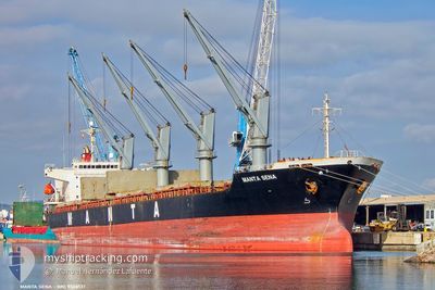
MANTA SENA
General Cargo
Current Trip
| Time Travelled | 2 days |
|---|---|
| Remaining Time | --- |
| Distance Travelled | 684.13 nm |
| Remaining Distance | --- |
| AVG Speed | 11.7 Knots |
| MAX Speed | 13.4 Knots |
| AVG Wind | 16.3 knots |
| MAX Wind | 26.3 knots |
| MIN Temp | 8.9°C / 48.02°F |
| MAX Temp | 14.5°C / 58.1°F |
| Draught | 8.7 m |
| Position Received | 3 m ago |
Current Position
| Longitude | -8.26102° |
|---|---|
| Latitude | 51.70284° |
| Status | At anchor |
| Speed | 0.1 Knots |
| Course | 160° |
| Area | Celtic Sea |
| Station | T-AIS |
| Position Received | 3 m ago |
Info
Information
The current position of MANTA SENA is in Celtic Sea with coordinates 51.70284° / -8.26102° as reported on 2025-02-16 04:42 by AIS to our vessel tracker app. The vessel's current speed is 0.1 Knots
The vessel MANTA SENA (IMO: 9338137, MMSI: 636021630) is a General Cargo that was built in 2006 ( 19 years old ). It's sailing under the flag of [LR] Liberia.
In this page you can find informations about the vessels current position, last detected port calls, and current voyage information. If the vessels is not in coverage by AIS you will find the latest position.
The current position of MANTA SENA is detected by our AIS receivers and we are not responsible for the reliability of the data. The last position was recorded while the vessel was in Coverage by the Ais receivers of our vessel tracking app.
The current draught of MANTA SENA as reported by AIS is 8.7 meters
Weather
| Temperature | 8.9°C / 48.02°F |
|---|---|
| Wind Speed | 18 knots |
| Direction | 121° ESE |
| Pressure | 1011.2 hPa |
| Humidity | 84.5 % |
| Cloud Coverage | 100 % |
Featured Company
Most Visited Ports (Last year)
| Port | Arrivals | |
|---|---|---|
| 2 | ||
| 2 | ||
| 2 | ||
| 2 | ||
| 2 | ||
| 1 |
Last Trips
| Origin | Departure | Destination | Arrival | Distance | |
|---|---|---|---|---|---|
| 2025-02-05 02:36 | 2025-02-08 11:57 | 733.01 nm | |||
| 2025-01-27 19:25 | 2025-02-02 08:51 | 306.53 nm | |||
| 2025-01-15 22:11 | 2025-01-24 08:42 | 470.76 nm | |||
| 2024-12-06 15:02 | 2025-01-09 00:13 | 4078.66 nm | |||
| 2024-11-29 19:27 | 2024-12-01 01:48 | 381.47 nm |
Events
| Time | Event | Details | Position / Dest | Info |
|---|---|---|---|---|
| 2025-02-16 01:48 | Status Changed | At anchor Default |
51.70211 / -8.26254
IE ORK
|
Speed: 0.4 kn Course: 129° |
| 2025-02-16 01:45 | Status Changed | Default At anchor |
51.70208 / -8.26270
IE ORK
|
Speed: 0.1 kn Course: 137° |
| 2025-02-15 19:36 | Status Changed | At anchor Default |
51.70257 / -8.26078
IE ORK
|
Speed: 0.2 kn Course: 150° |
| 2025-02-15 19:33 | Status Changed | Default At anchor |
51.70251 / -8.26110
IE ORK
|
Speed: 0.4 kn Course: 145° |
| 2025-02-15 18:36 | Status Changed | At anchor Under way using engine |
51.70103 / -8.25989
IE ORK
|
Speed: 0.6 kn Course: 168° |
| 2025-02-15 18:35 | STOP Moving | 7.67 nm, South of WHITEGATE |
51.70095 / -8.25971
IE ORK
|
Speed: 0.3 kn Course: 168° |
| 2025-02-15 14:54 | Change Sea Area | Irish part of the Celtic Sea Portuguese part of the North Atlantic Ocean |
51.01234 / -8.21849
Celtic Sea
IE ORK
|
Speed: 12.8 kn Course: 4.8° |
| 2025-02-15 14:54 | Status Changed | Under way using engine Default |
51.01234 / -8.21849
IE ORK
|
Speed: 12.8 kn Course: 5° |
| 2025-02-15 14:54 | IN Coverage |
51.01234 / -8.21849
Celtic Sea
IE ORK
|
Speed: 12.8 kn Course: 4.8° |
|
| 2025-02-13 15:04 | OUT of Coverage |
41.36651 / -9.29674
North Atlantic Ocean
IE ORK
|
Speed: 12 kn Course: 337.7° |