

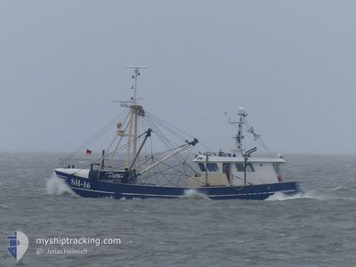
MARIE LOUISE SH-16
Fishing

Current Trip
CUXHAVEN
| Time Travelled | 18 h, 21 mins |
|---|---|
| Remaining Time | --- |
| Distance Travelled | 31.82 nm |
| Remaining Distance | --- |
| AVG Speed | 5.4 Knots |
| MAX Speed | 7.7 Knots |
| AVG Wind | 14.2 knots |
| MAX Wind | 16.8 knots |
| MIN Temp | 12.6°C / 54.68°F |
| MAX Temp | 14.8°C / 58.64°F |
| Draught | 2.6 m |
| Position Received | 33 m ago |
Current Position
| Longitude | 8.53807° |
|---|---|
| Latitude | 53.97601° |
| Status | Engaged in Fishing |
| Speed | 3.1 Knots |
| Course | 258° |
| Area | North Sea |
| Station | T-AIS |
| Position Received | 33 m ago |
Information
The current position of MARIE LOUISE SH-16 is in North Sea with coordinates 53.97601° / 8.53807° as reported on 2025-06-10 01:06 by AIS to our vessel tracker app. The vessel's current speed is 3.1 Knots
The vessel MARIE LOUISE SH-16 (MMSI: 211588480) is a Fishing It's sailing under the flag of [DE] Germany.
In this page you can find informations about the vessels current position, last detected port calls, and current voyage information. If the vessels is not in coverage by AIS you will find the latest position.
The current position of MARIE LOUISE SH-16 is detected by our AIS receivers and we are not responsible for the reliability of the data. The last position was recorded while the vessel was in Coverage by the Ais receivers of our vessel tracking app.
The current draught of MARIE LOUISE SH-16 as reported by AIS is 2.6 meters
Weather
| Temperature | 14.6°C / 58.28°F |
|---|---|
| Wind Speed | 17 knots |
| Direction | 205° SSW |
| Pressure | 1015.8 hPa |
| Humidity | 79.2 % |
| Cloud Coverage | 100 % |


Featured Company
Last Port Calls
| Port | Arrival | Departure | Time In Port |
|---|---|---|---|
| 2025-06-05 08:34 | 2025-06-09 09:18 | 4 d | |
| 2025-05-29 14:19 | 2025-06-02 11:08 | 3 d | |
| 2025-05-28 21:24 | 2025-05-29 06:12 | 8 h | |
| 2025-05-22 08:16 | 2025-05-26 08:45 | 4 d | |
| 2025-05-15 09:30 | 2025-05-19 09:03 | 3 d | |
| 2025-05-08 11:04 | 2025-05-12 09:10 | 3 d | |
| 2025-05-01 10:08 | 2025-05-05 11:04 | 4 d | |
| 2025-04-25 09:23 | 2025-04-28 10:22 | 3 d | |
| 2025-04-21 14:51 | 2025-04-22 10:43 | 19 h | |
| 2025-04-16 15:55 | 2025-04-19 10:56 | 2 d |
Most Visited Ports (Last year)
| Port | Arrivals | |
|---|---|---|
| 17 | ||
| 11 | ||
| 8 | ||
| 5 | ||
| 4 | ||
| 4 |
Last Trips
| Origin | Departure | Destination | Arrival | Distance | |
|---|---|---|---|---|---|
| 2025-06-02 11:08 | 2025-06-05 08:34 | 120.08 nm | |||
| 2025-05-29 06:12 | 2025-05-29 14:19 | 5.58 nm | |||
| 2025-05-26 08:45 | 2025-05-28 21:24 | 47.91 nm | |||
| 2025-05-19 09:03 | 2025-05-22 08:16 | 93.66 nm | |||
| 2025-05-12 09:10 | 2025-05-15 09:30 | 7.02 nm | |||
| 2025-05-05 11:04 | 2025-05-08 11:04 | 17.21 nm | |||
| 2025-04-28 10:22 | 2025-05-01 10:08 | 44.91 nm | |||
| 2025-04-22 10:43 | 2025-04-25 09:23 | 145.49 nm | |||
| 2025-04-19 10:56 | 2025-04-21 14:51 | 6.54 nm | |||
| 2025-04-11 00:35 | 2025-04-16 15:55 | 194.09 nm |
Events
| Time | Event | Details | Position / Dest | Info |
|---|---|---|---|---|
| 2025-06-09 21:57 | IN Coverage |
53.98116 / 8.60074
North Sea
|
Speed: 3.1 kn Course: 120.7° |
|
| 2025-06-09 20:36 | OUT of Coverage |
53.96836 / 8.62607
North Sea
|
Speed: 2.1 kn Course: 283.7° |
|
| 2025-06-09 20:29 | STOP Moving | 6.46 nm, North West of CUXHAVEN |
53.96587 / 8.63626
CUXHAVEN
|
Speed: 0.3 kn Course: 305° |
| 2025-06-09 19:52 | IN Coverage |
53.98835 / 8.58281
North Sea
|
Speed: 3.7 kn Course: 139.3° |
|
| 2025-06-09 18:43 | OUT of Coverage |
53.97681 / 8.60587
North Sea
|
Speed: 2.6 kn Course: 312.9° |
|
| 2025-06-09 11:44 | IN Coverage |
53.97337 / 8.61823
North Sea
|
Speed: 2.8 kn Course: 137.8° |
|
| 2025-06-09 10:18 | OUT of Coverage |
53.97258 / 8.61949
North Sea
|
Speed: 2.3 kn Course: 311.8° |
|
| 2025-06-09 09:57 | IN Coverage |
53.97761 / 8.60940
North Sea
|
Speed: 3.3 kn Course: 124.2° |
|
| 2025-06-09 08:38 | OUT of Coverage |
53.97029 / 8.62245
North Sea
|
Speed: 2.3 kn Course: 295° |
|
| 2025-06-09 07:18 | PORT DEPARTURE |
|
53.87232 / 8.71508
CUXHAVEN
|
Speed: 7.9 kn Course: 25° |