
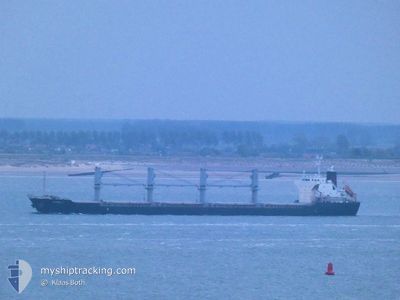
MARINA L
Bulk Carrier
Current Trip
| Time Travelled | 27 days |
|---|---|
| Remaining Time | 10 h, 35 mins |
| Distance Travelled | 3763.10 nm |
| Remaining Distance | 126.96 nm |
| AVG Speed | 11.4 Knots |
| MAX Speed | 13.5 Knots |
| AVG Wind | 11.2 knots |
| MAX Wind | 28.8 knots |
| MIN Temp | 4.6°C / 40.28°F |
| MAX Temp | 19.8°C / 67.64°F |
| Draught | 5.6 m |
| Position Received | 1 m ago |
Current Position
| Longitude | 31.48704° |
|---|---|
| Latitude | 70.80150° |
| Status | Under way using engine |
| Speed | 11.5 Knots |
| Course | 126.2° |
| Area | Barentsz Sea |
| Station | T-AIS |
| Position Received | 1 m ago |
Information
The current position of MARINA L is in Barentsz Sea with coordinates 70.80150° / 31.48704° as reported on 2025-05-24 21:11 by AIS to our vessel tracker app. The vessel's current speed is 11.5 Knots and is heading at the port of MURMANSK. The estimated time of arrival as calculated by MyShipTracking vessel tracking app is 2025-05-25 07:47 LT
The vessel MARINA L (IMO: 9675705, MMSI: 636016827) is a Bulk Carrier that was built in 2014 ( 11 years old ). It's sailing under the flag of [LR] Liberia.
In this page you can find informations about the vessels current position, last detected port calls, and current voyage information. If the vessels is not in coverage by AIS you will find the latest position.
The current position of MARINA L is detected by our AIS receivers and we are not responsible for the reliability of the data. The last position was recorded while the vessel was in Coverage by the Ais receivers of our vessel tracking app.
The current draught of MARINA L as reported by AIS is 5.6 meters
Weather
| Temperature | 5°C / 41°F |
|---|---|
| Wind Speed | 15 knots |
| Direction | 121° ESE |
| Pressure | 1017.3 hPa |
| Humidity | 98.5 % |
| Cloud Coverage | 100 % |
Featured Company
Last Port Calls
| Port | Arrival | Departure | Time In Port |
|---|---|---|---|
| 2025-04-24 02:55 | 2025-04-26 23:50 | 2 d | |
| 2025-04-01 06:46 | 2025-04-01 16:37 | 9 h | |
| 2025-03-31 00:20 | 2025-03-31 16:39 | 16 h | |
| 2025-03-30 06:09 | 2025-03-30 16:23 | 10 h | |
| 2025-03-29 14:56 | 2025-03-30 04:27 | 13 h | |
| 2025-03-07 07:00 | 2025-03-11 04:46 | 3 d |
Most Visited Ports (Last year)
| Port | Arrivals | |
|---|---|---|
| 8 | ||
| 6 | ||
| 2 | ||
| 1 | ||
| 1 | ||
| 1 |
Last Trips
| Origin | Departure | Destination | Arrival | Distance | |
|---|---|---|---|---|---|
| 2025-04-01 19:37 | 2025-04-24 03:55 | 2709.04 nm | |||
| 2025-03-31 19:39 | 2025-04-01 09:46 | 60.87 nm | |||
| 2025-03-30 19:23 | 2025-03-31 03:20 | 68.11 nm | |||
| 2025-03-30 07:27 | 2025-03-30 09:09 | 14.31 nm | |||
| 2025-03-11 06:46 | 2025-03-29 17:56 | 1671.70 nm | |||
| 2025-01-28 13:10 | 2025-03-07 09:00 | 4964.60 nm |
Events
| Time | Event | Details | Position / Dest | Info |
|---|---|---|---|---|
| 2025-05-24 13:04 | Status Changed | Under way using engine Default |
71.55757 / 27.22618
RU MMK
|
Speed: 11.9 kn Course: 106° |
| 2025-05-24 13:02 | Status Changed | Default Under way using engine |
71.55930 / 27.20780
RU MMK
|
Speed: 11.9 kn Course: 106.4° |
| 2025-05-24 10:31 | Draught Changed | 5.6 5.5 |
71.67076 / 25.63789
RU MMK
|
Speed: 11.9 kn Course: 76.3° |
| 2025-05-24 10:31 | ETA Changed | 2025/05/25 09:30 2025/05/25 05:00 |
71.67076 / 25.63789
RU MMK
|
Speed: 11.9 kn Course: 76.3° |
| 2025-05-24 10:21 | Status Changed | Under way using engine Default |
71.66460 / 25.55005
RU MMK
|
Speed: 12.3 kn Course: 78° |
| 2025-05-24 10:17 | Status Changed | Default Under way using engine |
71.66193 / 25.50801
RU MMK
|
Speed: 12.3 kn Course: 77.7° |
| 2025-05-24 09:50 | Status Changed | Under way using engine Default |
71.64276 / 25.22579
RU MMK
|
Speed: 12.4 kn Course: 77° |
| 2025-05-24 09:46 | Status Changed | Default Under way using engine |
71.63959 / 25.18134
RU MMK
|
Speed: 12.4 kn Course: 77.5° |
| 2025-05-24 09:15 | Change Sea Area | Norwegian part of the Barentsz Sea Norwegian part of the Norwegian Sea |
71.61651 / 24.85221
Barentsz Sea
RU MMK
|
Speed: 12.3 kn Course: 79.7° |
| 2025-05-24 00:32 | Status Changed | Under way using engine Default |
71.09417 / 19.82735
RU MMK
|
Speed: 12.2 kn Course: 65° |