

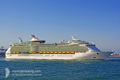
MARINER OF THE SEAS
Passengers Ship
Current Trip
| Trip Time | 11 h, 40 mins |
|---|---|
| Trip Distance | 105.68 nm |
| AVG Speed | 9 Knots |
| MAX Speed | 11.9 Knots |
| Draught | 9.3 m |
| AVG Wind | 10 knots |
| MAX Wind | 17 knots |
| MIN Temp | 27.6°C / 81.68°F |
| MAX Temp | 28.7°C / 83.66°F |
| Position Received | 1 m ago |
Current Position
| Longitude | -86.95990° |
|---|---|
| Latitude | 20.50856° |
| Status | Under way using engine |
| Speed | 5.4 Knots |
| Course | 50° |
| Area | Caribbean Sea |
| Station | T-AIS |
| Position Received | 1 m ago |
Information
The current position of MARINER OF THE SEAS is in Caribbean Sea with coordinates 20.50856° / -86.95990° as reported on 2025-06-12 11:18 by AIS to our vessel tracker app. The vessel's current speed is 5.4 Knots and is currently inside the port of COZUMEL.
The vessel MARINER OF THE SEAS (IMO: 9227510, MMSI: 311493000) is a Passengers Ship that was built in 2003 ( 22 years old ). It's sailing under the flag of [BS] Bahamas.
In this page you can find informations about the vessels current position, last detected port calls, and current voyage information. If the vessels is not in coverage by AIS you will find the latest position.
The current position of MARINER OF THE SEAS is detected by our AIS receivers and we are not responsible for the reliability of the data. The last position was recorded while the vessel was in Coverage by the Ais receivers of our vessel tracking app.
The current draught of MARINER OF THE SEAS as reported by AIS is 9.3 meters
Weather
| Temperature | 27.6°C / 81.68°F |
|---|---|
| Wind Speed | 9 knots |
| Direction | 112° ESE |
| Pressure | 1014.6 hPa |
| Humidity | 76.3 % |
| Cloud Coverage | 15 % |
Featured Company
Last Port Calls
| Port | Arrival | Departure | Time In Port |
|---|---|---|---|
| 2025-06-12 06:17 | |||
| 2025-06-11 11:00 | 2025-06-11 18:37 | 7 h | |
| 2025-06-09 06:36 | 2025-06-09 16:02 | 9 h | |
| 2025-06-07 06:47 | 2025-06-07 16:50 | 10 h | |
| 2025-06-05 06:36 | 2025-06-05 16:05 | 9 h | |
| 2025-06-03 06:08 | 2025-06-03 17:04 | 10 h | |
| 2025-06-02 10:30 | 2025-06-02 19:01 | 8 h | |
| 2025-05-31 06:21 | 2025-05-31 16:20 | 9 h | |
| 2025-05-29 06:24 | 2025-05-29 16:45 | 10 h | |
| 2025-05-28 11:26 | 2025-05-28 18:56 | 7 h |
Most Visited Ports (Last year)
| Port | Arrivals | |
|---|---|---|
| 79 | ||
| 78 | ||
| 26 |
Last Trips
| Origin | Departure | Destination | Arrival | Distance | |
|---|---|---|---|---|---|
| 2025-06-11 18:37 | 2025-06-12 06:17 | 105.68 nm | |||
| 2025-06-09 16:02 | 2025-06-11 11:00 | 831.51 nm | |||
| 2025-06-07 16:50 | 2025-06-09 06:36 | 715.89 nm | |||
| 2025-06-05 16:05 | 2025-06-07 06:47 | 716.16 nm | |||
| 2025-06-03 17:04 | 2025-06-05 06:36 | 715.26 nm | |||
| 2025-06-02 19:01 | 2025-06-03 06:08 | 116.35 nm | |||
| 2025-05-31 16:20 | 2025-06-02 10:30 | 826.68 nm | |||
| 2025-05-29 16:45 | 2025-05-31 06:21 | 704.04 nm | |||
| 2025-05-28 18:56 | 2025-05-29 06:24 | 115.97 nm | |||
| 2025-05-26 16:09 | 2025-05-28 11:26 | 819.02 nm |
Events
| Time | Event | Details | Position / Dest | Info |
|---|---|---|---|---|
| 2025-06-12 11:17 | PORT ARRIVAL |
|
20.50760 / -86.96089
[MX] COZUMEL
|
Speed: 6.5 kn Course: 47.5° |
| 2025-06-12 10:57 | Destination Changed | MX CZM MX CMM |
20.48677 / -87.00422
MX CZM
|
Speed: 9.1 kn Course: 72.9° |
| 2025-06-12 10:57 | ETA Changed | 2025/06/12 11:15 2025/06/11 16:30 |
20.48677 / -87.00422
MX CZM
|
Speed: 9.1 kn Course: 72.9° |
| 2025-06-12 10:13 | IN Coverage |
20.38479 / -87.06242
Caribbean Sea
|
Speed: 11.9 kn Course: 11.3° |
|
| 2025-06-11 23:37 | PORT DEPARTURE |
|
18.86500 / -87.49167
MX CMM
|
Speed: Course: 61° |
| 2025-06-11 16:00 | PORT ARRIVAL |
|
18.73119 / -87.68731
[MX] COSTA MAYA
|
Speed: 17.6 kn Course: 208° |
| 2025-06-11 10:07 | Status Changed | Default Under way using engine |
20.33128 / -87.12642
MX CMM
|
Speed: 16.7 kn Course: 211.2° |
| 2025-06-11 10:04 | OUT of Coverage |
20.34145 / -87.11994
Caribbean Sea
MX CMM
|
Speed: 16.7 kn Course: 211.2° |
|
| 2025-06-11 09:17 | Draught Changed | 9.3 9 |
20.55045 / -86.99185
MX CMM
|
Speed: 17.9 kn Course: 209° |
| 2025-06-11 09:17 | Destination Changed | MX CMM US GAL |
20.55045 / -86.99185
MX CMM
|
Speed: 17.9 kn Course: 209° |