
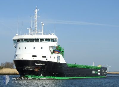
MAXIMAR
Cargo
Current Trip
| Time Travelled | 8 days |
|---|---|
| Remaining Time | 3 mins |
| Distance Travelled | 1020.15 nm |
| Remaining Distance | 1.14 nm |
| AVG Speed | 8.7 Knots |
| MAX Speed | 11.4 Knots |
| AVG Wind | 15.7 knots |
| MAX Wind | 29 knots |
| MIN Temp | 0.6°C / 33.08°F |
| MAX Temp | 8.7°C / 47.66°F |
| Draught | 6.2 m |
| Position Received | 1 m ago |
Current Position
| Longitude | 10.25811° |
|---|---|
| Latitude | 56.15692° |
| Status | Under way using engine |
| Speed | 7 Knots |
| Course | 297.2° |
| Area | Kattegat |
| Station | T-AIS |
| Position Received | 1 m ago |
Info
Information
The current position of MAXIMAR is in Kattegat with coordinates 56.15692° / 10.25811° as reported on 2025-12-14 16:54 by AIS to our vessel tracker app. The vessel's current speed is 7 Knots and is heading at the port of AARHUS. The estimated time of arrival as calculated by MyShipTracking vessel tracking app is 2025-12-14 17:58 LT
The vessel MAXIMAR (IMO: 9951862, MMSI: 210674000) is a Cargo It's sailing under the flag of [CY] Cyprus.
In this page you can find informations about the vessels current position, last detected port calls, and current voyage information. If the vessels is not in coverage by AIS you will find the latest position.
The current position of MAXIMAR is detected by our AIS receivers and we are not responsible for the reliability of the data. The last position was recorded while the vessel was in Coverage by the Ais receivers of our vessel tracking app.
The current draught of MAXIMAR as reported by AIS is 6.2 meters
Weather
| Temperature | 8.7°C / 47.66°F |
|---|---|
| Wind Speed | 14 knots |
| Direction | 238° WSW |
| Pressure | 1013.5 hPa |
| Humidity | 82.1 % |
| Cloud Coverage | 100 % |
Featured Company
Last Port Calls
| Port | Arrival | Departure | Time In Port |
|---|---|---|---|
| 2025-12-05 08:01 | 2025-12-06 12:45 | 1 d | |
| 2025-12-01 00:53 | 2025-12-02 10:24 | 1 d | |
| 2025-11-29 14:14 | 2025-11-29 15:04 | 50 m | |
| 2025-11-26 16:11 | 2025-11-29 09:22 | 2 d | |
| 2025-11-26 10:40 | 2025-11-26 11:15 | 34 m | |
| 2025-11-22 09:01 | 2025-11-24 21:25 | 2 d | |
| 2025-11-18 19:22 | 2025-11-19 13:46 | 18 h | |
| 2025-11-17 03:42 | 2025-11-18 12:46 | 1 d | |
| 2025-11-08 17:36 | 2025-11-12 06:08 | 3 d | |
| 2025-11-05 12:20 | 2025-11-06 23:32 | 1 d |
Most Visited Ports (Last year)
| Port | Arrivals | |
|---|---|---|
| 4 | ||
| 4 | ||
| 3 | ||
| 3 | ||
| 3 | ||
| 2 |
Last Trips
| Origin | Departure | Destination | Arrival | Distance | |
|---|---|---|---|---|---|
| 2025-12-02 10:24 | 2025-12-05 08:01 | 746.24 nm | |||
| 2025-11-29 15:04 | 2025-12-01 00:53 | 297.81 nm | |||
| 2025-11-29 09:22 | 2025-11-29 14:14 | 48.90 nm | |||
| 2025-11-26 11:15 | 2025-11-26 16:11 | 48.63 nm | |||
| 2025-11-24 21:25 | 2025-11-26 10:40 | 274.28 nm | |||
| 2025-11-19 13:46 | 2025-11-22 09:01 | 579.97 nm | |||
| 2025-11-18 12:46 | 2025-11-18 19:22 | 49.27 nm | |||
| 2025-11-12 06:08 | 2025-11-17 03:42 | 664.19 nm | |||
| 2025-11-06 23:32 | 2025-11-08 17:36 | 356.92 nm | |||
| 2025-11-04 03:50 | 2025-11-05 12:20 | 323.39 nm |
Events
| Time | Event | Details | Position / Dest | Info |
|---|---|---|---|---|
| 2025-12-14 14:01 | Status Changed | Under way using engine Default |
56.04964 / 10.72818
DKAAR
|
Speed: 8.5 kn Course: 271° |
| 2025-12-14 13:17 | Status Changed | Default Under way using engine |
56.06422 / 10.90842
DKAAR
|
Speed: 8.5 kn Course: 241.2° |
| 2025-12-14 13:09 | Status Changed | Under way using engine Default |
56.07278 / 10.93749
DKAAR
|
Speed: 8.4 kn Course: 241° |
| 2025-12-14 13:05 | Status Changed | Default Under way using engine |
56.07741 / 10.95294
DKAAR
|
Speed: 8.4 kn Course: 239.8° |
| 2025-12-14 12:57 | Status Changed | Under way using engine Default |
56.08681 / 10.98192
DKAAR
|
Speed: 8.4 kn Course: 240° |
| 2025-12-14 12:49 | IN Coverage |
56.08643 / 10.98072
Kattegat
DKAAR
|
Speed: 8.4 kn Course: 239.8° |
|
| 2025-12-14 08:13 | Status Changed | Default Under way using engine |
56.19224 / 12.14483
DKAAR
|
Speed: 8.9 kn Course: 271.3° |
| 2025-12-14 08:06 | Status Changed | Under way using engine Default |
56.19188 / 12.17291
DKAAR
|
Speed: 9.2 kn Course: 271° |
| 2025-12-14 08:06 | OUT of Coverage |
56.19188 / 12.17291
Kattegat
DKAAR
|
Speed: 8.9 kn Course: 271.3° |
|
| 2025-12-14 08:05 | Status Changed | Default Under way using engine |
56.19180 / 12.17968
DKAAR
|
Speed: 10 kn Course: 271° |