
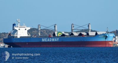
MAXIMOS
Cargo
Current Trip
| Time Travelled | 21 days |
|---|---|
| Remaining Time | 1 day |
| Distance Travelled | 5219.34 nm |
| Remaining Distance | 353.43 nm |
| AVG Speed | 10.4 Knots |
| MAX Speed | 14.1 Knots |
| AVG Wind | 13.4 knots |
| MAX Wind | 29.7 knots |
| MIN Temp | 8.4°C / 47.12°F |
| MAX Temp | 28.6°C / 83.48°F |
| Draught | 9.9 m |
| Position Received | 9 d ago |
Current Position
| Longitude | 104.27783° |
|---|---|
| Latitude | 1.27512° |
| Status | Under way using engine |
| Speed | 8.8 Knots |
| Course | 82.3° |
| Area | Singapore Strait |
| Station | T-AIS |
| Position Received | 9 d ago |
Info
Information
The current position of MAXIMOS is in Singapore Strait with coordinates 1.27512° / 104.27783° as reported on 2025-01-28 12:27 by AIS to our vessel tracker app. The vessel's current speed is 8.8 Knots and is heading at the port of BUSAN. The estimated time of arrival as calculated by MyShipTracking vessel tracking app is 2025-02-08 16:12 LT
The vessel MAXIMOS (IMO: 9883027, MMSI: 636020010) is a Cargo It's sailing under the flag of [LR] Liberia.
In this page you can find informations about the vessels current position, last detected port calls, and current voyage information. If the vessels is not in coverage by AIS you will find the latest position.
The current position of MAXIMOS is detected by our AIS receivers and we are not responsible for the reliability of the data. The last position was recorded while the vessel was in Coverage by the Ais receivers of our vessel tracking app.
The current draught of MAXIMOS as reported by AIS is 9.9 meters
Weather
| Temperature | 9.3°C / 48.74°F |
|---|---|
| Wind Speed | 21 knots |
| Direction | 301° WNW |
| Pressure | 1023.7 hPa |
| Humidity | 49.1 % |
| Cloud Coverage | 21 % |
Featured Company
Last Port Calls
| Port | Arrival | Departure | Time In Port |
|---|---|---|---|
| 2025-01-12 16:36 | 2025-01-16 16:16 | 3 d | |
| 2024-12-22 21:56 | 2024-12-28 16:28 | 5 d | |
| 2024-12-05 04:51 |
Last Trips
| Origin | Departure | Destination | Arrival | Distance | |
|---|---|---|---|---|---|
| 2024-12-28 16:28 | 2025-01-12 16:36 | 1960.94 nm | |||
| 2024-12-05 04:51 | 2024-12-22 21:56 | 2380.36 nm |
Events
| Time | Event | Details | Position / Dest | Info |
|---|---|---|---|---|
| 2025-01-28 12:33 | Status Changed | Default Under way using engine |
1.27718 / 104.29279
KRPUS
|
Speed: 8.8 kn Course: 82.3° |
| 2025-01-28 12:27 | Status Changed | Under way using engine Default |
1.27512 / 104.27783
KRPUS
|
Speed: 8.8 kn Course: 82° |
| 2025-01-28 12:27 | OUT of Coverage |
1.27512 / 104.27783
Singapore Strait
KRPUS
|
Speed: 8.8 kn Course: 82.3° |
|
| 2025-01-28 12:25 | Status Changed | Default Under way using engine |
1.27457 / 104.27343
KRPUS
|
Speed: 8.9 kn Course: 83.1° |
| 2025-01-28 12:16 | Status Changed | Under way using engine Default |
1.27144 / 104.25056
KRPUS
|
Speed: 9.3 kn Course: 85° |
| 2025-01-28 12:09 | Status Changed | Default Under way using engine |
1.26960 / 104.23343
KRPUS
|
Speed: 9.7 kn Course: 80.7° |
| 2025-01-28 11:42 | Change Sea Area | Malaysian part of the Singapore Strait Indonesian part of the Singapore Strait |
1.25876 / 104.15766
Singapore Strait
KRPUS
|
Speed: 10.4 kn Course: 81.7° |
| 2025-01-28 08:18 | Status Changed | Under way using engine Default |
1.08185 / 103.58789
KRPUS
|
Speed: 10.1 kn Course: 122° |
| 2025-01-28 08:13 | Status Changed | Default Under way using engine |
1.08823 / 103.57754
KRPUS
|
Speed: 10.1 kn Course: 122.4° |
| 2025-01-28 08:07 | Status Changed | Under way using engine Default |
1.09703 / 103.56355
KRPUS
|
Speed: 10.2 kn Course: 122° |