

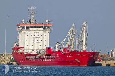
MED ANTARCTIC
Tanker

Current Trip
| Time Travelled | 1 day |
|---|---|
| Remaining Time | --- |
| Distance Travelled | 389.97 nm |
| Remaining Distance | --- |
| AVG Speed | 10.9 Knots |
| MAX Speed | 14.8 Knots |
| AVG Wind | 15.7 knots |
| MAX Wind | 20.9 knots |
| MIN Temp | 11.5°C / 52.7°F |
| MAX Temp | 15.3°C / 59.54°F |
| Draught | 5.5 m |
| Position Received | 2 m ago |
Current Position
| Longitude | 3.32447° |
|---|---|
| Latitude | 51.80628° |
| Status | At anchor |
| Speed | 0.1 Knots |
| Course | 303° |
| Area | North Sea |
| Station | T-AIS |
| Position Received | 2 m ago |
Information
The current position of MED ANTARCTIC is in North Sea with coordinates 51.80628° / 3.32447° as reported on 2025-06-09 20:38 by AIS to our vessel tracker app. The vessel's current speed is 0.1 Knots
The vessel MED ANTARCTIC (IMO: 9462316, MMSI: 248315000) is a Tanker It's sailing under the flag of [MT] Malta.
In this page you can find informations about the vessels current position, last detected port calls, and current voyage information. If the vessels is not in coverage by AIS you will find the latest position.
The current position of MED ANTARCTIC is detected by our AIS receivers and we are not responsible for the reliability of the data. The last position was recorded while the vessel was in Coverage by the Ais receivers of our vessel tracking app.
The current draught of MED ANTARCTIC as reported by AIS is 5.5 meters
Weather
| Temperature | 15°C / 59°F |
|---|---|
| Wind Speed | 17 knots |
| Direction | 229° SW |
| Pressure | 1019.7 hPa |
| Humidity | 78.1 % |
| Cloud Coverage | 97 % |


Featured Company
Last Port Calls
| Port | Arrival | Departure | Time In Port |
|---|---|---|---|
| 2025-06-05 16:34 | 2025-06-07 22:56 | 2 d | |
| 2025-06-05 08:54 | 2025-06-05 12:42 | 3 h | |
| 2025-06-03 16:36 | 2025-06-04 03:02 | 10 h | |
| 2025-05-31 20:46 | 2025-06-02 12:43 | 1 d | |
| 2025-05-26 05:59 | 2025-05-27 10:28 | 1 d | |
| 2025-05-21 00:21 | 2025-05-22 01:03 | 1 d | |
| 2025-05-19 02:10 | 2025-05-19 14:32 | 12 h | |
| 2025-05-11 00:23 | 2025-05-11 13:30 | 13 h | |
| 2025-05-07 09:48 | 2025-05-08 10:30 | 1 d | |
| 2025-04-25 09:24 | 2025-04-26 13:06 | 1 d |
Most Visited Ports (Last year)
| Port | Arrivals | |
|---|---|---|
| 4 | ||
| 4 | ||
| 4 | ||
| 3 | ||
| 3 | ||
| 3 |
Last Trips
| Origin | Departure | Destination | Arrival | Distance | |
|---|---|---|---|---|---|
| 2025-06-05 12:42 | 2025-06-05 16:34 | 40.94 nm | |||
| 2025-06-04 03:02 | 2025-06-05 08:54 | 81.78 nm | |||
| 2025-06-02 12:43 | 2025-06-03 16:36 | 257.32 nm | |||
| 2025-05-27 10:28 | 2025-05-31 20:46 | 314.23 nm | |||
| 2025-05-22 01:03 | 2025-05-26 05:59 | 804.53 nm | |||
| 2025-05-19 14:32 | 2025-05-21 00:21 | 409.31 nm | |||
| 2025-05-11 13:30 | 2025-05-19 02:10 | 1724.73 nm | |||
| 2025-05-08 10:30 | 2025-05-11 00:23 | 534.00 nm | |||
| 2025-04-26 13:06 | 2025-05-07 09:48 | 1238.70 nm | |||
| 2025-04-21 10:25 | 2025-04-25 09:24 | 398.43 nm |
Events
| Time | Event | Details | Position / Dest | Info |
|---|---|---|---|---|
| 2025-06-09 19:44 | Status Changed | At anchor Default |
51.80614 / 3.32258
BEANR
|
Speed: Course: 342° |
| 2025-06-09 19:41 | Status Changed | Default At anchor |
51.80613 / 3.32267
BEANR
|
Speed: Course: 339° |
| 2025-06-09 19:26 | Status Changed | At anchor Default |
51.80617 / 3.32263
BEANR
|
Speed: Course: 341° |
| 2025-06-09 19:20 | Status Changed | Default At anchor |
51.80608 / 3.32272
BEANR
|
Speed: Course: 340° |
| 2025-06-09 18:56 | Status Changed | At anchor Default |
51.80634 / 3.32246
BEANR
|
Speed: 0.2 kn Course: 357° |
| 2025-06-09 18:53 | Status Changed | Default At anchor |
51.80620 / 3.32253
BEANR
|
Speed: 0.1 kn Course: 342° |
| 2025-06-09 16:02 | Status Changed | At anchor Under way using engine |
51.80830 / 3.32586
BEANR
|
Speed: Course: 223° |
| 2025-06-09 10:28 | STOP Moving | 17.74 nm, North West of NEELTJE JANS |
51.80701 / 3.32483
BEANR
|
Speed: 0.3 kn Course: 265° |
| 2025-06-09 07:28 | Change Sea Area | Dutch part of the North Sea United Kingdom part of the North Sea |
52.02002 / 2.66474
North Sea
BEANR
|
Speed: 9.1 kn Course: 171.6° |
| 2025-06-09 07:28 | Status Changed | Under way using engine Default |
52.02129 / 2.66444
BEANR
|
Speed: 9.2 kn Course: 180° |