

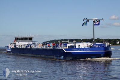
MEGANTIC
Other Type
Current Trip
| Time Travelled | 1 day |
|---|---|
| Remaining Time | --- |
| Distance Travelled | 120.98 nm |
| Remaining Distance | --- |
| AVG Speed | 9 Knots |
| MAX Speed | 12.7 Knots |
| AVG Wind | 6.9 knots |
| MAX Wind | 12.8 knots |
| MIN Temp | 4.8°C / 40.64°F |
| MAX Temp | 16°C / 60.8°F |
| Draught | 0.3 m |
| Position Received | 4 h, 54 m ago |
Current Position
| Longitude | 10.66067° |
|---|---|
| Latitude | 52.52042° |
| Status | Under way using engine |
| Speed | 5.7 Knots |
| Course | 161.1° |
| Area | North Sea |
| Station | T-AIS |
| Position Received | 4 h, 54 m ago |
Information
The current position of MEGANTIC is in North Sea with coordinates 52.52042° / 10.66067° as reported on 2025-05-16 03:56 by AIS to our vessel tracker app. The vessel's current speed is 5.7 Knots and is heading at the port of MAGDEBURG.
The vessel MEGANTIC (MMSI: 211628610) is a Other Type It's sailing under the flag of [DE] Germany.
In this page you can find informations about the vessels current position, last detected port calls, and current voyage information. If the vessels is not in coverage by AIS you will find the latest position.
The current position of MEGANTIC is detected by our AIS receivers and we are not responsible for the reliability of the data. The last position was recorded while the vessel was in Coverage by the Ais receivers of our vessel tracking app.
The current draught of MEGANTIC as reported by AIS is 0.3 meters
Weather
| Temperature | 4.8°C / 40.64°F |
|---|---|
| Wind Speed | 4 knots |
| Direction | 257° WSW |
| Pressure | 1019 hPa |
| Humidity | 93.9 % |
| Cloud Coverage | --- |
Featured Company
Last Port Calls
| Port | Arrival | Departure | Time In Port |
|---|---|---|---|
| 2025-05-14 10:26 | 2025-05-14 23:51 | 13 h | |
| 2025-05-13 11:36 | 2025-05-14 07:10 | 19 h | |
| 2025-05-08 18:17 | 2025-05-09 13:37 | 19 h | |
| 2025-05-08 08:37 | 2025-05-08 17:13 | 8 h | |
| 2025-05-01 11:16 | 2025-05-01 18:51 | 7 h | |
| 2025-04-30 16:27 | 2025-05-01 10:11 | 17 h | |
| 2025-04-25 10:29 | 2025-04-26 03:44 | 17 h | |
| 2025-04-23 17:03 | 2025-04-25 09:16 | 1 d | |
| 2025-04-16 20:58 | 2025-04-18 03:15 | 1 d | |
| 2025-04-16 15:33 | 2025-04-16 16:51 | 1 h |
Most Visited Ports (Last year)
| Port | Arrivals | |
|---|---|---|
| 29 | ||
| 17 | ||
| 12 | ||
| 7 | ||
| 6 | ||
| 5 |
Last Trips
| Origin | Departure | Destination | Arrival | Distance | |
|---|---|---|---|---|---|
| 2025-05-14 07:10 | 2025-05-14 10:26 | 37.01 nm | |||
| 2025-05-09 13:37 | 2025-05-13 11:36 | 187.68 nm | |||
| 2025-05-08 17:13 | 2025-05-08 18:17 | 11.57 nm | |||
| 2025-05-01 18:51 | 2025-05-08 08:37 | 209.48 nm | |||
| 2025-05-01 10:11 | 2025-05-01 11:16 | 11.94 nm | |||
| 2025-04-26 03:44 | 2025-04-30 16:27 | 216.73 nm | |||
| 2025-04-25 09:16 | 2025-04-25 10:29 | 11.57 nm | |||
| 2025-04-18 03:15 | 2025-04-23 17:03 | 264.32 nm | |||
| 2025-04-16 16:51 | 2025-04-16 20:58 | 37.21 nm | |||
| 2025-04-04 16:25 | 2025-04-16 15:33 | 546.14 nm |
Events
| Time | Event | Details | Position / Dest | Info |
|---|---|---|---|---|
| 2025-05-16 03:56 | OUT of Coverage |
52.52042 / 10.66067
North Sea
|
Speed: 5.7 kn Course: 161.1° |
|
| 2025-05-16 03:11 | Status Changed | Under way using engine Moored |
52.59002 / 10.67821
DEMAG0394BDOCKX00006
|
Speed: Course: 511° |
| 2025-05-16 03:11 | START Moving | 8.08 nm, South of WITTINGEN |
52.59002 / 10.67821
DEMAG0394BDOCKX00006
|
Speed: 5.6 kn Course: 184.5° |
| 2025-05-15 17:40 | Status Changed | Moored Under way using engine |
52.60415 / 10.68044
DEMAG0394BDOCKX00006
|
Speed: Course: 511° |
| 2025-05-15 17:40 | STOP Moving | 7.23 nm, South of WITTINGEN |
52.60414 / 10.68046
DEMAG0394BDOCKX00006
|
Speed: 0.3 kn Course: 511° |
| 2025-05-15 17:19 | Draught Changed | 0.3 0 |
52.62949 / 10.66447
DEMAG0394BDOCKX00006
|
Speed: 5.3 kn Course: 135° |
| 2025-05-15 17:09 | IN Coverage |
52.63917 / 10.65062
North Sea
|
Speed: 5.5 kn Course: 150.1° |
|
| 2025-05-15 14:28 | Status Changed | Default Under way using engine |
52.87672 / 10.64428
DEMAG0394BDOCKX00006
|
Speed: 5.2 kn Course: 135° |
| 2025-05-15 14:26 | OUT of Coverage |
52.87895 / 10.64035
North Sea
|
Speed: 5.2 kn Course: 135° |
|
| 2025-05-15 14:23 | IN Coverage |
52.87895 / 10.64035
North Sea
|
Speed: 5.2 kn Course: 135° |