
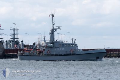
MHV 805 GEMINI
Military ops
Current Trip
| Trip Time | 6 h, 30 mins |
|---|---|
| Trip Distance | 37.79 nm |
| AVG Speed | 7.9 Knots |
| MAX Speed | 12.6 Knots |
| Draught | 2.5 m |
| AVG Wind | 7.6 knots |
| MAX Wind | 9 knots |
| MIN Temp | 2.6°C / 36.68°F |
| MAX Temp | 5.1°C / 41.18°F |
| Position Received | 1 m ago |
Current Position
| Longitude | 10.82698° |
|---|---|
| Latitude | 55.28823° |
| Status | Moored |
| Speed | |
| Course | 179° |
| Area | Kattegat |
| Station | T-AIS |
| Position Received | 1 m ago |
Info
Information
The current position of MHV 805 GEMINI is in Kattegat with coordinates 55.28823° / 10.82698° as reported on 2025-02-05 01:56 by AIS to our vessel tracker app. The vessel's current speed is 0 Knots and is currently inside the port of NYBORG.
The vessel MHV 805 GEMINI (MMSI: 219000185) is a Military ops It's sailing under the flag of [DK] Denmark.
In this page you can find informations about the vessels current position, last detected port calls, and current voyage information. If the vessels is not in coverage by AIS you will find the latest position.
The current position of MHV 805 GEMINI is detected by our AIS receivers and we are not responsible for the reliability of the data. The last position was recorded while the vessel was in Coverage by the Ais receivers of our vessel tracking app.
The current draught of MHV 805 GEMINI as reported by AIS is 2.5 meters
Weather
| Temperature | 1.4°C / 34.52°F |
|---|---|
| Wind Speed | 13 knots |
| Direction | 214° SW |
| Pressure | 1024.7 hPa |
| Humidity | 93 % |
| Cloud Coverage | 88 % |
Featured Company
Last Port Calls
| Port | Arrival | Departure | Time In Port |
|---|---|---|---|
| 2025-02-01 15:42 | |||
| 2025-01-18 15:01 | 2025-02-01 09:12 | 13 d | |
| 2025-01-14 11:25 | 2025-01-18 09:13 | 3 d | |
| 2025-01-04 15:09 | 2025-01-14 11:12 | 9 d | |
| 2024-12-17 17:22 | 2025-01-04 09:23 | 17 d | |
| 2024-12-11 20:59 | 2024-12-17 15:58 | 5 d | |
| 2024-12-07 14:55 | 2024-12-11 18:30 | 4 d | |
| 2024-12-07 09:30 |
Last Trips
| Origin | Departure | Destination | Arrival | Distance | |
|---|---|---|---|---|---|
| 2025-02-01 09:12 | 2025-02-01 15:42 | 37.79 nm | |||
| 2025-01-18 09:13 | 2025-01-18 15:01 | 35.09 nm | |||
| 2025-01-14 11:12 | 2025-01-14 11:25 | 0.82 nm | |||
| 2025-01-04 09:23 | 2025-01-04 15:09 | 38.87 nm | |||
| 2024-12-17 15:58 | 2024-12-17 17:22 | 12.07 nm | |||
| 2024-12-11 18:30 | 2024-12-11 20:59 | 9.65 nm | |||
| 2024-12-07 09:30 | 2024-12-07 14:55 | 21.44 nm |
Events
| Time | Event | Details | Position / Dest | Info |
|---|---|---|---|---|
| 2025-02-01 14:50 | Status Changed | Moored Under way using engine |
55.28823 / 10.82699
[DK] NYBORG
|
Speed: Course: 181° |
| 2025-02-01 14:46 | STOP Moving |
55.28829 / 10.82705
[DK] NYBORG
|
Speed: 0.3 kn Course: 208° |
|
| 2025-02-01 14:42 | PORT ARRIVAL |
|
55.28502 / 10.82046
[DK] NYBORG
|
Speed: 9.9 kn Course: 339.7° |
| 2025-02-01 13:21 | START Moving | 6.07 nm, East of LINDOE |
55.44326 / 10.70528
SLIPSHAVN
|
Speed: 3.3 kn Course: 187° |
| 2025-02-01 12:30 | STOP Moving | 5.91 nm, East of LINDOE |
55.44754 / 10.70261
SLIPSHAVN
|
Speed: 0.3 kn Course: 194° |
| 2025-02-01 12:11 | START Moving | 5.21 nm, East of LINDOE |
55.45858 / 10.68567
SLIPSHAVN
|
Speed: 10.6 kn Course: 131.4° |
| 2025-02-01 12:10 | Status Changed | Under way using engine At anchor |
55.46021 / 10.68309
SLIPSHAVN
|
Speed: 0.3 kn Course: 262° |
| 2025-02-01 11:13 | Status Changed | At anchor Under way using engine |
55.45986 / 10.68318
SLIPSHAVN
|
Speed: 0.3 kn Course: 329° |
| 2025-02-01 11:12 | STOP Moving | 5.11 nm, East of LINDOE |
55.45982 / 10.68314
SLIPSHAVN
|
Speed: 0.2 kn Course: 343° |
| 2025-02-01 10:44 | START Moving | 7.97 nm, North of NYBORG |
55.42556 / 10.78044
SLIPSHAVN
|
Speed: 8.3 kn Course: 74.9° |