
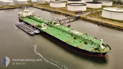
MIKELA P.
Crude Oil Tanker
Current Trip
KW MIS
| Time Travelled | --- |
|---|---|
| Remaining Time | --- |
| Distance Travelled | 11242.43 nm |
| Remaining Distance | --- |
| AVG Speed | 12.1 Knots |
| MAX Speed | 17 Knots |
| AVG Wind | 10.7 knots |
| MAX Wind | 26 knots |
| MIN Temp | 15.1°C / 59.18°F |
| MAX Temp | 28.5°C / 83.3°F |
| Draught | 9.3 m |
| Position Received | 7 d ago |
Current Position
| Longitude | 101.99142° |
|---|---|
| Latitude | 2.17477° |
| Status | Under way using engine |
| Speed | 12.9 Knots |
| Course | 311° |
| Area | Malacca Strait |
| Station | T-AIS |
| Position Received | 7 d ago |
Info
Information
The current position of MIKELA P. is in Malacca Strait with coordinates 2.17477° / 101.99142° as reported on 2025-12-14 04:52 by AIS to our vessel tracker app. The vessel's current speed is 12.9 Knots
The vessel MIKELA P. (IMO: 9440382, MMSI: 538008330) is a Crude Oil Tanker that was built in 2009 ( 16 years old ). It's sailing under the flag of [MH] Marshall Is.
In this page you can find informations about the vessels current position, last detected port calls, and current voyage information. If the vessels is not in coverage by AIS you will find the latest position.
The current position of MIKELA P. is detected by our AIS receivers and we are not responsible for the reliability of the data. The last position was recorded while the vessel was in Coverage by the Ais receivers of our vessel tracking app.
The current draught of MIKELA P. as reported by AIS is 9.3 meters
Weather
| Temperature | 25.4°C / 77.72°F |
|---|---|
| Wind Speed | 12 knots |
| Direction | 37° NE |
| Pressure | 1011.9 hPa |
| Humidity | 64.8 % |
| Cloud Coverage | 100 % |
Featured Company
Most Visited Ports (Last year)
| Port | Arrivals | |
|---|---|---|
| 2 | ||
| 2 | ||
| 2 | ||
| 1 | ||
| 1 | ||
| 1 |
Last Trips
| Origin | Departure | Destination | Arrival | Distance | |
|---|---|---|---|---|---|
| 2025-09-28 04:49 | 2025-10-08 01:12 | 597.95 nm |
Events
| Time | Event | Details | Position / Dest | Info |
|---|---|---|---|---|
| 2025-12-14 04:57 | Status Changed | Default Under way using engine |
2.18658 / 101.97810
KW MIS
|
Speed: 12.9 kn Course: 311° |
| 2025-12-14 04:52 | OUT of Coverage |
2.17477 / 101.99142
Malacca Strait
KW MIS
|
Speed: 12.9 kn Course: 311° |
|
| 2025-12-14 04:50 | Status Changed | Under way using engine Default |
2.17007 / 101.99673
KW MIS
|
Speed: 12.9 kn Course: 311° |
| 2025-12-14 04:45 | Status Changed | Default Under way using engine |
2.15752 / 102.01090
KW MIS
|
Speed: 12.9 kn Course: 313° |
| 2025-12-14 03:59 | Status Changed | Under way using engine Default |
2.04498 / 102.12942
KW MIS
|
Speed: 12.8 kn Course: 315° |
| 2025-12-14 03:57 | Status Changed | Default Under way using engine |
2.03905 / 102.13517
KW MIS
|
Speed: 12.9 kn Course: 307° |
| 2025-12-14 02:46 | Status Changed | Under way using engine Default |
1.89858 / 102.33932
KW MIS
|
Speed: 12.8 kn Course: 293° |
| 2025-12-14 02:37 | IN Coverage |
1.89858 / 102.33932
Malacca Strait
KW MIS
|
Speed: 12.8 kn Course: 293° |
|
| 2025-12-13 21:13 | Status Changed | Default Under way using engine |
1.30053 / 103.34008
KW MIS
|
Speed: 12.2 kn Course: 312° |
| 2025-12-13 21:04 | OUT of Coverage |
1.28198 / 103.36063
Malacca Strait
KW MIS
|
Speed: 12.2 kn Course: 312° |