

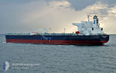
MINERVA KARTERIA
Tanker

Current Trip
| Time Travelled | 22 days |
|---|---|
| Remaining Time | --- |
| Distance Travelled | 3398.71 nm |
| Remaining Distance | --- |
| AVG Speed | 10.4 Knots |
| MAX Speed | 13.5 Knots |
| AVG Wind | 9.6 knots |
| MAX Wind | 21 knots |
| MIN Temp | 5.3°C / 41.54°F |
| MAX Temp | 19.4°C / 66.92°F |
| Draught | 14.2 m |
| Position Received | 1 h, 44 m ago |
Current Position
| Longitude | -8.24168° |
|---|---|
| Latitude | 36.36630° |
| Status | Under way using engine |
| Speed | 11.1 Knots |
| Course | 291.9° |
| Area | North Atlantic Ocean |
| Station | T-AIS |
| Position Received | 1 h, 44 m ago |
Information
The current position of MINERVA KARTERIA is in North Atlantic Ocean with coordinates 36.36630° / -8.24168° as reported on 2025-02-25 07:50 by AIS to our vessel tracker app. The vessel's current speed is 11.1 Knots and is heading at the port of GDANSK. The estimated time of arrival as calculated by MyShipTracking vessel tracking app is 2025-03-04 22:00 LT
The vessel MINERVA KARTERIA (IMO: 9787170, MMSI: 241574000) is a Tanker It's sailing under the flag of [GR] Greece.
In this page you can find informations about the vessels current position, last detected port calls, and current voyage information. If the vessels is not in coverage by AIS you will find the latest position.
The current position of MINERVA KARTERIA is detected by our AIS receivers and we are not responsible for the reliability of the data. The last position was recorded while the vessel was in Coverage by the Ais receivers of our vessel tracking app.
The current draught of MINERVA KARTERIA as reported by AIS is 14.2 meters
Weather
| Temperature | 16.1°C / 60.98°F |
|---|---|
| Wind Speed | 8 knots |
| Direction | 280° W |
| Pressure | 1028.6 hPa |
| Humidity | 81.1 % |
| Cloud Coverage | 100 % |


Featured Company
Most Visited Ports (Last year)
| Port | Arrivals | |
|---|---|---|
| 3 | ||
| 2 | ||
| 1 | ||
| 1 | ||
| 1 | ||
| 1 |
Events
| Time | Event | Details | Position / Dest | Info |
|---|---|---|---|---|
| 2025-02-25 07:58 | Status Changed | Default Under way using engine |
36.37477 / -8.26831
PLGDN
|
Speed: 11.1 kn Course: 291.9° |
| 2025-02-25 07:50 | Status Changed | Under way using engine Default |
36.36630 / -8.24168
PLGDN
|
Speed: 10.6 kn Course: 292° |
| 2025-02-25 07:50 | OUT of Coverage |
36.36630 / -8.24168
North Atlantic Ocean
PLGDN
|
Speed: 11.1 kn Course: 291.9° |
|
| 2025-02-25 06:59 | Status Changed | Default Under way using engine |
36.31636 / -8.05912
PLGDN
|
Speed: 10.7 kn Course: 284.3° |
| 2025-02-25 06:54 | Status Changed | Under way using engine Default |
36.31243 / -8.04026
PLGDN
|
Speed: 11.1 kn Course: 285° |
| 2025-02-25 06:52 | IN Coverage |
36.31243 / -8.04026
North Atlantic Ocean
PLGDN
|
Speed: 10.7 kn Course: 284.3° |
|
| 2025-02-25 05:40 | Status Changed | Default Under way using engine |
36.26273 / -7.77675
PLGDN
|
Speed: 10.7 kn Course: 282.9° |
| 2025-02-25 05:35 | OUT of Coverage |
36.25960 / -7.76018
North Atlantic Ocean
PLGDN
|
Speed: 10.7 kn Course: 282.9° |
|
| 2025-02-25 05:31 | Status Changed | Under way using engine Default |
36.25709 / -7.74729
PLGDN
|
Speed: 11 kn Course: 283° |
| 2025-02-25 05:22 | Status Changed | Default Under way using engine |
36.25066 / -7.71146
PLGDN
|
Speed: 10.7 kn Course: 282.1° |