

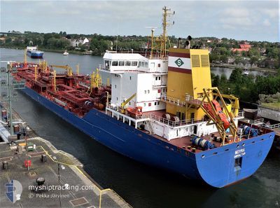
MOYRA
Not available

Current Trip
| Time Travelled | 2 days |
|---|---|
| Remaining Time | --- |
| Distance Travelled | 825.03 nm |
| Remaining Distance | --- |
| AVG Speed | 11.6 Knots |
| MAX Speed | 12.8 Knots |
| AVG Wind | 10.9 knots |
| MAX Wind | 21 knots |
| MIN Temp | 22.5°C / 72.5°F |
| MAX Temp | 27.2°C / 80.96°F |
| Draught | 7 m |
| Position Received | 2 h, 29 m ago |
Current Position
| Longitude | -43.06199° |
|---|---|
| Latitude | -23.67092° |
| Status | Under way using engine |
| Speed | 12.3 Knots |
| Course | 236.8° |
| Area | South Atlantic Ocean |
| Station | T-AIS |
| Position Received | 2 h, 29 m ago |
Information
The current position of MOYRA is in South Atlantic Ocean with coordinates -23.67092° / -43.06199° as reported on 2025-05-21 19:43 by AIS to our vessel tracker app. The vessel's current speed is 12.3 Knots
The vessel MOYRA (MMSI: 236271000) is a Not available It's sailing under the flag of [GI] Gibraltar.
In this page you can find informations about the vessels current position, last detected port calls, and current voyage information. If the vessels is not in coverage by AIS you will find the latest position.
The current position of MOYRA is detected by our AIS receivers and we are not responsible for the reliability of the data. The last position was recorded while the vessel was in Coverage by the Ais receivers of our vessel tracking app.
The current draught of MOYRA as reported by AIS is 7 meters
Weather
| Temperature | 23.9°C / 75.02°F |
|---|---|
| Wind Speed | 7 knots |
| Direction | 184° S |
| Pressure | 1017.6 hPa |
| Humidity | 79.2 % |
| Cloud Coverage | 1 % |


Featured Company
Last Port Calls
| Port | Arrival | Departure | Time In Port |
|---|---|---|---|
| 2025-05-17 17:46 | 2025-05-18 19:47 | 1 d | |
| 2025-05-11 11:28 | 2025-05-14 01:51 | 2 d | |
| 2025-05-05 19:07 | 2025-05-07 18:43 | 1 d | |
| 2025-05-01 12:53 | 2025-05-02 12:06 | 23 h | |
| 2025-04-26 10:27 | 2025-04-28 00:11 | 1 d | |
| 2025-04-21 16:26 | 2025-04-22 16:11 | 23 h | |
| 2025-04-14 08:35 | 2025-04-18 02:15 | 3 d | |
| 2025-04-06 09:14 | 2025-04-07 10:44 | 1 d | |
| 2025-03-01 05:22 |
Most Visited Ports (Last year)
| Port | Arrivals | |
|---|---|---|
| 21 | ||
| 14 | ||
| 7 | ||
| 2 | ||
| 1 | ||
| 1 |
Last Trips
| Origin | Departure | Destination | Arrival | Distance | |
|---|---|---|---|---|---|
| 2025-05-14 01:51 | 2025-05-17 17:46 | 1051.75 nm | |||
| 2025-05-07 18:43 | 2025-05-11 11:28 | 1025.60 nm | |||
| 2025-05-02 12:06 | 2025-05-05 19:07 | 1002.64 nm | |||
| 2025-04-28 00:11 | 2025-05-01 12:53 | 1015.32 nm | |||
| 2025-04-22 16:11 | 2025-04-26 10:27 | 1022.39 nm | |||
| 2025-04-18 02:15 | 2025-04-21 16:26 | 1019.09 nm | |||
| 2025-04-07 10:44 | 2025-04-14 08:35 | 441.68 nm | |||
| 2025-03-01 05:22 | 2025-04-06 09:14 | 4421.60 nm |
Events
| Time | Event | Details | Position / Dest | Info |
|---|---|---|---|---|
| 2025-05-21 19:51 | Status Changed | Default Under way using engine |
-23.68065 / -43.08668
BR ARB
|
Speed: 12.3 kn Course: 236.8° |
| 2025-05-21 19:43 | OUT of Coverage |
-23.67092 / -43.06199
South Atlantic Ocean
|
Speed: 12.3 kn Course: 236.8° |
|
| 2025-05-21 18:59 | Status Changed | Under way using engine Default |
-23.60777 / -42.92011
BR ARB
|
Speed: 11.9 kn Course: 250° |
| 2025-05-21 18:49 | Status Changed | Default Under way using engine |
-23.59782 / -42.88640
BR ARB
|
Speed: 11.7 kn Course: 252.3° |
| 2025-05-21 18:41 | Status Changed | Under way using engine Default |
-23.58982 / -42.85865
BR ARB
|
Speed: 11.7 kn Course: 253° |
| 2025-05-21 18:28 | IN Coverage |
-23.58982 / -42.85865
South Atlantic Ocean
|
Speed: 11.7 kn Course: 254.3° |
|
| 2025-05-18 22:47 | PORT DEPARTURE |
|
-12.79141 / -38.50953
BR ARB
|
Speed: 8.5 kn Course: 255° |
| 2025-05-18 22:31 | START Moving |
-12.78666 / -38.48137
[BR] ARATU
|
Speed: 3.6 kn Course: 237° |
|
| 2025-05-17 21:11 | STOP Moving |
-12.78373 / -38.47664
[BR] ARATU
|
Speed: 0.2 kn Course: 65° |
|
| 2025-05-17 20:52 | OUT of Coverage |
-12.79067 / -38.48996
South Atlantic Ocean
[BR] ARATU
|
Speed: 5.3 kn Course: 92° |