

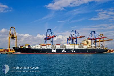
MSC ALBANY
Container Ship

Current Trip
| Time Travelled | 15 h, 23 mins |
|---|---|
| Remaining Time | 1 h, 55 mins |
| Distance Travelled | 189.50 nm |
| Remaining Distance | 64.03 nm |
| AVG Speed | 12.5 Knots |
| MAX Speed | 13.5 Knots |
| AVG Wind | 6.5 knots |
| MAX Wind | 9.8 knots |
| MIN Temp | 11.5°C / 52.7°F |
| MAX Temp | 20.8°C / 69.44°F |
| Draught | 9.9 m |
| Position Received | 13 h, 51 m ago |
Current Position
| Longitude | -48.38990° |
|---|---|
| Latitude | -26.72080° |
| Status | Under way using engine |
| Speed | 12.6 Knots |
| Course | 40.2° |
| Area | South Atlantic Ocean |
| Station | T-AIS |
| Position Received | 13 h, 51 m ago |
Information
The current position of MSC ALBANY is in South Atlantic Ocean with coordinates -26.72080° / -48.38990° as reported on 2025-05-31 13:01 by AIS to our vessel tracker app. The vessel's current speed is 12.6 Knots and is heading at the port of SANTOS. The estimated time of arrival as calculated by MyShipTracking vessel tracking app is 2025-06-01 01:47 LT
The vessel MSC ALBANY (IMO: 9619438, MMSI: 636015665) is a Container Ship that was built in 2013 ( 12 years old ). It's sailing under the flag of [LR] Liberia.
In this page you can find informations about the vessels current position, last detected port calls, and current voyage information. If the vessels is not in coverage by AIS you will find the latest position.
The current position of MSC ALBANY is detected by our AIS receivers and we are not responsible for the reliability of the data. The last position was recorded while the vessel was in Coverage by the Ais receivers of our vessel tracking app.
The current draught of MSC ALBANY as reported by AIS is 9.9 meters
Weather
| Temperature | 20.7°C / 69.26°F |
|---|---|
| Wind Speed | 8 knots |
| Direction | 59° ENE |
| Pressure | 1020.5 hPa |
| Humidity | 77 % |
| Cloud Coverage | --- |


Featured Company
Last Port Calls
| Port | Arrival | Departure | Time In Port |
|---|---|---|---|
| 2025-05-30 22:02 | 2025-05-31 08:29 | 10 h | |
| 2025-05-27 00:23 | 2025-05-27 14:51 | 14 h | |
| 2025-05-23 18:57 | 2025-05-24 11:52 | 16 h | |
| 2025-05-23 00:08 | 2025-05-23 13:06 | 12 h | |
| 2025-05-21 11:00 | 2025-05-22 06:03 | 19 h | |
| 2025-05-19 11:18 | 2025-05-19 11:31 | 13 m | |
| 2025-05-15 15:53 | 2025-05-16 14:18 | 22 h | |
| 2025-05-03 21:06 | 2025-05-05 13:39 | 1 d | |
| 2025-04-27 01:42 | 2025-04-29 05:28 | 2 d | |
| 2025-04-25 08:16 | 2025-04-26 20:21 | 1 d |
Most Visited Ports (Last year)
| Port | Arrivals | |
|---|---|---|
| 13 | ||
| 10 | ||
| 8 | ||
| 6 | ||
| 5 | ||
| 5 |
Last Trips
| Origin | Departure | Destination | Arrival | Distance | |
|---|---|---|---|---|---|
| 2025-05-27 14:51 | 2025-05-30 22:02 | 713.40 nm | |||
| 2025-05-24 11:52 | 2025-05-27 00:23 | 755.63 nm | |||
| 2025-05-23 13:06 | 2025-05-23 18:57 | 64.87 nm | |||
| 2025-05-22 06:03 | 2025-05-23 00:08 | 173.23 nm | |||
| 2025-05-19 11:31 | 2025-05-21 11:00 | 235.13 nm | |||
| 2025-05-16 14:18 | 2025-05-19 11:18 | 1082.89 nm | |||
| 2025-05-05 13:39 | 2025-05-15 15:53 | 3560.55 nm | |||
| 2025-04-29 05:28 | 2025-05-03 21:06 | 522.69 nm | |||
| 2025-04-26 20:21 | 2025-04-27 01:42 | 91.10 nm | |||
| 2025-04-23 19:46 | 2025-04-25 08:16 | 403.11 nm |
Events
| Time | Event | Details | Position / Dest | Info |
|---|---|---|---|---|
| 2025-05-31 13:06 | Status Changed | Default Under way using engine |
-26.70831 / -48.37806
BRSSZ
|
Speed: 12.6 kn Course: 40.2° |
| 2025-05-31 13:01 | OUT of Coverage |
-26.72080 / -48.38990
South Atlantic Ocean
BRSSZ
|
Speed: 12.6 kn Course: 40.2° |
|
| 2025-05-31 12:54 | Status Changed | Under way using engine Default |
-26.73957 / -48.40765
BRSSZ
|
Speed: 12.8 kn Course: 40° |
| 2025-05-31 12:33 | Status Changed | Default Under way using engine |
-26.79713 / -48.46208
BRSSZ
|
Speed: 12.7 kn Course: 40° |
| 2025-05-31 11:54 | Destination Changed | BRSSZ BRNVT |
-26.89725 / -48.56843
BRSSZ
|
Speed: 13.5 kn Course: 55° |
| 2025-05-31 11:54 | ETA Changed | 2025/06/01 06:00 2025/05/29 12:00 |
-26.89725 / -48.56843
BRSSZ
|
Speed: 13.5 kn Course: 55° |
| 2025-05-31 11:37 | Status Changed | Under way using engine Default |
-26.91295 / -48.62361
BRNVT
|
Speed: 7.8 kn Course: 122° |
| 2025-05-31 11:29 | PORT DEPARTURE |
|
-26.91073 / -48.64732
BRNVT
|
Speed: 5.3 kn Course: 127° |
| 2025-05-31 11:22 | IN Coverage |
-26.91191 / -48.61492
South Atlantic Ocean
|
Speed: 12 kn Course: 82° |
|
| 2025-05-31 11:17 | START Moving |
-26.89878 / -48.66447
[BR] NAVEGANTES
|
Speed: 3.1 kn Course: 107° |