
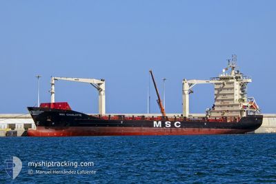
MSC CHARLOTTE
General Cargo
Current Trip
| Time Travelled | 14 h, 37 mins |
|---|---|
| Remaining Time | 1 day |
| Distance Travelled | 120.64 nm |
| Remaining Distance | 259.94 nm |
| AVG Speed | 8.3 Knots |
| MAX Speed | 9.7 Knots |
| AVG Wind | 18.5 knots |
| MAX Wind | 28 knots |
| MIN Temp | 5.9°C / 42.62°F |
| MAX Temp | 12.4°C / 54.32°F |
| Draught | 7.4 m |
| Position Received | 1 m ago |
Current Position
| Longitude | 34.27656° |
|---|---|
| Latitude | 35.13914° |
| Status | Under way using engine |
| Speed | 8.6 Knots |
| Course | 182.5° |
| Area | Mediterranean Sea - Eastern Basin |
| Station | T-AIS |
| Position Received | 1 m ago |
Info
Information
The current position of MSC CHARLOTTE is in Mediterranean Sea - Eastern Basin with coordinates 35.13914° / 34.27656° as reported on 2025-02-06 20:40 by AIS to our vessel tracker app. The vessel's current speed is 8.6 Knots and is heading at the port of DAMIETTA. The estimated time of arrival as calculated by MyShipTracking vessel tracking app is 2025-02-08 09:29 LT
The vessel MSC CHARLOTTE (IMO: 9330238, MMSI: 636020574) is a General Cargo that was built in 2007 ( 18 years old ). It's sailing under the flag of [LR] Liberia.
In this page you can find informations about the vessels current position, last detected port calls, and current voyage information. If the vessels is not in coverage by AIS you will find the latest position.
The current position of MSC CHARLOTTE is detected by our AIS receivers and we are not responsible for the reliability of the data. The last position was recorded while the vessel was in Coverage by the Ais receivers of our vessel tracking app.
The current draught of MSC CHARLOTTE as reported by AIS is 7.4 meters
Weather
| Temperature | 11.7°C / 53.06°F |
|---|---|
| Wind Speed | 20 knots |
| Direction | 319° NW |
| Pressure | 1014.2 hPa |
| Humidity | 50.3 % |
| Cloud Coverage | 30 % |
Featured Company
Last Port Calls
| Port | Arrival | Departure | Time In Port |
|---|---|---|---|
| 2025-02-05 08:43 | 2025-02-06 08:05 | 23 h | |
| 2025-02-02 17:49 | 2025-02-03 18:00 | 1 d | |
| 2025-01-30 07:58 | 2025-02-01 14:49 | 2 d | |
| 2025-01-26 17:36 | 2025-01-27 10:25 | 16 h | |
| 2025-01-24 11:02 | 2025-01-24 21:10 | 10 h | |
| 2025-01-23 12:16 | 2025-01-24 00:02 | 11 h | |
| 2025-01-20 16:57 | 2025-01-21 14:43 | 21 h | |
| 2025-01-16 10:07 | 2025-01-18 08:04 | 1 d | |
| 2025-01-14 21:47 | 2025-01-15 11:38 | 13 h | |
| 2025-01-11 19:21 | 2025-01-12 07:06 | 11 h |
Last Trips
| Origin | Departure | Destination | Arrival | Distance | |
|---|---|---|---|---|---|
| 2025-02-03 18:00 | 2025-02-05 08:43 | 530.35 nm | |||
| 2025-02-01 14:49 | 2025-02-02 17:49 | 260.52 nm | |||
| 2025-01-27 10:25 | 2025-01-30 07:58 | 678.03 nm | |||
| 2025-01-24 21:10 | 2025-01-26 17:36 | 361.84 nm | |||
| 2025-01-24 00:02 | 2025-01-24 11:02 | 133.55 nm | |||
| 2025-01-21 14:43 | 2025-01-23 12:16 | 530.53 nm | |||
| 2025-01-18 08:04 | 2025-01-20 16:57 | 319.17 nm | |||
| 2025-01-15 11:38 | 2025-01-16 10:07 | 276.37 nm | |||
| 2025-01-12 07:06 | 2025-01-14 21:47 | 685.22 nm | |||
| 2025-01-11 15:25 | 2025-01-11 19:21 | 27.32 nm |
Events
| Time | Event | Details | Position / Dest | Info |
|---|---|---|---|---|
| 2025-02-06 16:37 | Status Changed | Under way using engine Default |
35.20797 / 34.34251
EGDAM
|
Speed: 8.5 kn Course: 180° |
| 2025-02-06 16:31 | Status Changed | Default Under way using engine |
35.22184 / 34.34273
EGDAM
|
Speed: 8.2 kn Course: 179° |
| 2025-02-06 16:21 | Status Changed | Under way using engine Default |
35.24544 / 34.34268
EGDAM
|
Speed: 8.6 kn Course: 26° |
| 2025-02-06 16:21 | IN Coverage |
35.24544 / 34.34268
Mediterranean Sea - Eastern Basin
EGDAM
|
Speed: 8.2 kn Course: 179° |
|
| 2025-02-06 14:40 | OUT of Coverage |
35.15135 / 34.28049
Mediterranean Sea - Eastern Basin
EGDAM
|
Speed: 8.5 kn Course: 19.8° |
|
| 2025-02-06 12:43 | Status Changed | Under way using engine Default |
34.90071 / 34.16189
EGDAM
|
Speed: 8.3 kn Course: 65° |
| 2025-02-06 12:23 | IN Coverage |
34.90071 / 34.16189
Mediterranean Sea - Eastern Basin
EGDAM
|
Speed: 8.3 kn Course: 54.7° |
|
| 2025-02-06 09:13 | Status Changed | Default Under way using engine |
34.71136 / 33.59204
EGDAM
|
Speed: 8.7 kn Course: 66.7° |
| 2025-02-06 09:08 | OUT of Coverage |
34.70606 / 33.57707
Mediterranean Sea - Eastern Basin
EGDAM
|
Speed: 8.7 kn Course: 66.7° |
|
| 2025-02-06 09:04 | Status Changed | Under way using engine Default |
34.70273 / 33.56759
EGDAM
|
Speed: 8.6 kn Course: 67° |