
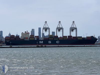
MSC FLORIANA VI
Container Ship
Current Trip
| Time Travelled | 2 days |
|---|---|
| Remaining Time | --- |
| Distance Travelled | 773.14 nm |
| Remaining Distance | --- |
| AVG Speed | 18.3 Knots |
| MAX Speed | 19.7 Knots |
| AVG Wind | 7.6 knots |
| MAX Wind | 18.8 knots |
| MIN Temp | 24.1°C / 75.38°F |
| MAX Temp | 28°C / 82.4°F |
| Draught | 12.6 m |
| Position Received | 2 d ago |
Current Position
| Longitude | 76.24147° |
|---|---|
| Latitude | 8.52941° |
| Status | Under way using engine |
| Speed | 18.4 Knots |
| Course | 290° |
| Area | Laccadive Sea |
| Station | T-AIS |
| Position Received | 2 d ago |
Info
Information
The current position of MSC FLORIANA VI is in Laccadive Sea with coordinates 8.52941° / 76.24147° as reported on 2025-02-10 09:42 by AIS to our vessel tracker app. The vessel's current speed is 18.4 Knots and is heading at the port of KHALIFA. The estimated time of arrival as calculated by MyShipTracking vessel tracking app is 2025-02-14 19:00 LT
The vessel MSC FLORIANA VI (IMO: 9168831, MMSI: 636022985) is a Container Ship that was built in 1999 ( 26 years old ). It's sailing under the flag of [LR] Liberia.
In this page you can find informations about the vessels current position, last detected port calls, and current voyage information. If the vessels is not in coverage by AIS you will find the latest position.
The current position of MSC FLORIANA VI is detected by our AIS receivers and we are not responsible for the reliability of the data. The last position was recorded while the vessel was in Coverage by the Ais receivers of our vessel tracking app.
The current draught of MSC FLORIANA VI as reported by AIS is 12.6 meters
Weather
| Temperature | 27°C / 80.6°F |
|---|---|
| Wind Speed | 18 knots |
| Direction | 334° NNW |
| Pressure | 1012.8 hPa |
| Humidity | 68.2 % |
| Cloud Coverage | --- |
Featured Company
Last Port Calls
| Port | Arrival | Departure | Time In Port |
|---|---|---|---|
| 2025-02-08 15:23 | 2025-02-10 01:35 | 1 d | |
| 2025-02-04 16:15 | 2025-02-06 05:11 | 1 d | |
| 2025-01-30 15:17 | 2025-02-01 10:43 | 1 d | |
| 2025-01-26 14:19 | 2025-01-28 23:27 | 2 d | |
| 2025-01-23 16:14 | 2025-01-25 00:19 | 1 d | |
| 2025-01-13 11:37 | 2025-01-14 15:43 | 1 d | |
| 2025-01-10 23:31 | 2025-01-11 04:47 | 5 h | |
| 2025-01-08 07:45 | 2025-01-09 00:04 | 16 h | |
| 2024-12-24 19:36 | 2024-12-29 13:12 | 4 d | |
| 2024-12-15 13:08 | 2024-12-22 17:13 | 7 d |
Last Trips
| Origin | Departure | Destination | Arrival | Distance | |
|---|---|---|---|---|---|
| 2025-02-06 05:11 | 2025-02-08 15:23 | 95.71 nm | |||
| 2025-02-01 10:43 | 2025-02-04 16:15 | 693.27 nm | |||
| 2025-01-28 23:27 | 2025-01-30 15:17 | 691.42 nm | |||
| 2025-01-25 00:19 | 2025-01-26 14:19 | 190.61 nm | |||
| 2025-01-14 15:43 | 2025-01-23 16:14 | 2273.17 nm | |||
| 2025-01-11 04:47 | 2025-01-13 11:37 | 60.77 nm | |||
| 2025-01-09 00:04 | 2025-01-10 23:31 | 807.77 nm | |||
| 2024-12-29 13:12 | 2025-01-08 07:45 | 4208.97 nm | |||
| 2024-12-22 17:13 | 2024-12-24 19:36 | 255.28 nm | |||
| 2024-12-11 10:23 | 2024-12-15 13:08 | 1058.11 nm |
Events
| Time | Event | Details | Position / Dest | Info |
|---|---|---|---|---|
| 2025-02-10 09:45 | Status Changed | Default Under way using engine |
8.53586 / 76.22732
LKCMB>AEKHL
|
Speed: 18.4 kn Course: 290° |
| 2025-02-10 09:42 | OUT of Coverage |
8.52941 / 76.24147
Laccadive Sea
LKCMB>AEKHL
|
Speed: 18.4 kn Course: 290° |
|
| 2025-02-10 09:05 | Status Changed | Under way using engine Default |
8.43143 / 76.41243
LKCMB>AEKHL
|
Speed: 18.2 kn Course: 298° |
| 2025-02-10 08:16 | Status Changed | Default Under way using engine |
8.30480 / 76.62827
LKCMB>AEKHL
|
Speed: 18.1 kn Course: 299° |
| 2025-02-10 05:31 | Change Sea Area | Indian part of the Laccadive Sea Sri Lankan part of the Laccadive Sea |
7.90475 / 77.35009
Laccadive Sea
LKCMB>AEKHL
|
Speed: 17.9 kn Course: 287° |
| 2025-02-10 05:30 | Draught Changed | 12.6 10.5 |
7.90336 / 77.35447
LKCMB>AEKHL
|
Speed: 17.9 kn Course: 288° |
| 2025-02-10 05:30 | Destination Changed | LKCMB>AEKHL INENR>LKCMB |
7.90336 / 77.35447
LKCMB>AEKHL
|
Speed: 17.9 kn Course: 288° |
| 2025-02-10 05:30 | ETA Changed | 2025/02/14 15:00 2025/02/04 01:30 |
7.90336 / 77.35447
LKCMB>AEKHL
|
Speed: 17.9 kn Course: 288° |
| 2025-02-10 05:30 | IN Coverage |
7.90475 / 77.35009
Laccadive Sea
LKCMB>AEKHL
|
Speed: 17.9 kn Course: 287° |
|
| 2025-02-09 20:05 | PORT DEPARTURE |
|
6.97396 / 79.83450
INENR>LKCMB
|
Speed: 8 kn Course: 325° |