
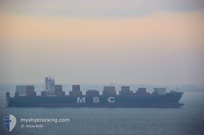
MSC LILY
Cargo
Current Trip
SGSIG
| Time Travelled | 1 day |
|---|---|
| Remaining Time | --- |
| Distance Travelled | 362.00 nm |
| Remaining Distance | --- |
| AVG Speed | 17.7 Knots |
| MAX Speed | 19.8 Knots |
| AVG Wind | 16.4 knots |
| MAX Wind | 23 knots |
| MIN Temp | 21.9°C / 71.42°F |
| MAX Temp | 25.5°C / 77.9°F |
| Draught | 13.8 m |
| Position Received | 15 h, 15 m ago |
Current Position
| Longitude | 56.81613° |
|---|---|
| Latitude | 25.44101° |
| Status | Under way using engine |
| Speed | 18.6 Knots |
| Course | 163° |
| Area | Gulf of Oman |
| Station | T-AIS |
| Position Received | 15 h, 15 m ago |
Info
Information
The current position of MSC LILY is in Gulf of Oman with coordinates 25.44101° / 56.81613° as reported on 2025-12-16 13:02 by AIS to our vessel tracker app. The vessel's current speed is 18.6 Knots
The vessel MSC LILY (IMO: 9704960, MMSI: 255806489) is a Cargo It's sailing under the flag of [PT] Portugal.
In this page you can find informations about the vessels current position, last detected port calls, and current voyage information. If the vessels is not in coverage by AIS you will find the latest position.
The current position of MSC LILY is detected by our AIS receivers and we are not responsible for the reliability of the data. The last position was recorded while the vessel was in Coverage by the Ais receivers of our vessel tracking app.
The current draught of MSC LILY as reported by AIS is 13.8 meters
Weather
| Temperature | 24.8°C / 76.64°F |
|---|---|
| Wind Speed | 23 knots |
| Direction | 142° SE |
| Pressure | 1012.3 hPa |
| Humidity | 69.8 % |
| Cloud Coverage | 3 % |
Featured Company
Last Port Calls
| Port | Arrival | Departure | Time In Port |
|---|---|---|---|
| 2025-12-14 04:28 | 2025-12-16 03:57 | 1 d | |
| 2025-11-30 09:36 | 2025-12-02 00:16 | 1 d | |
| 2025-11-25 20:08 | 2025-11-27 16:04 | 1 d | |
| 2025-11-15 10:18 | 2025-11-15 10:25 | 7 m | |
| 2025-11-04 15:09 | 2025-11-05 08:29 | 17 h | |
| 2025-11-01 00:05 | 2025-11-01 10:13 | 10 h | |
| 2025-10-23 19:33 | 2025-10-26 09:57 | 2 d | |
| 2025-10-18 14:41 | 2025-10-19 14:13 | 23 h | |
| 2025-10-17 17:13 | 2025-10-18 10:21 | 17 h | |
| 2025-10-14 08:33 | 2025-10-16 00:29 | 1 d |
Last Trips
| Origin | Departure | Destination | Arrival | Distance | |
|---|---|---|---|---|---|
| 2025-12-02 00:16 | 2025-12-14 04:28 | 4323.63 nm | |||
| 2025-11-27 16:04 | 2025-11-30 09:36 | 1155.56 nm | |||
| 2025-11-15 10:25 | 2025-11-25 20:08 | 3270.99 nm | |||
| 2025-11-05 08:29 | 2025-11-15 10:18 | 934.09 nm | |||
| 2025-11-01 10:13 | 2025-11-04 15:09 | 245.39 nm | |||
| 2025-10-26 09:57 | 2025-11-01 00:05 | 1639.84 nm | |||
| 2025-10-19 14:13 | 2025-10-23 19:33 | 859.29 nm | |||
| 2025-10-18 10:21 | 2025-10-18 14:41 | 61.69 nm | |||
| 2025-10-16 00:29 | 2025-10-17 17:13 | 226.93 nm | |||
| 2025-10-12 09:27 | 2025-10-14 08:33 | 256.46 nm |
Events
| Time | Event | Details | Position / Dest | Info |
|---|---|---|---|---|
| 2025-12-16 13:02 | Status Changed | Default Under way using engine |
25.43904 / 56.81681
SGSIG
|
Speed: 18.6 kn Course: 163° |
| 2025-12-16 13:02 | OUT of Coverage |
25.44101 / 56.81613
Gulf of Oman
SGSIG
|
Speed: 18.6 kn Course: 163° |
|
| 2025-12-16 13:01 | Status Changed | Under way using engine Default |
25.44151 / 56.81597
SGSIG
|
Speed: 18.9 kn Course: 170° |
| 2025-12-16 12:54 | Status Changed | Default Under way using engine |
25.48125 / 56.80588
SGSIG
|
Speed: 18.8 kn Course: 170.6° |
| 2025-12-16 12:47 | Status Changed | Under way using engine Default |
25.51754 / 56.79924
SGSIG
|
Speed: 19.1 kn Course: 171° |
| 2025-12-16 12:38 | Status Changed | Default Under way using engine |
25.56465 / 56.79071
SGSIG
|
Speed: 19.1 kn Course: 166.4° |
| 2025-12-16 12:37 | Status Changed | Under way using engine Default |
25.56716 / 56.79002
SGSIG
|
Speed: 19.1 kn Course: 170° |
| 2025-12-16 12:37 | Change Sea Area | United Arab Emirates part of the Gulf of Oman Omani part of the Gulf of Oman |
25.56716 / 56.79002
Gulf of Oman
SGSIG
|
Speed: 19.1 kn Course: 166.4° |
| 2025-12-16 12:34 | Status Changed | Default Under way using engine |
25.58507 / 56.78651
SGSIG
|
Speed: 18.9 kn Course: 167.5° |
| 2025-12-16 12:33 | Status Changed | Under way using engine Default |
25.59177 / 56.78512
SGSIG
|
Speed: 19.2 kn Course: 170° |