

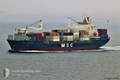
MSC MASHA 3
Container Ship
Current Trip
| Trip Time | 5 days |
|---|---|
| Trip Distance | 450.85 nm |
| AVG Speed | 9.1 Knots |
| MAX Speed | 13.6 Knots |
| Draught | 7.3 m |
| AVG Wind | 10.9 knots |
| MAX Wind | 19 knots |
| MIN Temp | 16.4°C / 61.52°F |
| MAX Temp | 23.4°C / 74.12°F |
| Position Received | 4 d ago |
Current Position
| Longitude | 29.92423° |
|---|---|
| Latitude | 31.35160° |
| Status | Under way using engine |
| Speed | 6.8 Knots |
| Course | 256.5° |
| Area | Mediterranean Sea - Eastern Basin |
| Station | T-AIS |
| Position Received | 4 d ago |
Information
The current position of MSC MASHA 3 is in Mediterranean Sea - Eastern Basin with coordinates 31.35160° / 29.92423° as reported on 2025-05-29 08:35 by AIS to our vessel tracker app. The vessel's current speed is 6.8 Knots and is currently inside the port of EL DEKHEILA.
The vessel MSC MASHA 3 (IMO: 9188219, MMSI: 255806109) is a Container Ship that was built in 1998 ( 27 years old ). It's sailing under the flag of [PT] Portugal.
In this page you can find informations about the vessels current position, last detected port calls, and current voyage information. If the vessels is not in coverage by AIS you will find the latest position.
The current position of MSC MASHA 3 is detected by our AIS receivers and we are not responsible for the reliability of the data. The last position was recorded while the vessel was in Coverage by the Ais receivers of our vessel tracking app.
The current draught of MSC MASHA 3 as reported by AIS is 7.3 meters
Weather
| Temperature | 21.3°C / 70.34°F |
|---|---|
| Wind Speed | 9 knots |
| Direction | 306° NW |
| Pressure | 1020.3 hPa |
| Humidity | 69.7 % |
| Cloud Coverage | --- |
Featured Company
Last Port Calls
| Port | Arrival | Departure | Time In Port |
|---|---|---|---|
| 2025-06-02 02:35 | |||
| 2025-05-27 00:24 | 2025-05-28 00:02 | 23 h | |
| 2025-05-24 10:17 | 2025-05-25 06:38 | 20 h | |
| 2025-05-21 10:02 | 2025-05-22 07:17 | 21 h | |
| 2025-05-17 03:20 | 2025-05-19 13:09 | 2 d | |
| 2025-05-13 09:18 | 2025-05-13 21:18 | 12 h | |
| 2025-05-11 20:33 | 2025-05-12 16:36 | 20 h | |
| 2025-05-11 10:09 | 2025-05-11 18:16 | 8 h | |
| 2025-05-10 11:40 | 2025-05-11 02:28 | 14 h | |
| 2025-05-09 11:04 | 2025-05-10 02:50 | 15 h |
Most Visited Ports (Last year)
| Port | Arrivals | |
|---|---|---|
| 14 | ||
| 12 | ||
| 11 | ||
| 10 | ||
| 7 | ||
| 6 |
Last Trips
| Origin | Departure | Destination | Arrival | Distance | |
|---|---|---|---|---|---|
| 2025-05-28 00:02 | 2025-06-02 02:35 | 450.85 nm | |||
| 2025-05-25 06:38 | 2025-05-27 00:24 | 197.69 nm | |||
| 2025-05-22 07:17 | 2025-05-24 10:17 | 656.52 nm | |||
| 2025-05-19 13:09 | 2025-05-21 10:02 | 526.82 nm | |||
| 2025-05-13 21:18 | 2025-05-17 03:20 | 623.56 nm | |||
| 2025-05-12 16:36 | 2025-05-13 09:18 | 166.75 nm | |||
| 2025-05-11 18:16 | 2025-05-11 20:33 | 13.49 nm | |||
| 2025-05-11 02:28 | 2025-05-11 10:09 | 72.51 nm | |||
| 2025-05-10 02:50 | 2025-05-10 11:40 | 91.28 nm | |||
| 2025-05-05 11:06 | 2025-05-09 11:04 | 1188.19 nm |
Events
| Time | Event | Details | Position / Dest | Info |
|---|---|---|---|---|
| 2025-06-02 01:07 | STOP Moving |
31.14487 / 29.79350
[EG] EL DEKHEILA
|
Speed: Course: 57° |
|
| 2025-06-02 00:35 | PORT ARRIVAL |
|
31.15391 / 29.80812
[EG] EL DEKHEILA
|
Speed: 6.1 kn Course: 174° |
| 2025-06-01 11:02 | START Moving | 14.36 nm, North West of ABU QIR |
31.44073 / 29.84365
EGEDK
|
Speed: 3.3 kn Course: 231° |
| 2025-06-01 08:33 | STOP Moving | 14.49 nm, North of ALEXANDRIA |
31.41901 / 29.80553
EGEDK
|
Speed: Course: 252° |
| 2025-06-01 07:55 | START Moving | 15.97 nm, North West of ABU QIR |
31.45161 / 29.81455
EGEDK
|
Speed: 4.6 kn Course: 200° |
| 2025-05-31 22:24 | STOP Moving | 12.36 nm, North West of ALEXANDRIA |
31.35665 / 29.73469
EGEDK
|
Speed: Course: 4° |
| 2025-05-31 20:50 | START Moving | 7.05 nm, North of ALEXANDRIA |
31.29629 / 29.83036
EGEDK
|
Speed: 3.8 kn Course: 298° |
| 2025-05-31 09:27 | STOP Moving | 12.61 nm, North West of ALEXANDRIA |
31.34686 / 29.71040
EGEDK
|
Speed: 0.3 kn Course: 314° |
| 2025-05-31 07:34 | START Moving | 15.64 nm, North West of ABU QIR |
31.44876 / 29.82019
EGEDK
|
Speed: 3.7 kn Course: 255° |
| 2025-05-31 03:43 | STOP Moving | 13.66 nm, North of ALEXANDRIA |
31.40792 / 29.82654
EGEDK
|
Speed: Course: 308° |