
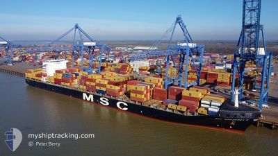
MSC MONTEREY V
Container Ship
Current Trip
| Time Travelled | 1 day |
|---|---|
| Remaining Time | -2 mins |
| Distance Travelled | 88.28 nm |
| Remaining Distance | 5.54 nm |
| AVG Speed | 6 Knots |
| MAX Speed | 10.8 Knots |
| AVG Wind | 20.8 knots |
| MAX Wind | 30 knots |
| MIN Temp | 8.4°C / 47.12°F |
| MAX Temp | 15°C / 59°F |
| Draught | 13.3 m |
| Position Received | 1 m ago |
Current Position
| Longitude | 27.61719° |
|---|---|
| Latitude | 40.92535° |
| Status | Under way using engine |
| Speed | 1 Knots |
| Course | 294° |
| Area | Sea of Marmara |
| Station | T-AIS |
| Position Received | 1 m ago |
Info
Information
The current position of MSC MONTEREY V is in Sea of Marmara with coordinates 40.92535° / 27.61719° as reported on 2026-01-04 20:41 by AIS to our vessel tracker app. The vessel's current speed is 1 Knots and is heading at the port of TEKIRDAG. The estimated time of arrival as calculated by MyShipTracking vessel tracking app is 2026-01-04 23:40 LT
The vessel MSC MONTEREY V (IMO: 9349796, MMSI: 255915882) is a Container Ship that was built in 2007 ( 19 years old ). It's sailing under the flag of [PT] Portugal.
In this page you can find informations about the vessels current position, last detected port calls, and current voyage information. If the vessels is not in coverage by AIS you will find the latest position.
The current position of MSC MONTEREY V is detected by our AIS receivers and we are not responsible for the reliability of the data. The last position was recorded while the vessel was in Coverage by the Ais receivers of our vessel tracking app.
The current draught of MSC MONTEREY V as reported by AIS is 13.3 meters
Weather
| Temperature | 14°C / 57.2°F |
|---|---|
| Wind Speed | 19 knots |
| Direction | 215° SW |
| Pressure | 1016.5 hPa |
| Humidity | 68.1 % |
| Cloud Coverage | 91 % |
Featured Company
Last Port Calls
| Port | Arrival | Departure | Time In Port |
|---|---|---|---|
| 2026-01-02 07:46 | 2026-01-03 07:38 | 23 h | |
| 2025-12-31 22:45 | 2026-01-01 23:17 | 1 d | |
| 2025-12-30 23:57 | 2025-12-31 18:29 | 18 h | |
| 2025-12-28 19:26 | 2025-12-29 15:30 | 20 h | |
| 2025-12-17 23:10 | 2025-12-19 08:54 | 1 d | |
| 2025-12-14 14:20 | 2025-12-16 14:19 | 1 d | |
| 2025-12-03 11:37 | 2025-12-04 08:17 | 20 h | |
| 2025-12-01 08:33 | 2025-12-02 12:05 | 1 d | |
| 2025-11-30 06:55 | 2025-12-01 01:59 | 19 h | |
| 2025-11-18 04:15 | 2025-11-19 07:03 | 1 d |
Most Visited Ports (Last year)
| Port | Arrivals | |
|---|---|---|
| 12 | ||
| 11 | ||
| 11 | ||
| 10 | ||
| 10 | ||
| 9 |
Last Trips
| Origin | Departure | Destination | Arrival | Distance | |
|---|---|---|---|---|---|
| 2026-01-01 23:17 | 2026-01-02 07:46 | 88.13 nm | |||
| 2025-12-31 18:29 | 2025-12-31 22:45 | 47.42 nm | |||
| 2025-12-29 15:30 | 2025-12-30 23:57 | 102.51 nm | |||
| 2025-12-19 08:54 | 2025-12-28 19:26 | 3370.06 nm | |||
| 2025-12-16 14:19 | 2025-12-17 23:10 | 157.35 nm | |||
| 2025-12-04 08:17 | 2025-12-14 14:20 | 3213.57 nm | |||
| 2025-12-02 12:05 | 2025-12-03 11:37 | 98.68 nm | |||
| 2025-12-01 01:59 | 2025-12-01 08:33 | 67.88 nm | |||
| 2025-11-19 07:03 | 2025-11-30 06:55 | 3280.19 nm | |||
| 2025-11-17 07:12 | 2025-11-18 04:15 | 230.17 nm |
Events
| Time | Event | Details | Position / Dest | Info |
|---|---|---|---|---|
| 2026-01-04 18:06 | Status Changed | Under way using engine Default |
40.87875 / 27.66427
TEKIRDAG
|
Speed: 1.4 kn Course: 320° |
| 2026-01-04 18:05 | Status Changed | Default Under way using engine |
40.87872 / 27.66347
TEKIRDAG
|
Speed: 1.4 kn Course: 323° |
| 2026-01-04 14:48 | START Moving | 9.09 nm, South West of MARTAS |
40.87809 / 27.76723
TEKIRDAG
|
Speed: 3.3 kn Course: 298° |
| 2026-01-04 10:53 | STOP Moving | 7.57 nm, East of BARBAROS |
40.85982 / 27.63021
TEKIRDAG
|
Speed: 0.2 kn Course: 241° |
| 2026-01-04 09:43 | Status Changed | Under way using engine Default |
40.89888 / 27.64116
TEKIRDAG
|
Speed: 1 kn Course: 308° |
| 2026-01-04 09:40 | Status Changed | Default Under way using engine |
40.89888 / 27.64014
TEKIRDAG
|
Speed: 1.1 kn Course: 301° |
| 2026-01-04 08:15 | START Moving | 9.41 nm, South East of TEKIRDAG |
40.87800 / 27.68708
TEKIRDAG
|
Speed: 5.2 kn Course: 297.2° |
| 2026-01-04 07:09 | ETA Changed | 2026/01/04 17:00 2026/01/04 13:00 |
40.87058 / 27.67565
TEKIRDAG
|
Speed: 0.8 kn Course: 327° |
| 2026-01-04 06:17 | STOP Moving | 8.82 nm, East of BARBAROS |
40.86727 / 27.66127
TEKIRDAG
|
Speed: 0.3 kn Course: 219° |
| 2026-01-04 05:30 | START Moving | 10.07 nm, South West of MARTAS |
40.88245 / 27.73865
TEKIRDAG
|
Speed: 4.2 kn Course: 269° |