

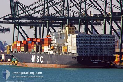
MSC SORAYA
Container Ship

Current Trip
| Time Travelled | 5 days |
|---|---|
| Remaining Time | --- |
| Distance Travelled | 1912.99 nm |
| Remaining Distance | 13.02 nm |
| AVG Speed | 14.9 Knots |
| MAX Speed | 21.4 Knots |
| AVG Wind | 10.2 knots |
| MAX Wind | 21.8 knots |
| MIN Temp | 17.1°C / 62.78°F |
| MAX Temp | 23°C / 73.4°F |
| Draught | 13.8 m |
| Position Received | Now |
Current Position
| Longitude | -8.89779° |
|---|---|
| Latitude | 37.72261° |
| Status | Under way using engine |
| Speed | 0.7 Knots |
| Course | 224° |
| Area | North Atlantic Ocean |
| Station | T-AIS |
| Position Received | Now |
Information
The current position of MSC SORAYA is in North Atlantic Ocean with coordinates 37.72261° / -8.89779° as reported on 2025-05-31 19:01 by AIS to our vessel tracker app. The vessel's current speed is 0.7 Knots and is heading at the port of SINES. The estimated time of arrival as calculated by MyShipTracking vessel tracking app is 2025-06-01 16:00 LT
The vessel MSC SORAYA (IMO: 9372494, MMSI: 370271000) is a Container Ship that was built in 2008 ( 17 years old ). It's sailing under the flag of [PA] Panama.
In this page you can find informations about the vessels current position, last detected port calls, and current voyage information. If the vessels is not in coverage by AIS you will find the latest position.
The current position of MSC SORAYA is detected by our AIS receivers and we are not responsible for the reliability of the data. The last position was recorded while the vessel was in Coverage by the Ais receivers of our vessel tracking app.
The current draught of MSC SORAYA as reported by AIS is 13.8 meters
Weather
| Temperature | 19.1°C / 66.38°F |
|---|---|
| Wind Speed | 8 knots |
| Direction | 316° NW |
| Pressure | 1018 hPa |
| Humidity | 86 % |
| Cloud Coverage | 52 % |


Featured Company
Last Port Calls
| Port | Arrival | Departure | Time In Port |
|---|---|---|---|
| 2025-05-25 04:41 | 2025-05-26 13:57 | 1 d | |
| 2025-05-23 17:08 | 2025-05-24 11:07 | 17 h | |
| 2025-05-22 00:47 | 2025-05-22 16:40 | 15 h | |
| 2025-05-21 06:30 | 2025-05-21 21:15 | 14 h | |
| 2025-05-19 01:45 | 2025-05-20 06:46 | 1 d | |
| 2025-05-13 08:47 | 2025-05-14 05:32 | 20 h | |
| 2025-05-08 20:06 | 2025-05-10 15:02 | 1 d | |
| 2025-05-05 04:55 | 2025-05-06 19:25 | 1 d | |
| 2025-05-04 00:04 | 2025-05-04 19:32 | 19 h | |
| 2025-05-01 00:26 | 2025-05-02 08:41 | 1 d |
Last Trips
| Origin | Departure | Destination | Arrival | Distance | |
|---|---|---|---|---|---|
| 2025-05-24 11:07 | 2025-05-25 04:41 | 211.43 nm | |||
| 2025-05-22 16:40 | 2025-05-23 17:08 | 88.91 nm | |||
| 2025-05-21 21:15 | 2025-05-22 00:47 | 46.61 nm | |||
| 2025-05-20 06:46 | 2025-05-21 06:30 | 359.25 nm | |||
| 2025-05-14 05:32 | 2025-05-19 01:45 | 1803.67 nm | |||
| 2025-05-10 15:02 | 2025-05-13 08:47 | 1191.67 nm | |||
| 2025-05-06 19:25 | 2025-05-08 20:06 | 409.26 nm | |||
| 2025-05-04 19:32 | 2025-05-05 04:55 | 132.98 nm | |||
| 2025-05-02 08:41 | 2025-05-04 00:04 | 401.63 nm | |||
| 2025-04-28 23:30 | 2025-05-01 00:26 | 270.26 nm |
Events
| Time | Event | Details | Position / Dest | Info |
|---|---|---|---|---|
| 2025-05-31 14:50 | STOP Moving | 12.99 nm, South of SINES |
37.73827 / -8.95258
PTSIE
|
Speed: 0.3 kn Course: 299° |
| 2025-05-31 13:36 | ETA Changed | 2025/06/01 15:00 2025/05/31 15:00 |
37.68423 / -8.94956
PTSIE
|
Speed: 9.8 kn Course: 28° |
| 2025-05-31 01:32 | ETA Changed | 2025/05/31 15:00 2025/05/31 09:00 |
36.36910 / -7.74322
PTSIE
|
Speed: 11 kn Course: 289° |
| 2025-05-31 00:10 | Change Sea Area | Portuguese part of the North Atlantic Ocean Spanish part of the North Atlantic Ocean |
36.28883 / -7.44598
North Atlantic Ocean
PTSIE
|
Speed: 11.6 kn Course: 289° |
| 2025-05-30 18:22 | Change Sea Area | Spanish part of the North Atlantic Ocean Spanish part of the Strait of Gibraltar |
35.96856 / -6.09652
North Atlantic Ocean
PTSIE
|
Speed: 11.1 kn Course: 270° |
| 2025-05-30 18:19 | Status Changed | Under way using engine Default |
35.96854 / -6.08637
PTSIE
|
Speed: 11.4 kn Course: 269° |
| 2025-05-30 17:53 | Status Changed | Default Under way using engine |
35.96903 / -5.98275
PTSIE
|
Speed: 11.6 kn Course: 270° |
| 2025-05-30 17:33 | Status Changed | Under way using engine Default |
35.96866 / -5.90635
PTSIE
|
Speed: 11.5 kn Course: 270° |
| 2025-05-30 16:56 | Status Changed | Default Under way using engine |
35.95854 / -5.76444
PTSIE
|
Speed: 10.8 kn Course: 270° |
| 2025-05-30 16:41 | Status Changed | Under way using engine Default |
35.95830 / -5.70718
PTSIE
|
Speed: 11 kn Course: 271° |