

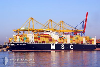
MSC TARANTO
Container Ship

Current Trip
| Time Travelled | 3 days |
|---|---|
| Remaining Time | --- |
| Distance Travelled | 1219.78 nm |
| Remaining Distance | --- |
| AVG Speed | 16.4 Knots |
| MAX Speed | 20.7 Knots |
| AVG Wind | 16.2 knots |
| MAX Wind | 23.4 knots |
| MIN Temp | 22.7°C / 72.86°F |
| MAX Temp | 30°C / 86°F |
| Draught | 11.1 m |
| Position Received | 10 d ago |
Current Position
| Longitude | 129.07187° |
|---|---|
| Latitude | 34.61188° |
| Status | Under way using engine |
| Speed | 12.7 Knots |
| Course | 152.5° |
| Area | Japan Sea |
| Station | T-AIS |
| Position Received | 10 d ago |
Information
The current position of MSC TARANTO is in Japan Sea with coordinates 34.61188° / 129.07187° as reported on 2025-05-23 09:06 by AIS to our vessel tracker app. The vessel's current speed is 12.7 Knots
The vessel MSC TARANTO (IMO: 9475258, MMSI: 636092247) is a Container Ship that was built in 2011 ( 14 years old ). It's sailing under the flag of [LR] Liberia.
In this page you can find informations about the vessels current position, last detected port calls, and current voyage information. If the vessels is not in coverage by AIS you will find the latest position.
The current position of MSC TARANTO is detected by our AIS receivers and we are not responsible for the reliability of the data. The last position was recorded while the vessel was in Coverage by the Ais receivers of our vessel tracking app.
The current draught of MSC TARANTO as reported by AIS is 11.1 meters
Weather
| Temperature | 29.6°C / 85.28°F |
|---|---|
| Wind Speed | 12 knots |
| Direction | 185° S |
| Pressure | 1008.1 hPa |
| Humidity | 72.5 % |
| Cloud Coverage | 100 % |


Featured Company
Last Port Calls
| Port | Arrival | Departure | Time In Port |
|---|---|---|---|
| 2025-05-30 07:30 | 2025-05-31 02:10 | 18 h | |
| 2025-05-21 22:23 | 2025-05-23 15:21 | 1 d | |
| 2025-05-16 06:43 | 2025-05-16 20:51 | 14 h | |
| 2025-05-03 12:18 | 2025-05-05 04:05 | 1 d | |
| 2025-04-23 05:50 | 2025-04-30 05:51 | 7 d | |
| 2025-04-07 13:18 | 2025-04-08 20:26 | 1 d | |
| 2025-04-02 14:06 |
Last Trips
| Origin | Departure | Destination | Arrival | Distance | |
|---|---|---|---|---|---|
| 2025-05-23 15:21 | 2025-05-30 07:30 | 1345.39 nm | |||
| 2025-05-16 20:51 | 2025-05-21 22:23 | 1034.09 nm | |||
| 2025-05-05 04:05 | 2025-05-16 06:43 | 4563.02 nm | |||
| 2025-04-30 05:51 | 2025-05-03 12:18 | 397.19 nm | |||
| 2025-04-08 20:26 | 2025-04-23 05:50 | 6720.33 nm | |||
| 2025-04-02 14:06 | 2025-04-07 13:18 | 1611.56 nm |
Events
| Time | Event | Details | Position / Dest | Info |
|---|---|---|---|---|
| 2025-05-30 18:10 | PORT DEPARTURE |
|
22.56564 / 114.30035
KRPUS > CNNGB
|
Speed: 6.2 kn Course: 122° |
| 2025-05-30 18:03 | START Moving |
22.57262 / 114.28839
[CN] YANTIAN
|
Speed: 3.5 kn Course: 130° |
|
| 2025-05-29 23:55 | STOP Moving |
22.56965 / 114.28680
[CN] YANTIAN
|
Speed: 0.2 kn Course: 315° |
|
| 2025-05-29 23:30 | PORT ARRIVAL |
|
22.56965 / 114.29020
[CN] YANTIAN
|
Speed: 0.8 kn Course: 326° |
| 2025-05-29 00:46 | START Moving | 1.71 nm, North West of ZHANGZHOU |
24.43861 / 118.03788
KRPUS > CNNGB
|
Speed: 3.9 kn Course: 114° |
| 2025-05-28 13:26 | STOP Moving | 1.96 nm, North West of ZHANGZHOU |
24.44119 / 118.03386
KRPUS > CNNGB
|
Speed: 0.2 kn Course: 93° |
| 2025-05-27 09:42 | START Moving | 9.13 nm, South West of ZHOUSHAN |
29.89885 / 122.04327
KRPUS > CNNGB
|
Speed: 3.6 kn Course: 45° |
| 2025-05-25 02:02 | STOP Moving | 9.41 nm, South West of ZHOUSHAN |
29.89173 / 122.04155
KRPUS > CNNGB
|
Speed: 0.2 kn Course: 294° |