

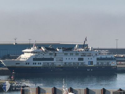
NAT GEO VENTURE
Passenger

Current Trip
KETCHKIN ALASKA
| Time Travelled | 8 days |
|---|---|
| Remaining Time | --- |
| Distance Travelled | 979.73 nm |
| Remaining Distance | --- |
| AVG Speed | 7.9 Knots |
| MAX Speed | 14.8 Knots |
| AVG Wind | 5.4 knots |
| MAX Wind | 15.8 knots |
| MIN Temp | 0.8°C / 33.44°F |
| MAX Temp | 12.4°C / 54.32°F |
| Draught | 4 m |
| Position Received | 8 d ago |
Current Position
| Longitude | -132.96854° |
|---|---|
| Latitude | 56.81101° |
| Status | Moored |
| Speed | |
| Course | 66° |
| Area | The Coastal Waters of Southeast Alaska and British Columbia |
| Station | T-AIS |
| Position Received | 8 d ago |
Information
The current position of NAT GEO VENTURE is in The Coastal Waters of Southeast Alaska and British Columbia with coordinates 56.81101° / -132.96854° as reported on 2025-06-03 00:52 by AIS to our vessel tracker app. The vessel's current speed is 0 Knots
The vessel NAT GEO VENTURE (IMO: 9799044, MMSI: 369358000) is a Passenger It's sailing under the flag of [US] USA.
In this page you can find informations about the vessels current position, last detected port calls, and current voyage information. If the vessels is not in coverage by AIS you will find the latest position.
The current position of NAT GEO VENTURE is detected by our AIS receivers and we are not responsible for the reliability of the data. The last position was recorded while the vessel was in Coverage by the Ais receivers of our vessel tracking app.
The current draught of NAT GEO VENTURE as reported by AIS is 4 meters
Weather
| Temperature | 10.8°C / 51.44°F |
|---|---|
| Wind Speed | 4 knots |
| Direction | 17° NNE |
| Pressure | 1019.2 hPa |
| Humidity | 66.4 % |
| Cloud Coverage | 32 % |


Featured Company
Last Port Calls
| Port | Arrival | Departure | Time In Port |
|---|---|---|---|
| 2025-06-02 07:36 | 2025-06-02 18:56 | 11 h | |
| 2025-05-31 06:00 | 2025-05-31 23:56 | 17 h | |
| 2025-05-29 08:56 | 2025-05-29 18:12 | 9 h | |
| 2025-05-19 07:32 | 2025-05-19 18:00 | 10 h | |
| 2025-05-17 05:48 | 2025-05-17 23:32 | 17 h | |
| 2025-05-15 08:48 | 2025-05-15 17:56 | 9 h | |
| 2025-05-09 22:04 | 2025-05-10 06:32 | 8 h | |
| 2025-05-06 10:32 | 2025-05-06 18:20 | 7 h | |
| 2025-04-29 07:09 | 2025-04-29 20:20 | 13 h | |
| 2025-04-22 17:55 | 2025-04-27 19:11 | 5 d |
Most Visited Ports (Last year)
| Port | Arrivals | |
|---|---|---|
| 17 | ||
| 10 | ||
| 9 | ||
| 8 | ||
| 7 | ||
| 6 |
Last Trips
| Origin | Departure | Destination | Arrival | Distance | |
|---|---|---|---|---|---|
| 2025-05-31 23:56 | 2025-06-02 07:36 | 196.00 nm | |||
| 2025-05-29 18:12 | 2025-05-31 06:00 | 210.19 nm | |||
| 2025-05-19 18:00 | 2025-05-29 08:56 | 1129.94 nm | |||
| 2025-05-17 23:32 | 2025-05-19 07:32 | 174.73 nm | |||
| 2025-05-15 17:56 | 2025-05-17 05:48 | 195.48 nm | |||
| 2025-05-10 06:32 | 2025-05-15 08:48 | 499.43 nm | |||
| 2025-05-06 18:20 | 2025-05-09 22:04 | 498.89 nm | |||
| 2025-04-29 20:20 | 2025-05-06 10:32 | 876.93 nm | |||
| 2025-04-27 19:11 | 2025-04-29 07:09 | 142.49 nm | |||
| 2025-04-12 15:53 | 2025-04-22 17:55 | 2217.46 nm |
Events
| Time | Event | Details | Position / Dest | Info |
|---|---|---|---|---|
| 2025-06-11 23:05 | START Moving | 8.27 nm, East of TENAKEE SPRINGS |
57.79285 / -134.96352
KETCHKIN ALASKA
|
Speed: 7.5 kn Course: 143° |
| 2025-06-11 23:01 | STOP Moving | 8.16 nm, East of TENAKEE SPRINGS |
57.79645 / -134.96788
KETCHKIN ALASKA
|
Speed: 0.2 kn Course: 190° |
| 2025-06-11 22:49 | START Moving | 8.38 nm, East of TENAKEE SPRINGS |
57.79449 / -134.96045
KETCHKIN ALASKA
|
Speed: 3.5 kn Course: 261° |
| 2025-06-11 22:25 | STOP Moving | 8.79 nm, East of TENAKEE SPRINGS |
57.79917 / -134.94861
KETCHKIN ALASKA
|
Speed: 0.2 kn Course: 95° |
| 2025-06-11 21:05 | START Moving | 8.28 nm, East of TENAKEE SPRINGS |
57.83013 / -134.98071
KETCHKIN ALASKA
|
Speed: 4.1 kn Course: 114° |
| 2025-06-11 16:17 | STOP Moving | 8.16 nm, North East of TENAKEE SPRINGS |
57.83047 / -134.98497
KETCHKIN ALASKA
|
Speed: 0.2 kn Course: 340° |
| 2025-06-11 04:29 | START Moving |
58.81860 / -136.45636
KETCHKIN ALASKA
|
Speed: 12.1 kn Course: 144° |
|
| 2025-06-11 04:17 | STOP Moving |
58.82670 / -136.47151
KETCHKIN ALASKA
|
Speed: 0.2 kn Course: 43° |
|
| 2025-06-11 01:12 | START Moving |
59.03215 / -137.02828
KETCHKIN ALASKA
|
Speed: 10 kn Course: 118° |
|
| 2025-06-11 00:27 | STOP Moving |
59.04084 / -137.05441
KETCHKIN ALASKA
|
Speed: Course: 252° |