

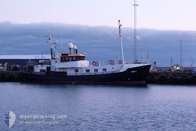
NEMO A
Other Type

Current Trip
THYBOROEN
| Time Travelled | 1 h, 43 mins |
|---|---|
| Remaining Time | --- |
| Distance Travelled | 8.14 nm |
| Remaining Distance | --- |
| AVG Speed | 4.5 Knots |
| MAX Speed | 5.4 Knots |
| AVG Wind | 16.6 knots |
| MAX Wind | 17.7 knots |
| MIN Temp | 10.6°C / 51.08°F |
| MAX Temp | 10.9°C / 51.62°F |
| Draught | 3 m |
| Position Received | Now |
Current Position
| Longitude | 8.16947° |
|---|---|
| Latitude | 56.82391° |
| Status | Default |
| Speed | 4.9 Knots |
| Course | 349° |
| Area | North Sea |
| Station | T-AIS |
| Position Received | Now |
Information
The current position of NEMO A is in North Sea with coordinates 56.82391° / 8.16947° as reported on 2025-05-17 02:03 by AIS to our vessel tracker app. The vessel's current speed is 4.9 Knots
The vessel NEMO A (MMSI: 235081865) is a Other Type It's sailing under the flag of [GB] United Kingdom.
In this page you can find informations about the vessels current position, last detected port calls, and current voyage information. If the vessels is not in coverage by AIS you will find the latest position.
The current position of NEMO A is detected by our AIS receivers and we are not responsible for the reliability of the data. The last position was recorded while the vessel was in Coverage by the Ais receivers of our vessel tracking app.
The current draught of NEMO A as reported by AIS is 3 meters
Weather
| Temperature | 10.6°C / 51.08°F |
|---|---|
| Wind Speed | 15 knots |
| Direction | 332° NNW |
| Pressure | 1018.7 hPa |
| Humidity | 88.3 % |
| Cloud Coverage | --- |


Featured Company
Last Port Calls
| Port | Arrival | Departure | Time In Port |
|---|---|---|---|
| 2025-05-12 17:42 | 2025-05-17 02:21 | 4 d | |
| 2025-05-11 17:53 | 2025-05-12 03:11 | 9 h | |
| 2025-05-10 21:13 | 2025-05-11 03:15 | 6 h | |
| 2025-05-09 14:42 | 2025-05-10 06:40 | 15 h | |
| 2025-04-30 16:15 | 2025-05-08 02:23 | 7 d | |
| 2025-04-25 02:42 | 2025-04-28 02:28 | 2 d | |
| 2025-04-21 17:46 | 2025-04-23 02:05 | 1 d | |
| 2025-04-18 20:45 | 2025-04-21 03:17 | 2 d | |
| 2025-04-17 17:42 | 2025-04-18 01:35 | 7 h | |
| 2025-04-15 17:02 | 2025-04-17 02:20 | 1 d |
Last Trips
| Origin | Departure | Destination | Arrival | Distance | |
|---|---|---|---|---|---|
| 2025-05-12 03:11 | 2025-05-12 17:42 | 64.20 nm | |||
| 2025-05-11 03:15 | 2025-05-11 17:53 | 71.17 nm | |||
| 2025-05-10 06:40 | 2025-05-10 21:13 | 70.00 nm | |||
| 2025-05-08 02:23 | 2025-05-09 14:42 | 134.07 nm | |||
| 2025-04-28 02:28 | 2025-04-30 16:15 | 170.28 nm | |||
| 2025-04-23 02:05 | 2025-04-25 02:42 | 190.71 nm | |||
| 2025-04-21 03:17 | 2025-04-21 17:46 | 76.25 nm | |||
| 2025-04-18 01:35 | 2025-04-18 20:45 | 94.46 nm | |||
| 2025-04-17 02:20 | 2025-04-17 17:42 | 80.26 nm | |||
| 2025-04-14 02:22 | 2025-04-15 17:02 | 144.42 nm |
Events
| Time | Event | Details | Position / Dest | Info |
|---|---|---|---|---|
| 2025-05-17 00:21 | PORT DEPARTURE |
|
56.70218 / 8.22849
THYBOROEN
|
Speed: 6.3 kn Course: 28° |
| 2025-05-17 00:17 | START Moving |
56.70228 / 8.22273
[DK] THYBORON
|
Speed: 4.9 kn Course: 126° |
|
| 2025-05-17 00:06 | STOP Moving |
56.70196 / 8.21935
[DK] THYBORON
|
Speed: 0.1 kn Course: 191° |
|
| 2025-05-17 00:02 | START Moving |
56.70382 / 8.22368
[DK] THYBORON
|
Speed: 4.9 kn Course: 161° |
|
| 2025-05-16 16:34 | IN Coverage |
56.70548 / 8.22148
North Sea
[DK] THYBORON
|
Speed: Course: 55.9° |
|
| 2025-05-16 08:24 | OUT of Coverage |
56.70549 / 8.22147
North Sea
[DK] THYBORON
|
Speed: Course: 143.4° |
|
| 2025-05-15 13:31 | IN Coverage |
56.70547 / 8.22148
North Sea
[DK] THYBORON
|
Speed: Course: 296.2° |
|
| 2025-05-15 12:29 | OUT of Coverage |
56.70547 / 8.22148
North Sea
[DK] THYBORON
|
Speed: Course: 285.9° |
|
| 2025-05-15 09:13 | IN Coverage |
56.70548 / 8.22147
North Sea
[DK] THYBORON
|
Speed: Course: 326.6° |
|
| 2025-05-15 07:52 | OUT of Coverage |
56.70548 / 8.22148
North Sea
[DK] THYBORON
|
Speed: Course: 297.2° |