
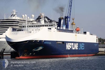
NEPTUNE DYNAMIS
Vehicles Carrier
Current Trip
| Time Travelled | 1 day |
|---|---|
| Remaining Time | -15 mins |
| Distance Travelled | 523.18 nm |
| Remaining Distance | 2.40 nm |
| AVG Speed | 13.3 Knots |
| MAX Speed | 20 Knots |
| AVG Wind | 23.3 knots |
| MAX Wind | 35 knots |
| MIN Temp | 4°C / 39.2°F |
| MAX Temp | 12.2°C / 53.96°F |
| Draught | 5.3 m |
| Position Received | 1 m ago |
Current Position
| Longitude | 2.35115° |
|---|---|
| Latitude | 51.06242° |
| Status | Under way using engine |
| Speed | 4.9 Knots |
| Course | 181° |
| Area | North Sea |
| Station | T-AIS |
| Position Received | 1 m ago |
Info
Information
The current position of NEPTUNE DYNAMIS is in North Sea with coordinates 51.06242° / 2.35115° as reported on 2025-12-18 13:35 by AIS to our vessel tracker app. The vessel's current speed is 4.9 Knots and is heading at the port of DUNKERQUE. The estimated time of arrival as calculated by MyShipTracking vessel tracking app is 2025-12-18 14:22 LT
The vessel NEPTUNE DYNAMIS (IMO: 9240976, MMSI: 215188000) is a Vehicles Carrier that was built in 2002 ( 23 years old ). It's sailing under the flag of [MT] Malta.
In this page you can find informations about the vessels current position, last detected port calls, and current voyage information. If the vessels is not in coverage by AIS you will find the latest position.
The current position of NEPTUNE DYNAMIS is detected by our AIS receivers and we are not responsible for the reliability of the data. The last position was recorded while the vessel was in Coverage by the Ais receivers of our vessel tracking app.
The current draught of NEPTUNE DYNAMIS as reported by AIS is 5.3 meters
Weather
| Temperature | 11.1°C / 51.98°F |
|---|---|
| Wind Speed | 18 knots |
| Direction | 177° S |
| Pressure | 1008.5 hPa |
| Humidity | 80.7 % |
| Cloud Coverage | 100 % |
Featured Company
Last Port Calls
| Port | Arrival | Departure | Time In Port |
|---|---|---|---|
| 2025-12-18 14:36 | |||
| 2025-12-16 12:50 | 2025-12-17 02:31 | 13 h | |
| 2025-12-14 17:48 | 2025-12-15 07:53 | 14 h | |
| 2025-12-13 05:28 | 2025-12-14 03:55 | 22 h | |
| 2025-12-09 06:17 | 2025-12-10 15:04 | 1 d | |
| 2025-12-05 06:28 | 2025-12-06 18:15 | 1 d | |
| 2025-12-04 09:26 | 2025-12-04 12:32 | 3 h | |
| 2025-12-02 17:06 | 2025-12-03 04:45 | 11 h | |
| 2025-11-29 21:34 | 2025-12-02 03:17 | 2 d | |
| 2025-11-26 12:42 | 2025-11-27 02:24 | 13 h |
Last Trips
| Origin | Departure | Destination | Arrival | Distance | |
|---|---|---|---|---|---|
| 2025-12-15 07:53 | 2025-12-16 12:50 | 411.07 nm | |||
| 2025-12-14 03:55 | 2025-12-14 17:48 | 213.94 nm | |||
| 2025-12-10 15:04 | 2025-12-13 05:28 | 717.47 nm | |||
| 2025-12-06 18:15 | 2025-12-09 06:17 | 595.71 nm | |||
| 2025-12-04 12:32 | 2025-12-05 06:28 | 174.03 nm | |||
| 2025-12-03 04:45 | 2025-12-04 09:26 | 383.74 nm | |||
| 2025-12-02 03:17 | 2025-12-02 17:06 | 212.32 nm | |||
| 2025-11-27 02:24 | 2025-11-29 21:34 | 731.83 nm | |||
| 2025-11-24 23:33 | 2025-11-26 12:42 | 577.86 nm | |||
| 2025-11-22 23:45 | 2025-11-24 06:23 | 503.32 nm |
Events
| Time | Event | Details | Position / Dest | Info |
|---|---|---|---|---|
| 2025-12-18 13:36 | PORT ARRIVAL |
|
51.06134 / 2.35108
[FR] DUNKERQUE
|
Speed: 4.4 kn Course: 181° |
| 2025-12-18 11:38 | START Moving | 6.41 nm, North of CALAIS |
51.07560 / 1.84497
FRDKK
|
Speed: 3.2 kn Course: 211° |
| 2025-12-18 11:25 | STOP Moving | 6.65 nm, North of CALAIS |
51.07951 / 1.84146
FRDKK
|
Speed: 0.2 kn Course: 210° |
| 2025-12-18 11:17 | START Moving | 6.73 nm, North of CALAIS |
51.08049 / 1.83401
FRDKK
|
Speed: 3.1 kn Course: 158° |
| 2025-12-18 11:03 | STOP Moving | 6.85 nm, North of CALAIS |
51.08215 / 1.82834
FRDKK
|
Speed: 0.3 kn Course: 207° |
| 2025-12-18 09:22 | Change Sea Area | French part of the North Sea French part of the English Channel |
50.99408 / 1.63975
North Sea
FRDKK
|
Speed: 7.6 kn Course: 49.7° |
| 2025-12-18 08:30 | ETA Changed | 2025/12/18 12:00 2025/12/18 09:00 |
50.92368 / 1.51998
FRDKK
|
Speed: 8 kn Course: 35.7° |
| 2025-12-18 07:00 | Draught Changed | 5.3 5 |
50.72403 / 1.40897
FRDKK
|
Speed: 14 kn Course: 22.5° |
| 2025-12-18 07:00 | ETA Changed | 2025/12/18 09:00 |
50.72403 / 1.40897
FRDKK
|
Speed: 14 kn Course: 22.5° |
| 2025-12-18 06:30 | Detected in Sea | French part of the English Channel |
50.63433 / 1.28363
English Channel
|
Speed: 13.6 kn Course: 46.8° |