

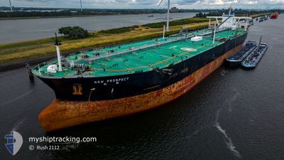
NEW PROSPECT
Crude Oil Tanker

Current Trip
NING BO,CN
| Time Travelled | 35 days |
|---|---|
| Remaining Time | --- |
| Distance Travelled | 9781.05 nm |
| Remaining Distance | --- |
| AVG Speed | 12.4 Knots |
| MAX Speed | 16.7 Knots |
| AVG Wind | 10.6 knots |
| MAX Wind | 22.6 knots |
| MIN Temp | 8.2°C / 46.76°F |
| MAX Temp | 33.6°C / 92.48°F |
| Draught | 20.4 m |
| Position Received | 3 d ago |
Current Position
| Longitude | 77.27912° |
|---|---|
| Latitude | 6.67719° |
| Status | Under way using engine |
| Speed | 14.2 Knots |
| Course | 116° |
| Area | Laccadive Sea |
| Station | T-AIS |
| Position Received | 3 d ago |
Information
The current position of NEW PROSPECT is in Laccadive Sea with coordinates 6.67719° / 77.27912° as reported on 2025-06-03 15:59 by AIS to our vessel tracker app. The vessel's current speed is 14.2 Knots
The vessel NEW PROSPECT (IMO: 9398058, MMSI: 636014203) is a Crude Oil Tanker that was built in 2009 ( 16 years old ). It's sailing under the flag of [LR] Liberia.
In this page you can find informations about the vessels current position, last detected port calls, and current voyage information. If the vessels is not in coverage by AIS you will find the latest position.
The current position of NEW PROSPECT is detected by our AIS receivers and we are not responsible for the reliability of the data. The last position was recorded while the vessel was in Coverage by the Ais receivers of our vessel tracking app.
The current draught of NEW PROSPECT as reported by AIS is 20.4 meters
Weather
| Temperature | 28.5°C / 83.3°F |
|---|---|
| Wind Speed | 16 knots |
| Direction | 219° SW |
| Pressure | 1009.6 hPa |
| Humidity | 77.3 % |
| Cloud Coverage | 100 % |


Featured Company
Events
| Time | Event | Details | Position / Dest | Info |
|---|---|---|---|---|
| 2025-06-03 16:06 | Status Changed | Default Under way using engine |
6.66428 / 77.30473
NING BO,CN
|
Speed: 14.2 kn Course: 116° |
| 2025-06-03 15:59 | OUT of Coverage |
6.67719 / 77.27912
Laccadive Sea
NING BO,CN
|
Speed: 14.2 kn Course: 116° |
|
| 2025-06-03 14:55 | Status Changed | Under way using engine Default |
6.79067 / 77.05069
NING BO,CN
|
Speed: 14.3 kn Course: 114° |
| 2025-06-03 14:37 | Status Changed | Default Under way using engine |
6.82147 / 76.98594
NING BO,CN
|
Speed: 14.3 kn Course: 115.3° |
| 2025-06-03 12:05 | ETA Changed | 2025/06/16 04:00 2025/06/16 12:00 |
7.07018 / 76.42727
NING BO,CN
|
Speed: 14.2 kn Course: 114.2° |
| 2025-06-03 11:34 | Change Sea Area | Indian part of the Laccadive Sea Omani part of the Gulf of Oman |
7.12122 / 76.31907
Laccadive Sea
NING BO,CN
|
Speed: 14 kn Course: 115.2° |
| 2025-06-03 11:33 | Status Changed | Under way using engine Default |
7.12273 / 76.31584
NING BO,CN
|
Speed: 13.7 kn Course: 118° |
| 2025-06-03 11:33 | IN Coverage |
7.12122 / 76.31907
Laccadive Sea
NING BO,CN
|
Speed: 14 kn Course: 115.2° |
|
| 2025-05-29 09:42 | Status Changed | Default Under way using engine |
24.82106 / 57.30490
NING BO,CN
|
Speed: 12.9 kn Course: 121.6° |
| 2025-05-29 09:35 | OUT of Coverage |
24.83535 / 57.27970
Gulf of Oman
NING BO,CN
|
Speed: 12.9 kn Course: 121.6° |