
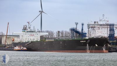
NEWBURY
Tanker
Current Trip
| Time Travelled | 1 day |
|---|---|
| Remaining Time | 6 days |
| Distance Travelled | 215.51 nm |
| Remaining Distance | 1212.73 nm |
| AVG Speed | 7.3 Knots |
| MAX Speed | 13.2 Knots |
| AVG Wind | 12.5 knots |
| MAX Wind | 16.2 knots |
| MIN Temp | 3.9°C / 39.02°F |
| MAX Temp | 6.8°C / 44.24°F |
| Draught | 8.3 m |
| Position Received | Now |
Current Position
| Longitude | -0.57615° |
|---|---|
| Latitude | 50.41828° |
| Status | Under way using engine |
| Speed | 4.9 Knots |
| Course | 257° |
| Area | English Channel |
| Station | T-AIS |
| Position Received | Now |
Info
Information
The current position of NEWBURY is in English Channel with coordinates 50.41828° / -0.57615° as reported on 2025-03-13 19:44 by AIS to our vessel tracker app. The vessel's current speed is 4.9 Knots and is heading at the port of ALGECIRAS. The estimated time of arrival as calculated by MyShipTracking vessel tracking app is 2025-03-19 23:04 LT
The vessel NEWBURY (IMO: 9920497, MMSI: 311001106) is a Tanker It's sailing under the flag of [BS] Bahamas.
In this page you can find informations about the vessels current position, last detected port calls, and current voyage information. If the vessels is not in coverage by AIS you will find the latest position.
The current position of NEWBURY is detected by our AIS receivers and we are not responsible for the reliability of the data. The last position was recorded while the vessel was in Coverage by the Ais receivers of our vessel tracking app.
The current draught of NEWBURY as reported by AIS is 8.3 meters
Weather
| Temperature | 6.7°C / 44.06°F |
|---|---|
| Wind Speed | 14 knots |
| Direction | 353° N |
| Pressure | 1005.1 hPa |
| Humidity | 67.7 % |
| Cloud Coverage | 98 % |
Featured Company
Last Port Calls
| Port | Arrival | Departure | Time In Port |
|---|---|---|---|
| 2025-03-11 11:59 | 2025-03-12 15:47 | 1 d | |
| 2025-03-08 10:04 | 2025-03-09 08:02 | 21 h | |
| 2025-02-21 12:34 | 2025-02-22 13:53 | 1 d | |
| 2025-02-01 10:30 | 2025-02-02 17:08 | 1 d | |
| 2025-01-27 14:19 | 2025-01-28 11:28 | 21 h | |
| 2025-01-13 08:22 | 2025-01-15 00:45 | 1 d |
Last Trips
| Origin | Departure | Destination | Arrival | Distance | |
|---|---|---|---|---|---|
| 2025-03-09 09:02 | 2025-03-11 12:59 | 580.65 nm | |||
| 2025-02-22 13:53 | 2025-03-08 11:04 | 2098.91 nm | |||
| 2025-02-02 18:08 | 2025-02-21 12:34 | 1064.87 nm | |||
| 2025-01-28 12:28 | 2025-02-01 11:30 | 939.70 nm | |||
| 2025-01-15 01:45 | 2025-01-27 15:19 | 1151.19 nm | |||
| 2024-12-02 07:31 | 2025-01-13 09:22 | 5815.51 nm |
Events
| Time | Event | Details | Position / Dest | Info |
|---|---|---|---|---|
| 2025-03-13 08:16 | Detected in Sea | United Kingdom part of the English Channel |
51.07573 / 1.46507
English Channel
NLRTM>ESALG
|
Speed: 10 kn Course: 232.8° |
| 2025-03-13 00:50 | Change Sea Area | United Kingdom part of the North Sea Belgian part of the North Sea |
51.79675 / 2.47070
North Sea
NLRTM>ESALG
|
Speed: 6 kn Course: 225.1° |
| 2025-03-13 00:05 | Change Sea Area | Belgian part of the North Sea Dutch part of the North Sea |
51.85257 / 2.56001
North Sea
NLRTM>ESALG
|
Speed: 6.5 kn Course: 221° |
| 2025-03-12 21:55 | Status Changed | Under way using engine Default |
52.02686 / 2.88525
NLRTM>ESALG
|
Speed: 7.5 kn Course: 266° |
| 2025-03-12 21:41 | Status Changed | Default Under way using engine |
52.02871 / 2.93485
NLRTM>ESALG
|
Speed: 7.5 kn Course: 264.3° |
| 2025-03-12 18:55 | Status Changed | Under way using engine Default |
52.04880 / 3.51158
NLRTM>ESALG
|
Speed: 7.9 kn Course: 266° |
| 2025-03-12 18:47 | IN Coverage |
52.04878 / 3.51104
North Sea
NLRTM>ESALG
|
Speed: 8 kn Course: 267.3° |
|
| 2025-03-12 17:48 | Status Changed | Default Under way using engine |
52.05142 / 3.73903
NLRTM>ESALG
|
Speed: 7.1 kn Course: 269.9° |
| 2025-03-12 17:47 | OUT of Coverage |
52.05141 / 3.74064
North Sea
NLRTM>ESALG
|
Speed: 7.1 kn Course: 269.9° |
|
| 2025-03-12 15:47 | PORT DEPARTURE |
|
51.96819 / 4.11754
NLRTM>ESALG
|
Speed: 8.6 kn Course: 300° |