
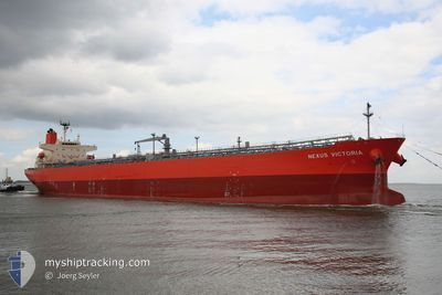
NEXUS VICTORIA
Tanker
Current Trip
| Time Travelled | 17 days |
|---|---|
| Remaining Time | 10 days |
| Distance Travelled | 4707.16 nm |
| Remaining Distance | 3258.68 nm |
| AVG Speed | 11.3 Knots |
| MAX Speed | 16.1 Knots |
| AVG Wind | 9.3 knots |
| MAX Wind | 25.3 knots |
| MIN Temp | 25.5°C / 77.9°F |
| MAX Temp | 34.1°C / 93.38°F |
| Draught | 12.4 m |
| Position Received | 4 h, 45 m ago |
Current Position
| Longitude | 57.04305° |
|---|---|
| Latitude | 24.68140° |
| Status | Under way using engine |
| Speed | 13 Knots |
| Course | 132.2° |
| Area | Gulf of Oman |
| Station | T-AIS |
| Position Received | 4 h, 45 m ago |
Information
The current position of NEXUS VICTORIA is in Gulf of Oman with coordinates 24.68140° / 57.04305° as reported on 2025-06-03 14:59 by AIS to our vessel tracker app. The vessel's current speed is 13 Knots and is heading at the port of SINGAPORE. The estimated time of arrival as calculated by MyShipTracking vessel tracking app is 2025-06-14 06:28 LT
The vessel NEXUS VICTORIA (IMO: 9610389, MMSI: 235108514) is a Tanker It's sailing under the flag of [GB] United Kingdom.
In this page you can find informations about the vessels current position, last detected port calls, and current voyage information. If the vessels is not in coverage by AIS you will find the latest position.
The current position of NEXUS VICTORIA is detected by our AIS receivers and we are not responsible for the reliability of the data. The last position was recorded while the vessel was in Coverage by the Ais receivers of our vessel tracking app.
The current draught of NEXUS VICTORIA as reported by AIS is 12.4 meters
Weather
| Temperature | 31.9°C / 89.42°F |
|---|---|
| Wind Speed | 8 knots |
| Direction | 309° NW |
| Pressure | 998.7 hPa |
| Humidity | 64.2 % |
| Cloud Coverage | 100 % |
Featured Company
Last Port Calls
| Port | Arrival | Departure | Time In Port |
|---|---|---|---|
| 2025-05-16 01:08 | 2025-05-17 04:57 | 1 d | |
| 2025-05-14 07:07 | 2025-05-16 00:54 | 1 d | |
| 2025-04-29 05:19 | 2025-04-30 20:55 | 1 d |
Last Trips
| Origin | Departure | Destination | Arrival | Distance | |
|---|---|---|---|---|---|
| 2025-05-16 08:54 | 2025-05-16 09:08 | 1.23 nm | |||
| 2025-04-30 23:55 | 2025-05-14 15:07 | 3776.84 nm | |||
| 2025-03-22 14:25 | 2025-04-29 08:19 | 7189.59 nm |
Events
| Time | Event | Details | Position / Dest | Info |
|---|---|---|---|---|
| 2025-06-03 15:01 | Status Changed | Default Under way using engine |
24.67653 / 57.04897
AE FJR=>SG SIN
|
Speed: 13 kn Course: 132.2° |
| 2025-06-03 14:59 | OUT of Coverage |
24.68140 / 57.04305
Gulf of Oman
AE FJR=>SG SIN
|
Speed: 13 kn Course: 132.2° |
|
| 2025-06-03 14:40 | Status Changed | Under way using engine Default |
24.72856 / 56.98675
AE FJR=>SG SIN
|
Speed: 13.2 kn Course: 132° |
| 2025-06-03 14:25 | Status Changed | Default Under way using engine |
24.76604 / 56.94213
AE FJR=>SG SIN
|
Speed: 13.2 kn Course: 132.5° |
| 2025-06-03 14:19 | Status Changed | Under way using engine Default |
24.78269 / 56.92229
AE FJR=>SG SIN
|
Speed: 13.2 kn Course: 131° |
| 2025-06-03 14:10 | Status Changed | Default Under way using engine |
24.80329 / 56.89737
AE FJR=>SG SIN
|
Speed: 13.2 kn Course: 131.5° |
| 2025-06-03 14:01 | Status Changed | Under way using engine Default |
24.82463 / 56.87083
AE FJR=>SG SIN
|
Speed: 13.1 kn Course: 131° |
| 2025-06-03 13:39 | Status Changed | Default Under way using engine |
24.87986 / 56.80368
AE FJR=>SG SIN
|
Speed: 13 kn Course: 133.1° |
| 2025-06-03 13:07 | Status Changed | Under way using engine Default |
24.96103 / 56.72027
AE FJR=>SG SIN
|
Speed: 12.5 kn Course: 159° |
| 2025-06-03 12:51 | Status Changed | Default Under way using engine |
25.01181 / 56.69835
AE FJR=>SG SIN
|
Speed: 12.4 kn Course: 158.9° |