

NIEDERSACHSEN 9
Cargo

Current Trip
| Time Travelled | 3 days |
|---|---|
| Remaining Time | --- |
| Distance Travelled | 21.27 nm |
| Remaining Distance | --- |
| AVG Speed | 6 Knots |
| MAX Speed | 7.2 Knots |
| AVG Wind | 12.5 knots |
| MAX Wind | 14 knots |
| MIN Temp | 18.6°C / 65.48°F |
| MAX Temp | 22.4°C / 72.32°F |
| Draught | 1.5 m |
| Position Received | 3 d ago |
Current Position
| Longitude | 7.54489° |
|---|---|
| Latitude | 52.28246° |
| Status | Under way using engine |
| Speed | 1.5 Knots |
| Course | --- |
| Area | North Sea |
| Station | T-AIS |
| Position Received | 3 d ago |
Information
The current position of NIEDERSACHSEN 9 is in North Sea with coordinates 52.28246° / 7.54489° as reported on 2025-05-30 14:42 by AIS to our vessel tracker app. The vessel's current speed is 1.5 Knots
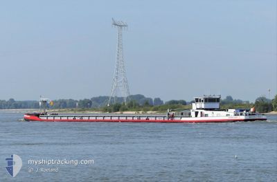
The vessel NIEDERSACHSEN 9 (MMSI: 211473580) is a Cargo It's sailing under the flag of [DE] Germany.
In this page you can find informations about the vessels current position, last detected port calls, and current voyage information. If the vessels is not in coverage by AIS you will find the latest position.
The current position of NIEDERSACHSEN 9 is detected by our AIS receivers and we are not responsible for the reliability of the data. The last position was recorded while the vessel was in Coverage by the Ais receivers of our vessel tracking app.
The current draught of NIEDERSACHSEN 9 as reported by AIS is 1.5 meters
Weather
| Temperature | 22.2°C / 71.96°F |
|---|---|
| Wind Speed | 12 knots |
| Direction | 252° WSW |
| Pressure | 1018.2 hPa |
| Humidity | 62.3 % |
| Cloud Coverage | 100 % |


Featured Company
Last Port Calls
| Port | Arrival | Departure | Time In Port |
|---|---|---|---|
| 2025-05-30 10:00 | 2025-05-30 10:25 | 24 m | |
| 2025-05-29 11:40 | 2025-05-29 13:17 | 1 h | |
| 2025-05-28 14:27 | 2025-05-29 07:13 | 16 h | |
| 2025-05-27 16:21 | 2025-05-28 09:19 | 16 h | |
| 2025-05-27 10:39 | 2025-05-27 12:40 | 2 h | |
| 2025-05-26 20:17 | 2025-05-27 05:58 | 9 h | |
| 2025-05-26 12:53 | 2025-05-26 20:12 | 7 h | |
| 2025-05-22 16:13 | 2025-05-23 06:59 | 14 h | |
| 2025-05-19 12:26 | 2025-05-22 15:00 | 3 d | |
| 2025-05-18 19:57 | 2025-05-19 11:15 | 15 h |
Last Trips
| Origin | Departure | Destination | Arrival | Distance | |
|---|---|---|---|---|---|
| 2025-05-29 13:17 | 2025-05-30 10:00 | 43.94 nm | |||
| 2025-05-29 07:13 | 2025-05-29 11:40 | 48.37 nm | |||
| 2025-05-28 09:19 | 2025-05-28 14:27 | 20.64 nm | |||
| 2025-05-27 12:40 | 2025-05-27 16:21 | 18.82 nm | |||
| 2025-05-27 05:58 | 2025-05-27 10:39 | 14.76 nm | |||
| 2025-05-26 20:12 | 2025-05-26 20:17 | 0.08 nm | |||
| 2025-05-23 06:59 | 2025-05-26 12:53 | 242.37 nm | |||
| 2025-05-22 15:00 | 2025-05-22 16:13 | 12.40 nm | |||
| 2025-05-19 11:15 | 2025-05-19 12:26 | 11.93 nm | |||
| 2025-05-15 16:22 | 2025-05-18 19:57 | 190.10 nm |
Events
| Time | Event | Details | Position / Dest | Info |
|---|---|---|---|---|
| 2025-05-30 14:49 | Status Changed | Default Under way using engine |
52.28248 / 7.54472
LINGEN
|
Speed: 1.5 kn Course: 511° |
| 2025-05-30 14:49 | STOP Moving | 2.34 nm, West of BERGESHOEVEDE |
52.28248 / 7.54472
LINGEN
|
Speed: Course: -1° |
| 2025-05-30 14:42 | OUT of Coverage |
52.28246 / 7.54489
North Sea
|
Speed: 1.5 kn Course: 283.5° |
|
| 2025-05-30 14:22 | START Moving | 0.75 nm, West of BERGESHOEVEDE |
52.27781 / 7.58714
LINGEN
|
Speed: 4 kn Course: 279.3° |
| 2025-05-30 13:08 | STOP Moving | 0.51 nm, West of BERGESHOEVEDE |
52.27750 / 7.59350
LINGEN
|
Speed: 0.2 kn Course: 511° |
| 2025-05-30 13:03 | START Moving | 0.28 nm, West of BERGESHOEVEDE |
52.27710 / 7.60010
LINGEN
|
Speed: 3.9 kn Course: 277.8° |
| 2025-05-30 11:30 | STOP Moving | 0.15 nm, North West of BERGESHOEVEDE |
52.27707 / 7.60404
LINGEN
|
Speed: 0.1 kn Course: 511° |
| 2025-05-30 11:09 | Status Changed | Under way using engine Default |
52.25279 / 7.64132
LINGEN
|
Speed: 6.7 kn Course: 311° |
| 2025-05-30 10:59 | IN Coverage |
52.25690 / 7.63376
North Sea
|
Speed: 7.2 kn Course: 327.3° |
|
| 2025-05-30 08:49 | OUT of Coverage |
52.01934 / 7.66438
North Sea
|
Speed: 5.6 kn Course: 12° |