
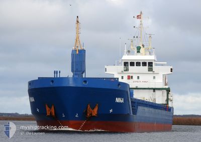
NINA
General Cargo
Current Trip
| Time Travelled | 1 day |
|---|---|
| Remaining Time | --- |
| Distance Travelled | 292.28 nm |
| Remaining Distance | --- |
| AVG Speed | 9.3 Knots |
| MAX Speed | 10.4 Knots |
| AVG Wind | 10.3 knots |
| MAX Wind | 19.8 knots |
| MIN Temp | 12.3°C / 54.14°F |
| MAX Temp | 13.9°C / 57.02°F |
| Draught | 6.1 m |
| Position Received | 1 d ago |
Current Position
| Longitude | -9.16669° |
|---|---|
| Latitude | 41.30495° |
| Status | Under way using engine |
| Speed | 9.3 Knots |
| Course | 333.3° |
| Area | North Atlantic Ocean |
| Station | T-AIS |
| Position Received | 1 d ago |
Info
Information
The current position of NINA is in North Atlantic Ocean with coordinates 41.30495° / -9.16669° as reported on 2025-02-11 20:17 by AIS to our vessel tracker app. The vessel's current speed is 9.3 Knots and is heading at the port of ROUEN. The estimated time of arrival as calculated by MyShipTracking vessel tracking app is 2025-02-15 04:00 LT
The vessel NINA (IMO: 9277278, MMSI: 209075000) is a General Cargo that was built in 2003 ( 22 years old ). It's sailing under the flag of [CY] Cyprus.
In this page you can find informations about the vessels current position, last detected port calls, and current voyage information. If the vessels is not in coverage by AIS you will find the latest position.
The current position of NINA is detected by our AIS receivers and we are not responsible for the reliability of the data. The last position was recorded while the vessel was in Coverage by the Ais receivers of our vessel tracking app.
The current draught of NINA as reported by AIS is 6.1 meters
Weather
| Temperature | 12.8°C / 55.04°F |
|---|---|
| Wind Speed | 14 knots |
| Direction | 184° S |
| Pressure | 1016.2 hPa |
| Humidity | 96.9 % |
| Cloud Coverage | 100 % |
Featured Company
Last Port Calls
| Port | Arrival | Departure | Time In Port |
|---|---|---|---|
| 2025-02-08 16:44 | 2025-02-11 15:35 | 2 d | |
| 2025-02-06 12:19 | 2025-02-07 21:43 | 1 d | |
| 2025-01-31 06:33 | 2025-02-01 00:27 | 17 h | |
| 2025-01-29 00:48 | 2025-01-29 20:09 | 19 h | |
| 2025-01-27 13:15 | 2025-01-27 14:05 | 49 m | |
| 2025-01-27 02:44 | 2025-01-27 04:05 | 1 h | |
| 2025-01-22 09:23 | 2025-01-23 20:21 | 1 d | |
| 2025-01-19 23:14 | 2025-01-20 19:45 | 20 h | |
| 2025-01-12 11:12 | 2025-01-14 08:51 | 1 d | |
| 2024-12-29 10:05 | 2025-01-01 07:19 | 2 d |
Last Trips
| Origin | Departure | Destination | Arrival | Distance | |
|---|---|---|---|---|---|
| 2025-02-07 21:43 | 2025-02-08 16:44 | 185.40 nm | |||
| 2025-02-01 01:27 | 2025-02-06 12:19 | 1191.24 nm | |||
| 2025-01-29 21:09 | 2025-01-31 07:33 | 71.09 nm | |||
| 2025-01-27 15:05 | 2025-01-29 01:48 | 289.73 nm | |||
| 2025-01-27 05:05 | 2025-01-27 14:15 | 51.84 nm | |||
| 2025-01-23 22:21 | 2025-01-27 03:44 | 677.83 nm | |||
| 2025-01-20 20:45 | 2025-01-22 11:23 | 347.89 nm | |||
| 2025-01-14 09:51 | 2025-01-20 00:14 | 915.20 nm | |||
| 2025-01-01 07:19 | 2025-01-12 12:12 | 986.82 nm | |||
| 2024-12-24 11:57 | 2024-12-29 10:05 | 1104.97 nm |
Events
| Time | Event | Details | Position / Dest | Info |
|---|---|---|---|---|
| 2025-02-11 20:17 | OUT of Coverage |
41.30495 / -9.16669
North Atlantic Ocean
FRURO
|
Speed: 9.3 kn Course: 333.3° |
|
| 2025-02-11 15:35 | PORT DEPARTURE |
|
40.64294 / -8.76057
FRURO
|
Speed: 8.4 kn Course: 235° |
| 2025-02-11 15:20 | START Moving |
40.64647 / -8.72665
[PT] AVEIRO
|
Speed: 4.7 kn Course: 342° |
|
| 2025-02-11 15:00 | Status Changed | Under way using engine Moored |
40.64430 / -8.72567
[PT] AVEIRO
|
Speed: Course: 328° |
| 2025-02-11 15:00 | Draught Changed | 6.1 3.7 |
40.64427 / -8.72569
[PT] AVEIRO
|
Speed: Course: 328° |
| 2025-02-11 15:00 | Destination Changed | FRURO PTAVE |
40.64427 / -8.72569
[PT] AVEIRO
|
Speed: Course: 328° |
| 2025-02-11 15:00 | ETA Changed | 2025/02/15 04:00 2025/02/08 16:00 |
40.64427 / -8.72569
[PT] AVEIRO
|
Speed: Course: 328° |
| 2025-02-08 17:32 | Status Changed | Moored Under way using engine |
40.64430 / -8.72570
[PT] AVEIRO
|
Speed: Course: 327° |
| 2025-02-08 17:09 | STOP Moving |
40.64490 / -8.72543
[PT] AVEIRO
|
Speed: 0.3 kn Course: 357° |
|
| 2025-02-08 16:44 | PORT ARRIVAL |
|
40.64360 / -8.75816
[PT] AVEIRO
|
Speed: 8.1 kn Course: 55.6° |