
NORDIC SKIER
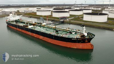
Crude Oil Tanker
Current Trip
| Time Travelled | 15 days |
|---|---|
| Remaining Time | --- |
| Distance Travelled | 572.25 nm |
| Remaining Distance | 8.97 nm |
| AVG Speed | 8.3 Knots |
| MAX Speed | 16.6 Knots |
| AVG Wind | 9.4 knots |
| MAX Wind | 25.8 knots |
| MIN Temp | 19.4°C / 66.92°F |
| MAX Temp | 26°C / 78.8°F |
| Draught | 9 m |
| Position Received | 2 m ago |
Current Position
| Longitude | 53.05947° |
|---|---|
| Latitude | 25.01582° |
| Status | At anchor |
| Speed | |
| Course | 315° |
| Area | Persian Gulf |
| Station | T-AIS |
| Position Received | 2 m ago |
Information
The current position of NORDIC SKIER is in Persian Gulf with coordinates 25.01582° / 53.05947° as reported on 2025-03-28 14:37 by AIS to our vessel tracker app. The vessel's current speed is 0 Knots and is heading at the port of ZIRKU. The estimated time of arrival as calculated by MyShipTracking vessel tracking app is 2025-03-27 10:00 LT
The vessel NORDIC SKIER (IMO: 9297515, MMSI: 319070500) is a Crude Oil Tanker that was built in 2005 ( 20 years old ). It's sailing under the flag of [KY] Cayman Is.
In this page you can find informations about the vessels current position, last detected port calls, and current voyage information. If the vessels is not in coverage by AIS you will find the latest position.
The current position of NORDIC SKIER is detected by our AIS receivers and we are not responsible for the reliability of the data. The last position was recorded while the vessel was in Coverage by the Ais receivers of our vessel tracking app.
The current draught of NORDIC SKIER as reported by AIS is 9 meters
Weather
| Temperature | 22.2°C / 71.96°F |
|---|---|
| Wind Speed | 6 knots |
| Direction | 345° NNW |
| Pressure | 1013.5 hPa |
| Humidity | 57.9 % |
| Cloud Coverage | 4 % |
Featured Company
Most Visited Ports (Last year)
| Port | Arrivals | |
|---|---|---|
| 1 |
Last Trips
| Origin | Departure | Destination | Arrival | Distance |
|---|
Events
| Time | Event | Details | Position / Dest | Info |
|---|---|---|---|---|
| 2025-03-28 14:34 | Status Changed | At anchor Default |
25.01582 / 53.05942
AEZUR
|
Speed: Course: 322° |
| 2025-03-28 14:23 | Status Changed | Default At anchor |
25.01562 / 53.05920
AEZUR
|
Speed: Course: 322° |
| 2025-03-28 06:31 | Status Changed | At anchor Default |
25.01810 / 53.06020
AEZUR
|
Speed: Course: 254° |
| 2025-03-28 06:25 | Status Changed | Default At anchor |
25.01808 / 53.06020
AEZUR
|
Speed: Course: 255° |
| 2025-03-27 23:22 | Status Changed | At anchor Default |
25.01602 / 53.05598
AEZUR
|
Speed: Course: 49° |
| 2025-03-27 23:19 | Status Changed | Default At anchor |
25.01598 / 53.05605
AEZUR
|
Speed: Course: 49° |
| 2025-03-27 20:46 | Status Changed | At anchor Default |
25.01557 / 53.05663
AEZUR
|
Speed: Course: 35° |
| 2025-03-27 20:40 | Status Changed | Default At anchor |
25.01563 / 53.05658
AEZUR
|
Speed: Course: 34° |
| 2025-03-27 20:13 | Status Changed | At anchor Default |
25.01545 / 53.05687
AEZUR
|
Speed: Course: 20° |
| 2025-03-27 20:08 | Status Changed | Default At anchor |
25.01540 / 53.05700
AEZUR
|
Speed: Course: 20° |