

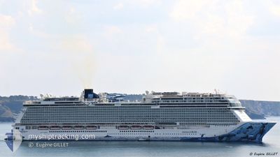
NORWEGIAN BLISS
Passenger
Current Trip
| Time Travelled | 1 day |
|---|---|
| Remaining Time | 2 h, 22 mins |
| Distance Travelled | 764.07 nm |
| Remaining Distance | 54.49 nm |
| AVG Speed | 19.1 Knots |
| MAX Speed | 22.3 Knots |
| AVG Wind | 11.5 knots |
| MAX Wind | 28.8 knots |
| MIN Temp | 8.6°C / 47.48°F |
| MAX Temp | 26.6°C / 79.88°F |
| Draught | 8.8 m |
| Position Received | 14 h, 30 m ago |
Current Position
| Longitude | -131.81639° |
|---|---|
| Latitude | 52.09293° |
| Status | Under way using engine |
| Speed | 19.6 Knots |
| Course | 320.3° |
| Area | North Pacific Ocean |
| Station | T-AIS |
| Position Received | 14 h, 30 m ago |
Information
The current position of NORWEGIAN BLISS is in North Pacific Ocean with coordinates 52.09293° / -131.81639° as reported on 2025-06-08 23:32 by AIS to our vessel tracker app. The vessel's current speed is 19.6 Knots and is heading at the port of SITKA. The estimated time of arrival as calculated by MyShipTracking vessel tracking app is 2025-06-09 08:25 LT
The vessel NORWEGIAN BLISS (IMO: 9751509, MMSI: 311000710) is a Passenger It's sailing under the flag of [BS] Bahamas.
In this page you can find informations about the vessels current position, last detected port calls, and current voyage information. If the vessels is not in coverage by AIS you will find the latest position.
The current position of NORWEGIAN BLISS is detected by our AIS receivers and we are not responsible for the reliability of the data. The last position was recorded while the vessel was in Coverage by the Ais receivers of our vessel tracking app.
The current draught of NORWEGIAN BLISS as reported by AIS is 8.8 meters
Weather
| Temperature | 8.7°C / 47.66°F |
|---|---|
| Wind Speed | 11 knots |
| Direction | 261° W |
| Pressure | 1026.4 hPa |
| Humidity | 83.7 % |
| Cloud Coverage | 100 % |
Featured Company
Last Port Calls
| Port | Arrival | Departure | Time In Port |
|---|---|---|---|
| 2025-06-07 05:04 | 2025-06-07 16:20 | 11 h | |
| 2025-06-06 19:28 | 2025-06-07 00:02 | 4 h | |
| 2025-06-03 05:52 | 2025-06-03 14:00 | 8 h | |
| 2025-05-31 05:01 | 2025-05-31 16:20 | 11 h | |
| 2025-05-30 19:16 | 2025-05-31 00:11 | 4 h | |
| 2025-05-27 05:52 | 2025-05-27 13:56 | 8 h | |
| 2025-05-24 05:04 | 2025-05-24 16:12 | 11 h | |
| 2025-05-23 19:16 | 2025-05-23 23:58 | 4 h | |
| 2025-05-20 05:44 | 2025-05-20 14:28 | 8 h | |
| 2025-05-17 05:05 | 2025-05-17 16:15 | 11 h |
Most Visited Ports (Last year)
| Port | Arrivals | |
|---|---|---|
| 29 | ||
| 28 | ||
| 28 | ||
| 13 | ||
| 8 | ||
| 7 |
Last Trips
| Origin | Departure | Destination | Arrival | Distance | |
|---|---|---|---|---|---|
| 2025-06-07 00:02 | 2025-06-07 05:04 | 83.23 nm | |||
| 2025-06-03 14:00 | 2025-06-06 19:28 | 1077.77 nm | |||
| 2025-05-31 16:20 | 2025-06-03 05:52 | 1045.15 nm | |||
| 2025-05-31 00:11 | 2025-05-31 05:01 | 83.13 nm | |||
| 2025-05-27 13:56 | 2025-05-30 19:16 | 1074.54 nm | |||
| 2025-05-24 16:12 | 2025-05-27 05:52 | 1045.44 nm | |||
| 2025-05-23 23:58 | 2025-05-24 05:04 | 83.47 nm | |||
| 2025-05-20 14:28 | 2025-05-23 19:16 | 1054.67 nm | |||
| 2025-05-17 16:15 | 2025-05-20 05:44 | 1045.06 nm | |||
| 2025-05-17 00:10 | 2025-05-17 05:05 | 83.14 nm |
Events
| Time | Event | Details | Position / Dest | Info |
|---|---|---|---|---|
| 2025-06-08 23:36 | Status Changed | Default Under way using engine |
52.10911 / -131.83849
SITKA, AK
|
Speed: 19.6 kn Course: 320.3° |
| 2025-06-08 23:32 | OUT of Coverage |
52.09293 / -131.81639
North Pacific Ocean
SITKA, AK
|
Speed: 19.6 kn Course: 320.3° |
|
| 2025-06-08 23:22 | Status Changed | Under way using engine Default |
52.04771 / -131.75557
SITKA, AK
|
Speed: 19.4 kn Course: 320° |
| 2025-06-08 22:26 | Status Changed | Default Under way using engine |
51.81081 / -131.44141
SITKA, AK
|
Speed: 20.2 kn Course: 313.9° |
| 2025-06-08 22:21 | Status Changed | Under way using engine Default |
51.78789 / -131.40848
SITKA, AK
|
Speed: 20.2 kn Course: 312° |
| 2025-06-08 22:21 | IN Coverage |
51.78789 / -131.40848
North Pacific Ocean
SITKA, AK
|
Speed: 20.2 kn Course: 313.9° |
|
| 2025-06-08 18:40 | Status Changed | Default Under way using engine |
50.91586 / -129.92253
SITKA, AK
|
Speed: 20.9 kn Course: 311.7° |
| 2025-06-08 18:32 | OUT of Coverage |
50.88645 / -129.87083
North Pacific Ocean
SITKA, AK
|
Speed: 20.9 kn Course: 311.7° |
|
| 2025-06-08 18:32 | Status Changed | Under way using engine Default |
50.88607 / -129.87015
SITKA, AK
|
Speed: 20.7 kn Course: 312° |
| 2025-06-08 17:55 | Status Changed | Default Under way using engine |
50.74112 / -129.61870
SITKA, AK
|
Speed: 21 kn Course: 312.1° |