
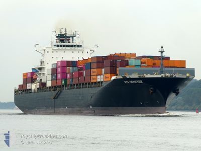
NYK DEMETER
Container Ship
Current Trip
| Time Travelled | 1 day |
|---|---|
| Remaining Time | 1 day |
| Distance Travelled | 309.71 nm |
| Remaining Distance | 645.30 nm |
| AVG Speed | 10.6 Knots |
| MAX Speed | 14.8 Knots |
| AVG Wind | 8.1 knots |
| MAX Wind | 15.7 knots |
| MIN Temp | 22.6°C / 72.68°F |
| MAX Temp | 29°C / 84.2°F |
| Draught | 11.9 m |
| Position Received | 17 h, 51 m ago |
Current Position
| Longitude | -79.55700° |
|---|---|
| Latitude | 9.83385° |
| Status | Under way using engine |
| Speed | 14.6 Knots |
| Course | 48.4° |
| Area | Caribbean Sea |
| Station | T-AIS |
| Position Received | 17 h, 51 m ago |
Info
Information
The current position of NYK DEMETER is in Caribbean Sea with coordinates 9.83385° / -79.55700° as reported on 2026-01-04 20:12 by AIS to our vessel tracker app. The vessel's current speed is 14.6 Knots and is heading at the port of BOCA CHIKA. The estimated time of arrival as calculated by MyShipTracking vessel tracking app is 2026-01-07 05:31 LT
The vessel NYK DEMETER (IMO: 9337664, MMSI: 353025000) is a Container Ship that was built in 2007 ( 19 years old ). It's sailing under the flag of [PA] Panama.
In this page you can find informations about the vessels current position, last detected port calls, and current voyage information. If the vessels is not in coverage by AIS you will find the latest position.
The current position of NYK DEMETER is detected by our AIS receivers and we are not responsible for the reliability of the data. The last position was recorded while the vessel was in Coverage by the Ais receivers of our vessel tracking app.
The current draught of NYK DEMETER as reported by AIS is 11.9 meters
Weather
| Temperature | 26.8°C / 80.24°F |
|---|---|
| Wind Speed | 13 knots |
| Direction | 12° NNE |
| Pressure | 1012.8 hPa |
| Humidity | 78.3 % |
| Cloud Coverage | 100 % |
Featured Company
Last Port Calls
| Port | Arrival | Departure | Time In Port |
|---|---|---|---|
| 2026-01-02 10:59 | 2026-01-03 09:18 | 22 h | |
| 2025-12-22 16:41 | 2025-12-24 05:23 | 1 d | |
| 2025-12-18 05:25 | 2025-12-21 04:01 | 2 d | |
| 2025-12-09 19:35 | 2025-12-10 06:53 | 11 h | |
| 2025-12-06 05:04 | 2025-12-06 18:45 | 13 h | |
| 2025-12-02 15:43 | 2025-12-03 10:21 | 18 h | |
| 2025-11-19 18:38 | 2025-11-20 23:08 | 1 d | |
| 2025-11-15 21:42 | 2025-11-16 15:02 | 17 h | |
| 2025-11-12 22:51 | 2025-11-13 20:12 | 21 h | |
| 2025-11-11 08:22 | 2025-11-12 13:45 | 1 d |
Last Trips
| Origin | Departure | Destination | Arrival | Distance | |
|---|---|---|---|---|---|
| 2025-12-24 05:23 | 2026-01-02 10:59 | 3343.47 nm | |||
| 2025-12-21 04:01 | 2025-12-22 16:41 | 411.73 nm | |||
| 2025-12-10 06:53 | 2025-12-18 05:25 | 3021.35 nm | |||
| 2025-12-06 18:45 | 2025-12-09 19:35 | 327.78 nm | |||
| 2025-12-03 10:21 | 2025-12-06 05:04 | 1159.01 nm | |||
| 2025-11-20 23:08 | 2025-12-02 15:43 | 4192.60 nm | |||
| 2025-11-16 15:02 | 2025-11-19 18:38 | 420.92 nm | |||
| 2025-11-13 20:12 | 2025-11-15 21:42 | 513.06 nm | |||
| 2025-11-12 13:45 | 2025-11-12 22:51 | 112.28 nm | |||
| 2025-10-30 16:18 | 2025-11-11 08:22 | 3965.91 nm |
Events
| Time | Event | Details | Position / Dest | Info |
|---|---|---|---|---|
| 2026-01-04 20:15 | Status Changed | Default Under way using engine |
9.84111 / -79.54871
DOCAU
|
Speed: 14.6 kn Course: 48.4° |
| 2026-01-04 20:12 | OUT of Coverage |
9.83385 / -79.55700
Caribbean Sea
|
Speed: 14.6 kn Course: 48.4° |
|
| 2026-01-04 18:10 | Destination Changed | DOCAU PANAMA |
9.47046 / -79.88905
DOCAU
|
Speed: 13.9 kn Course: 46° |
| 2026-01-04 17:44 | ETA Changed | 2026/01/04 10:00 |
9.38649 / -79.91864
PANAMA
|
Speed: 10.1 kn Course: 359.9° |
| 2026-01-04 17:37 | Change Sea Area | Panamanian part of the Caribbean Sea Panamanian part of the North Pacific Ocean |
9.36891 / -79.91864
Caribbean Sea
|
Speed: 5.9 kn Course: 0° |
| 2026-01-04 16:53 | START Moving | 3.91 nm, South of CRISTOBAL |
9.28185 / -79.92136
PANAMA
|
Speed: 4 kn Course: 6° |
| 2026-01-04 15:38 | ETA Changed | 2026/01/04 10:00 |
9.27022 / -79.92306
PANAMA
|
Speed: Course: 10° |
| 2026-01-04 15:12 | STOP Moving | 4.97 nm, South of CRISTOBAL |
9.26441 / -79.92386
PANAMA
|
Speed: Course: 9° |
| 2026-01-04 14:31 | Status Changed | Under way using engine Default |
9.19694 / -79.89737
PANAMA
|
Speed: 11.8 kn Course: 299° |
| 2026-01-04 14:27 | Status Changed | Default Under way using engine |
9.19016 / -79.88490
PANAMA
|
Speed: 10.9 kn Course: 286° |