
OLIB
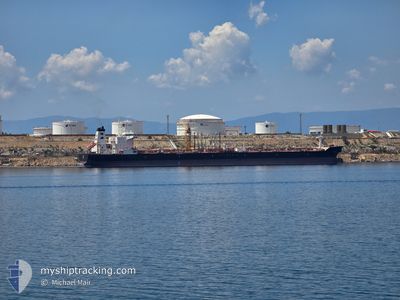
Crude Oil Tanker
Current Trip
| Time Travelled | 9 days |
|---|---|
| Remaining Time | --- |
| Distance Travelled | 858.76 nm |
| Remaining Distance | --- |
| AVG Speed | 8.6 Knots |
| MAX Speed | 13.2 Knots |
| AVG Wind | 13.4 knots |
| MAX Wind | 29 knots |
| MIN Temp | 11.4°C / 52.52°F |
| MAX Temp | 18°C / 64.4°F |
| Draught | 8.5 m |
| Position Received | 1 m ago |
Current Position
| Longitude | 35.39023° |
|---|---|
| Latitude | 36.19212° |
| Status | Under way using engine |
| Speed | 1.2 Knots |
| Course | 106° |
| Area | Mediterranean Sea - Eastern Basin |
| Station | T-AIS |
| Position Received | 1 m ago |
Info
Information
The current position of OLIB is in Mediterranean Sea - Eastern Basin with coordinates 36.19212° / 35.39023° as reported on 2025-12-18 00:17 by AIS to our vessel tracker app. The vessel's current speed is 1.2 Knots
The vessel OLIB (IMO: 9334739, MMSI: 238252000) is a Crude Oil Tanker that was built in 2009 ( 16 years old ). It's sailing under the flag of [HR] Croatia.
In this page you can find informations about the vessels current position, last detected port calls, and current voyage information. If the vessels is not in coverage by AIS you will find the latest position.
The current position of OLIB is detected by our AIS receivers and we are not responsible for the reliability of the data. The last position was recorded while the vessel was in Coverage by the Ais receivers of our vessel tracking app.
The current draught of OLIB as reported by AIS is 8.5 meters
Weather
| Temperature | 16.4°C / 61.52°F |
|---|---|
| Wind Speed | 7 knots |
| Direction | 8° N |
| Pressure | 1024.5 hPa |
| Humidity | 45 % |
| Cloud Coverage | --- |
Featured Company
Last Trips
| Origin | Departure | Destination | Arrival | Distance | |
|---|---|---|---|---|---|
| 2025-11-26 15:37 | 2025-12-07 16:53 | 1766.15 nm | |||
| 2025-11-10 19:48 | 2025-11-25 12:29 | 1452.53 nm | |||
| 2025-10-30 21:39 | 2025-11-09 15:40 | 1591.94 nm | |||
| 2025-10-18 19:56 | 2025-10-29 06:51 | 1461.91 nm | |||
| 2025-08-30 14:10 | 2025-10-17 23:44 | 9672.96 nm |
Events
| Time | Event | Details | Position / Dest | Info |
|---|---|---|---|---|
| 2025-12-17 15:38 | ETA Changed | 2025/12/18 06:00 2025/12/18 07:00 |
36.24955 / 35.07381
TR CEY
|
Speed: 12 kn Course: 73° |
| 2025-12-17 14:41 | Change Sea Area | Turkish part of the Mediterranean Sea - Eastern Basin Cypriote part of the Mediterranean Sea - Eastern Basin |
36.19566 / 34.86440
Mediterranean Sea - Eastern Basin
TR CEY
|
Speed: 11.5 kn Course: 73.4° |
| 2025-12-17 14:41 | Status Changed | Under way using engine Default |
36.19566 / 34.86440
TR CEY
|
Speed: 11.6 kn Course: 73° |
| 2025-12-17 14:35 | Status Changed | Default Under way using engine |
36.19004 / 34.84157
TR CEY
|
Speed: 11.6 kn Course: 72.6° |
| 2025-12-17 14:32 | Status Changed | Under way using engine Default |
36.18731 / 34.83073
TR CEY
|
Speed: 12 kn Course: 71° |
| 2025-12-17 14:32 | IN Coverage |
36.18731 / 34.83073
Mediterranean Sea - Eastern Basin
TR CEY
|
Speed: 11.6 kn Course: 72.6° |
|
| 2025-12-17 14:32 | Detected in Sea | Cypriote part of the Mediterranean Sea - Eastern Basin |
36.18731 / 34.83073
Mediterranean Sea - Eastern Basin
TR CEY
|
Speed: 11.6 kn Course: 72.6° |
| 2025-12-17 03:32 | Status Changed | Default Under way using engine |
35.86500 / 32.44833
TR CEY
|
Speed: 11.1 kn Course: 90.3° |
| 2025-12-17 03:24 | Status Changed | Under way using engine Default |
35.86425 / 32.41768
TR CEY
|
Speed: 11 kn Course: 89° |
| 2025-12-17 03:24 | OUT of Coverage |
35.86425 / 32.41768
Mediterranean Sea - Eastern Basin
TR CEY
|
Speed: 11.1 kn Course: 90.3° |