
OLYMPIC FLAG
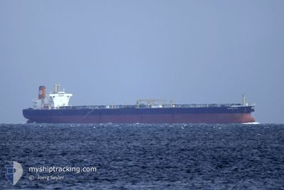
Crude Oil Tanker
Current Trip
EG SUZ
| Time Travelled | --- |
|---|---|
| Remaining Time | --- |
| Distance Travelled | --- |
| Remaining Distance | --- |
| AVG Speed | --- |
| MAX Speed | --- |
| AVG Wind | --- |
| MAX Wind | --- |
| MIN Temp | --- |
| MAX Temp | --- |
| Draught | 9.4 m |
| Position Received | 3 d ago |
Current Position
| Longitude | 32.26658° |
|---|---|
| Latitude | 31.51433° |
| Status | Under way using engine |
| Speed | 12.7 Knots |
| Course | 307.3° |
| Area | Mediterranean Sea - Eastern Basin |
| Station | T-AIS |
| Position Received | 3 d ago |
Info
Information
The current position of OLYMPIC FLAG is in Mediterranean Sea - Eastern Basin with coordinates 31.51433° / 32.26658° as reported on 2026-01-06 16:59 by AIS to our vessel tracker app. The vessel's current speed is 12.7 Knots
The vessel OLYMPIC FLAG (IMO: 9271341, MMSI: 240168000) is a Crude Oil Tanker that was built in 2004 ( 22 years old ). It's sailing under the flag of [GR] Greece.
In this page you can find informations about the vessels current position, last detected port calls, and current voyage information. If the vessels is not in coverage by AIS you will find the latest position.
The current position of OLYMPIC FLAG is detected by our AIS receivers and we are not responsible for the reliability of the data. The last position was recorded while the vessel was in Coverage by the Ais receivers of our vessel tracking app.
The current draught of OLYMPIC FLAG as reported by AIS is 9.4 meters
Weather
| Temperature | 14.4°C / 57.92°F |
|---|---|
| Wind Speed | 32 knots |
| Direction | 296° WNW |
| Pressure | 1011.3 hPa |
| Humidity | 60.9 % |
| Cloud Coverage | 80 % |
Featured Company
Last Port Calls
| Port | Arrival | Departure | Time In Port |
|---|---|---|---|
| 2026-01-06 08:21 | 2026-01-06 17:21 | 9 h | |
| 2025-12-15 21:36 | |||
| 2025-11-25 16:01 | |||
| 2025-11-06 08:18 | 2025-11-06 17:31 | 9 h |
Most Visited Ports (Last year)
| Port | Arrivals | |
|---|---|---|
| 9 | ||
| 6 | ||
| 1 | ||
| 1 | ||
| 1 |
Last Trips
| Origin | Departure | Destination | Arrival | Distance | |
|---|---|---|---|---|---|
| 2025-09-27 03:40 | 2025-11-25 16:01 | 15360.55 nm | |||
| 2025-09-27 03:40 | 2025-11-06 08:18 | 9697.32 nm |
Events
| Time | Event | Details | Position / Dest | Info |
|---|---|---|---|---|
| 2026-01-06 17:03 | Status Changed | Default Under way using engine |
31.52333 / 32.25167
EG SUZ
|
Speed: 12.7 kn Course: 307.3° |
| 2026-01-06 16:59 | Status Changed | Under way using engine Default |
31.51433 / 32.26658
EG SUZ
|
Speed: 12.7 kn Course: 306° |
| 2026-01-06 16:59 | OUT of Coverage |
31.51433 / 32.26658
Mediterranean Sea - Eastern Basin
|
Speed: 12.7 kn Course: 307.3° |
|
| 2026-01-06 16:32 | Status Changed | Default Under way using engine |
31.46405 / 32.35415
EG SUZ
|
Speed: 12.1 kn Course: 298.3° |
| 2026-01-06 16:23 | Status Changed | Under way using engine Default |
31.44823 / 32.38769
EG SUZ
|
Speed: 11.6 kn Course: 316° |
| 2026-01-06 16:00 | Status Changed | Default Under way using engine |
31.37989 / 32.39016
EG SUZ
|
Speed: 12.1 kn Course: 14.2° |
| 2026-01-06 15:53 | Status Changed | Under way using engine Default |
31.35717 / 32.38338
EG SUZ
|
Speed: 12 kn Course: 13° |
| 2026-01-06 15:53 | Status Changed | Default Under way using engine |
31.35497 / 32.38274
EG SUZ
|
Speed: 12 kn Course: 14° |
| 2026-01-06 15:34 | Change Sea Area | Egyptian part of the Mediterranean Sea - Eastern Basin Egyptian part of the Gulf of Suez |
31.29388 / 32.36410
Mediterranean Sea - Eastern Basin
|
Speed: 11.9 kn Course: 15.2° |
| 2026-01-06 15:34 | Status Changed | Under way using engine Default |
31.29388 / 32.36410
EG SUZ
|
Speed: 11.9 kn Course: 14° |