
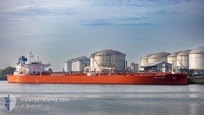
ON PHOENIX
Tanker
Current Trip
| Time Travelled | 1 day |
|---|---|
| Remaining Time | --- |
| Distance Travelled | 454.76 nm |
| Remaining Distance | --- |
| AVG Speed | 11.5 Knots |
| MAX Speed | 13.5 Knots |
| AVG Wind | 5.1 knots |
| MAX Wind | 11 knots |
| MIN Temp | 21.7°C / 71.06°F |
| MAX Temp | 25.5°C / 77.9°F |
| Draught | 14.7 m |
| Position Received | 5 h, 41 m ago |
Current Position
| Longitude | 55.93148° |
|---|---|
| Latitude | 26.22230° |
| Status | Under way using engine |
| Speed | 12.6 Knots |
| Course | 57.2° |
| Area | Persian Gulf |
| Station | T-AIS |
| Position Received | 5 h, 41 m ago |
Info
Information
The current position of ON PHOENIX is in Persian Gulf with coordinates 26.22230° / 55.93148° as reported on 2025-03-20 18:05 by AIS to our vessel tracker app. The vessel's current speed is 12.6 Knots and is heading at the port of LE HAVRE. The estimated time of arrival as calculated by MyShipTracking vessel tracking app is 2025-04-10 06:00 LT
The vessel ON PHOENIX (IMO: 9893228, MMSI: 353815000) is a Tanker It's sailing under the flag of [PA] Panama.
In this page you can find informations about the vessels current position, last detected port calls, and current voyage information. If the vessels is not in coverage by AIS you will find the latest position.
The current position of ON PHOENIX is detected by our AIS receivers and we are not responsible for the reliability of the data. The last position was recorded while the vessel was in Coverage by the Ais receivers of our vessel tracking app.
The current draught of ON PHOENIX as reported by AIS is 14.7 meters
Weather
| Temperature | 25.3°C / 77.54°F |
|---|---|
| Wind Speed | 6 knots |
| Direction | 167° SSE |
| Pressure | 1014.9 hPa |
| Humidity | 62.2 % |
| Cloud Coverage | 33 % |
Featured Company
Last Port Calls
| Port | Arrival | Departure | Time In Port |
|---|---|---|---|
| 2025-03-17 22:23 | 2025-03-19 13:23 | 1 d | |
| 2025-02-28 08:01 | 2025-03-02 04:17 | 1 d | |
| 2025-02-17 13:15 | 2025-02-19 15:40 | 2 d | |
| 2025-02-11 09:52 | 2025-02-12 10:21 | 1 d | |
| 2025-02-02 08:00 | 2025-02-04 11:34 | 2 d | |
| 2025-01-07 19:56 | 2025-01-10 08:20 | 2 d | |
| 2025-01-04 06:54 | 2025-01-05 07:37 | 1 d |
Most Visited Ports (Last year)
| Port | Arrivals | |
|---|---|---|
| 2 | ||
| 2 | ||
| 2 | ||
| 1 | ||
| 1 | ||
| 1 |
Last Trips
| Origin | Departure | Destination | Arrival | Distance | |
|---|---|---|---|---|---|
| 2025-03-02 04:17 | 2025-03-17 22:23 | 3982.59 nm | |||
| 2025-02-19 15:40 | 2025-02-28 08:01 | 2594.73 nm | |||
| 2025-02-12 10:21 | 2025-02-17 13:15 | 572.56 nm | |||
| 2025-02-04 11:34 | 2025-02-11 09:52 | 786.85 nm | |||
| 2025-01-10 08:20 | 2025-02-02 08:00 | 5947.07 nm | |||
| 2025-01-05 07:37 | 2025-01-07 19:56 | 394.68 nm | |||
| 2024-11-14 14:16 | 2025-01-04 06:54 | 6800.75 nm |
Events
| Time | Event | Details | Position / Dest | Info |
|---|---|---|---|---|
| 2025-03-20 18:10 | Status Changed | Default Under way using engine |
26.23192 / 55.94781
FRLEH
|
Speed: 12.6 kn Course: 57.2° |
| 2025-03-20 18:05 | OUT of Coverage |
26.22230 / 55.93148
Persian Gulf
FRLEH
|
Speed: 12.6 kn Course: 57.2° |
|
| 2025-03-20 17:50 | Change Sea Area | Omani part of the Persian Gulf United Arab Emirates part of the Persian Gulf |
26.19298 / 55.88364
Persian Gulf
FRLEH
|
Speed: 12.4 kn Course: 52.9° |
| 2025-03-20 15:36 | ETA Changed | 2025/04/10 04:00 2025/04/10 19:00 |
26.00376 / 55.64805
FRLEH
|
Speed: 12.5 kn Course: 65.7° |
| 2025-03-20 10:17 | Change Sea Area | United Arab Emirates part of the Persian Gulf Iranian part of the Persian Gulf |
25.69005 / 54.56353
Persian Gulf
FRLEH
|
Speed: 12.7 kn Course: 99° |
| 2025-03-20 08:05 | Status Changed | Under way using engine Default |
25.91779 / 54.10911
FRLEH
|
Speed: 13 kn Course: 96° |
| 2025-03-20 08:02 | IN Coverage |
25.91445 / 54.11850
Persian Gulf
FRLEH
|
Speed: 13 kn Course: 115.5° |
|
| 2025-03-20 03:00 | Status Changed | Default Under way using engine |
26.30659 / 53.04378
FRLEH
|
Speed: 12.1 kn Course: 122° |
| 2025-03-20 02:56 | OUT of Coverage |
26.31271 / 53.03119
Persian Gulf
FRLEH
|
Speed: 12.1 kn Course: 122° |
|
| 2025-03-20 01:06 | Status Changed | Under way using engine Default |
26.54016 / 52.71730
FRLEH
|
Speed: 11.9 kn Course: 155° |