
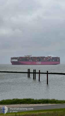
ONE INGENUITY
Cargo
Current Trip
| Time Travelled | 21 days |
|---|---|
| Remaining Time | --- |
| Distance Travelled | 7966.40 nm |
| Remaining Distance | --- |
| AVG Speed | 15.6 Knots |
| MAX Speed | 18.1 Knots |
| AVG Wind | 13.9 knots |
| MAX Wind | 26.8 knots |
| MIN Temp | 15.7°C / 60.26°F |
| MAX Temp | 30.1°C / 86.18°F |
| Draught | 16.1 m |
| Position Received | 6 d ago |
Current Position
| Longitude | 17.71697° |
|---|---|
| Latitude | -34.18373° |
| Status | Under way using engine |
| Speed | 15.5 Knots |
| Course | 316.9° |
| Area | South Atlantic Ocean |
| Station | T-AIS |
| Position Received | 6 d ago |
Information
The current position of ONE INGENUITY is in South Atlantic Ocean with coordinates -34.18373° / 17.71697° as reported on 2025-05-27 23:38 by AIS to our vessel tracker app. The vessel's current speed is 15.5 Knots and is heading at the port of ROTTERDAM. The estimated time of arrival as calculated by MyShipTracking vessel tracking app is 2025-06-14 15:00 LT
The vessel ONE INGENUITY (IMO: 9933016, MMSI: 636023290) is a Cargo It's sailing under the flag of [LR] Liberia.
In this page you can find informations about the vessels current position, last detected port calls, and current voyage information. If the vessels is not in coverage by AIS you will find the latest position.
The current position of ONE INGENUITY is detected by our AIS receivers and we are not responsible for the reliability of the data. The last position was recorded while the vessel was in Coverage by the Ais receivers of our vessel tracking app.
The current draught of ONE INGENUITY as reported by AIS is 16.1 meters
Weather
| Temperature | 24.8°C / 76.64°F |
|---|---|
| Wind Speed | 12 knots |
| Direction | 141° SE |
| Pressure | 1015.7 hPa |
| Humidity | 73 % |
| Cloud Coverage | 100 % |
Featured Company
Last Port Calls
| Port | Arrival | Departure | Time In Port |
|---|---|---|---|
| 2025-05-12 14:05 | 2025-05-13 12:03 | 21 h | |
| 2025-05-04 17:50 | 2025-05-06 02:46 | 1 d | |
| 2025-05-02 03:19 | 2025-05-03 10:39 | 1 d | |
| 2025-04-20 21:15 | 2025-04-22 02:48 | 1 d | |
| 2025-04-19 02:14 | 2025-04-20 12:01 | 1 d | |
| 2025-04-12 18:49 | 2025-04-15 06:18 | 2 d |
Last Trips
| Origin | Departure | Destination | Arrival | Distance | |
|---|---|---|---|---|---|
| 2025-05-06 02:46 | 2025-05-12 14:05 | 1681.31 nm | |||
| 2025-05-03 10:39 | 2025-05-04 17:50 | 344.82 nm | |||
| 2025-04-22 02:48 | 2025-05-02 03:19 | 1751.77 nm | |||
| 2025-04-20 12:01 | 2025-04-20 21:15 | 67.34 nm | |||
| 2025-04-15 06:18 | 2025-04-19 02:14 | 1498.86 nm | |||
| 2025-03-10 20:55 | 2025-04-12 18:49 | 11662.97 nm |
Events
| Time | Event | Details | Position / Dest | Info |
|---|---|---|---|---|
| 2025-05-27 23:44 | Status Changed | Default Under way using engine |
-34.16621 / 17.69741
SGSIN=>NLRTM
|
Speed: 15.5 kn Course: 316.9° |
| 2025-05-27 23:38 | Status Changed | Under way using engine Default |
-34.18373 / 17.71697
SGSIN=>NLRTM
|
Speed: 15.7 kn Course: 318° |
| 2025-05-27 23:38 | OUT of Coverage |
-34.18373 / 17.71697
South Atlantic Ocean
SGSIN=>NLRTM
|
Speed: 15.5 kn Course: 316.9° |
|
| 2025-05-27 23:16 | Status Changed | Default Under way using engine |
-34.25053 / 17.79942
SGSIN=>NLRTM
|
Speed: 15.5 kn Course: 315° |
| 2025-05-27 23:04 | Status Changed | Under way using engine Default |
-34.28715 / 17.84292
SGSIN=>NLRTM
|
Speed: 15.3 kn Course: 316° |
| 2025-05-27 22:55 | Status Changed | Default Under way using engine |
-34.31413 / 17.87522
SGSIN=>NLRTM
|
Speed: 15.1 kn Course: 315° |
| 2025-05-27 22:32 | Status Changed | Under way using engine Default |
-34.38438 / 17.95810
SGSIN=>NLRTM
|
Speed: 15.1 kn Course: 316° |
| 2025-05-27 22:11 | Status Changed | Default Under way using engine |
-34.44637 / 18.02956
SGSIN=>NLRTM
|
Speed: 14.9 kn Course: 316.2° |
| 2025-05-27 22:07 | Status Changed | Under way using engine Default |
-34.45845 / 18.04349
SGSIN=>NLRTM
|
Speed: 14.9 kn Course: 316° |
| 2025-05-27 21:37 | Status Changed | Default Under way using engine |
-34.55002 / 18.14838
SGSIN=>NLRTM
|
Speed: 15.1 kn Course: 317° |