
ONE MACKINAC
Cargo D
Current Trip
| Time Travelled | 2 days |
|---|---|
| Remaining Time | 1 day |
| Distance Travelled | 317.52 nm |
| Remaining Distance | 95.92 nm |
| AVG Speed | 11.1 Knots |
| MAX Speed | 14.7 Knots |
| AVG Wind | 7.5 knots |
| MAX Wind | 14 knots |
| MIN Temp | 4°C / 39.2°F |
| MAX Temp | 10.2°C / 50.36°F |
| Draught | 10.1 m |
| Position Received | 1 m ago |
Current Position
| Longitude | 3.64356° |
|---|---|
| Latitude | 52.34233° |
| Status | Under way using engine |
| Speed | 0.7 Knots |
| Course | 120° |
| Area | North Sea |
| Station | T-AIS |
| Position Received | 1 m ago |
Info
Information
The current position of ONE MACKINAC is in North Sea with coordinates 52.34233° / 3.64356° as reported on 2025-03-20 11:00 by AIS to our vessel tracker app. The vessel's current speed is 0.7 Knots and is heading at the port of ANTWERP. The estimated time of arrival as calculated by MyShipTracking vessel tracking app is 2025-03-21 12:32 LT
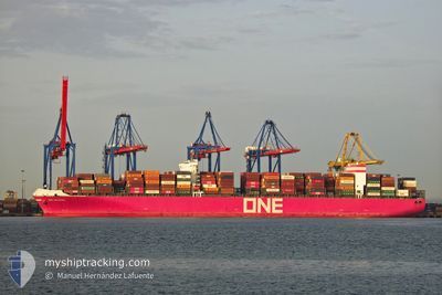
The vessel ONE MACKINAC (IMO: 9689603, MMSI: 431241000) is a Cargo D It's sailing under the flag of [JP] Japan.
In this page you can find informations about the vessels current position, last detected port calls, and current voyage information. If the vessels is not in coverage by AIS you will find the latest position.
The current position of ONE MACKINAC is detected by our AIS receivers and we are not responsible for the reliability of the data. The last position was recorded while the vessel was in Coverage by the Ais receivers of our vessel tracking app.
The current draught of ONE MACKINAC as reported by AIS is 10.1 meters
Weather
| Temperature | 7.5°C / 45.5°F |
|---|---|
| Wind Speed | 7 knots |
| Direction | 195° SSW |
| Pressure | 1022 hPa |
| Humidity | 88.6 % |
| Cloud Coverage | 99 % |
Featured Company
Last Port Calls
| Port | Arrival | Departure | Time In Port |
|---|---|---|---|
| 2025-03-16 06:41 | 2025-03-18 09:29 | 2 d | |
| 2025-03-07 19:37 | 2025-03-09 14:35 | 1 d | |
| 2025-02-27 11:43 | 2025-02-27 23:23 | 11 h | |
| 2025-01-15 07:41 | 2025-01-16 06:29 | 22 h | |
| 2025-01-08 18:58 | 2025-01-10 13:05 | 1 d | |
| 2025-01-02 19:24 | 2025-01-04 08:13 | 1 d | |
| 2025-01-01 09:00 |
Most Visited Ports (Last year)
| Port | Arrivals | |
|---|---|---|
| 3 | ||
| 3 | ||
| 3 | ||
| 3 | ||
| 3 | ||
| 3 |
Last Trips
| Origin | Departure | Destination | Arrival | Distance | |
|---|---|---|---|---|---|
| 2025-03-09 14:35 | 2025-03-16 06:41 | 325.35 nm | |||
| 2025-02-27 23:23 | 2025-03-07 19:37 | 1504.63 nm | |||
| 2025-01-16 06:29 | 2025-02-27 11:43 | 12252.07 nm | |||
| 2025-01-10 13:05 | 2025-01-15 07:41 | 1316.85 nm | |||
| 2025-01-04 08:13 | 2025-01-08 18:58 | 630.52 nm | |||
| 2025-01-01 09:00 | 2025-01-02 19:24 | 448.76 nm |
Events
| Time | Event | Details | Position / Dest | Info |
|---|---|---|---|---|
| 2025-03-20 08:13 | STOP Moving |
52.34237 / 3.63698
BEANR
|
Speed: 0.3 kn Course: 175° |
|
| 2025-03-20 04:39 | START Moving |
52.34220 / 3.58847
BEANR
|
Speed: 3.3 kn Course: 127° |
|
| 2025-03-19 21:03 | STOP Moving |
52.34607 / 3.62041
BEANR
|
Speed: 0.3 kn Course: 48° |
|
| 2025-03-19 17:40 | START Moving |
52.33350 / 3.55225
BEANR
|
Speed: 3.1 kn Course: 165° |
|
| 2025-03-19 17:12 | Status Changed | Under way using engine Default |
52.33107 / 3.55129
BEANR
|
Speed: 1.9 kn Course: 218° |
| 2025-03-19 17:09 | Status Changed | Default Under way using engine |
52.32930 / 3.55038
BEANR
|
Speed: 1.8 kn Course: 214° |
| 2025-03-19 14:24 | ETA Changed | 2025/03/22 03:00 2025/03/19 19:00 |
52.28366 / 3.53106
BEANR
|
Speed: 0.5 kn Course: 239° |
| 2025-03-19 12:38 | STOP Moving |
52.28285 / 3.55013
BEANR
|
Speed: 0.3 kn Course: 251° |
|
| 2025-03-19 08:45 | Draught Changed | 10.1 9.7 |
52.54682 / 3.52029
BEANR
|
Speed: 10.1 kn Course: 164.2° |
| 2025-03-18 20:05 | Change Sea Area | Dutch part of the North Sea German part of the North Sea |
53.81501 / 6.25279
North Sea
BEANR
|
Speed: 11.2 kn Course: 251.5° |