
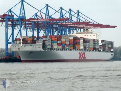
OOCL SEOUL
Container Ship
Current Trip
| Time Travelled | 4 h, 38 mins |
|---|---|
| Remaining Time | --- |
| Distance Travelled | 13.28 nm |
| Remaining Distance | --- |
| AVG Speed | 7 Knots |
| MAX Speed | 7.7 Knots |
| AVG Wind | 6.6 knots |
| MAX Wind | 12 knots |
| MIN Temp | 2.5°C / 36.5°F |
| MAX Temp | 7.8°C / 46.04°F |
| Draught | 13.3 m |
| Position Received | 50 m ago |
Current Position
| Longitude | 28.84110° |
|---|---|
| Latitude | 40.46482° |
| Status | Under way using engine |
| Speed | 0.3 Knots |
| Course | 241° |
| Area | Sea of Marmara |
| Station | T-AIS |
| Position Received | 50 m ago |
Info
Information
The current position of OOCL SEOUL is in Sea of Marmara with coordinates 40.46482° / 28.84110° as reported on 2025-03-20 11:26 by AIS to our vessel tracker app. The vessel's current speed is 0.3 Knots and is heading at the port of ALIAGA. The estimated time of arrival as calculated by MyShipTracking vessel tracking app is 2025-03-20 19:00 LT
The vessel OOCL SEOUL (IMO: 9417244, MMSI: 477617700) is a Container Ship that was built in 2010 ( 15 years old ). It's sailing under the flag of [HK] Hong Kong.
In this page you can find informations about the vessels current position, last detected port calls, and current voyage information. If the vessels is not in coverage by AIS you will find the latest position.
The current position of OOCL SEOUL is detected by our AIS receivers and we are not responsible for the reliability of the data. The last position was recorded while the vessel was in Coverage by the Ais receivers of our vessel tracking app.
The current draught of OOCL SEOUL as reported by AIS is 13.3 meters
Weather
| Temperature | 7.8°C / 46.04°F |
|---|---|
| Wind Speed | 12 knots |
| Direction | 23° NNE |
| Pressure | 1028.8 hPa |
| Humidity | 69.9 % |
| Cloud Coverage | 97 % |
Featured Company
Last Port Calls
| Port | Arrival | Departure | Time In Port |
|---|---|---|---|
| 2025-03-19 20:31 | 2025-03-20 10:39 | 14 h | |
| 2025-03-17 17:19 | 2025-03-19 15:29 | 1 d | |
| 2025-03-13 18:29 | 2025-03-17 00:17 | 3 d | |
| 2025-03-07 23:36 | 2025-03-09 19:35 | 1 d | |
| 2025-02-22 15:15 | 2025-02-23 20:15 | 1 d | |
| 2025-02-20 14:47 | 2025-02-21 16:01 | 1 d | |
| 2025-02-16 10:30 | 2025-02-18 14:42 | 2 d | |
| 2025-02-12 06:03 | 2025-02-14 07:33 | 2 d | |
| 2025-02-02 03:38 | 2025-02-03 22:29 | 1 d | |
| 2025-01-31 02:48 | 2025-01-31 23:46 | 20 h |
Most Visited Ports (Last year)
| Port | Arrivals | |
|---|---|---|
| 9 | ||
| 7 | ||
| 6 | ||
| 5 | ||
| 5 | ||
| 5 |
Last Trips
| Origin | Departure | Destination | Arrival | Distance | |
|---|---|---|---|---|---|
| 2025-03-19 15:29 | 2025-03-19 20:31 | 47.63 nm | |||
| 2025-03-17 00:17 | 2025-03-17 17:19 | 78.36 nm | |||
| 2025-03-09 19:35 | 2025-03-13 18:29 | 489.80 nm | |||
| 2025-02-23 20:15 | 2025-03-07 23:36 | 2963.69 nm | |||
| 2025-02-21 16:01 | 2025-02-22 15:15 | 358.88 nm | |||
| 2025-02-18 14:42 | 2025-02-20 14:47 | 153.38 nm | |||
| 2025-02-14 07:33 | 2025-02-16 10:30 | 407.94 nm | |||
| 2025-02-03 22:29 | 2025-02-12 06:03 | 3022.79 nm | |||
| 2025-01-31 23:46 | 2025-02-02 03:38 | 303.20 nm | |||
| 2025-01-30 22:47 | 2025-01-31 02:48 | 46.50 nm |
Events
| Time | Event | Details | Position / Dest | Info |
|---|---|---|---|---|
| 2025-03-20 11:34 | Status Changed | Default Under way using engine |
40.46545 / 28.84133
TR ALI
|
Speed: 0.3 kn Course: 241° |
| 2025-03-20 11:12 | Status Changed | Under way using engine Default |
40.46365 / 28.84094
TR ALI
|
Speed: 0.2 kn Course: 245° |
| 2025-03-20 11:10 | IN Coverage |
40.46372 / 28.84091
Sea of Marmara
TR ALI
|
Speed: 0.3 kn Course: 8° |
|
| 2025-03-20 10:18 | Status Changed | Default Under way using engine |
40.45999 / 28.83976
TR ALI
|
Speed: 0.3 kn Course: 286° |
| 2025-03-20 10:11 | Status Changed | Under way using engine Default |
40.45966 / 28.83995
TR ALI
|
Speed: 0.3 kn Course: 287° |
| 2025-03-20 10:11 | OUT of Coverage |
40.45966 / 28.83995
Sea of Marmara
TR ALI
|
Speed: 0.3 kn Course: 336.7° |
|
| 2025-03-20 10:10 | STOP Moving | 7.26 nm, North West of MUDANYA |
40.45958 / 28.84003
TR ALI
|
Speed: 0.3 kn Course: 287° |
| 2025-03-20 10:02 | Status Changed | Default Under way using engine |
40.45901 / 28.84055
TR ALI
|
Speed: 0.5 kn Course: 285° |
| 2025-03-20 09:54 | Status Changed | Under way using engine Default |
40.45837 / 28.84123
TR ALI
|
Speed: 0.4 kn Course: 284° |
| 2025-03-20 09:45 | Status Changed | Default Under way using engine |
40.45761 / 28.84210
TR ALI
|
Speed: 0.5 kn Course: 285° |