

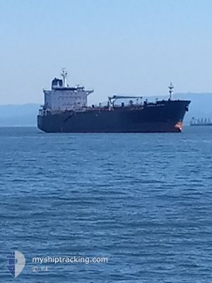
OVERSEAS BOSTON
Oil/Chemical Tanker

Current Trip
LONG BEACH B-9
| Time Travelled | 4 days |
|---|---|
| Remaining Time | --- |
| Distance Travelled | 1039.08 nm |
| Remaining Distance | --- |
| AVG Speed | 12.4 Knots |
| MAX Speed | 15.4 Knots |
| AVG Wind | 11.1 knots |
| MAX Wind | 26 knots |
| MIN Temp | 9.6°C / 49.28°F |
| MAX Temp | 16.9°C / 62.42°F |
| Draught | 9.6 m |
| Position Received | 3 h, 46 m ago |
Current Position
| Longitude | -122.81782° |
|---|---|
| Latitude | 35.17793° |
| Status | Under way using engine |
| Speed | 13.4 Knots |
| Course | 142° |
| Area | North Pacific Ocean |
| Station | T-AIS |
| Position Received | 3 h, 46 m ago |
Information
The current position of OVERSEAS BOSTON is in North Pacific Ocean with coordinates 35.17793° / -122.81782° as reported on 2025-06-08 19:20 by AIS to our vessel tracker app. The vessel's current speed is 13.4 Knots
The vessel OVERSEAS BOSTON (IMO: 9353565, MMSI: 338221000) is a Oil/Chemical Tanker that was built in 2008 ( 17 years old ). It's sailing under the flag of [US] USA.
In this page you can find informations about the vessels current position, last detected port calls, and current voyage information. If the vessels is not in coverage by AIS you will find the latest position.
The current position of OVERSEAS BOSTON is detected by our AIS receivers and we are not responsible for the reliability of the data. The last position was recorded while the vessel was in Coverage by the Ais receivers of our vessel tracking app.
The current draught of OVERSEAS BOSTON as reported by AIS is 9.6 meters
Weather
| Temperature | 15.4°C / 59.72°F |
|---|---|
| Wind Speed | 10 knots |
| Direction | 305° NW |
| Pressure | 1016.9 hPa |
| Humidity | 88.3 % |
| Cloud Coverage | 100 % |


Featured Company
Last Port Calls
| Port | Arrival | Departure | Time In Port |
|---|---|---|---|
| 2025-06-03 08:18 | 2025-06-04 07:19 | 23 h | |
| 2025-06-01 16:41 | 2025-06-03 03:32 | 1 d | |
| 2025-05-21 20:36 | 2025-05-28 09:29 | 6 d | |
| 2025-05-16 11:08 | 2025-05-18 06:54 | 1 d | |
| 2025-05-15 06:46 | 2025-05-16 06:09 | 23 h | |
| 2025-05-12 09:28 | 2025-05-15 02:30 | 2 d | |
| 2025-05-02 03:29 | 2025-05-03 11:59 | 1 d | |
| 2025-04-27 04:45 | 2025-04-30 08:36 | 3 d | |
| 2025-04-22 07:20 | 2025-04-23 07:21 | 1 d | |
| 2025-04-17 17:01 | 2025-04-18 22:15 | 1 d |
Most Visited Ports (Last year)
| Port | Arrivals | |
|---|---|---|
| 29 | ||
| 16 | ||
| 5 | ||
| 1 | ||
| 1 | ||
| 1 |
Last Trips
| Origin | Departure | Destination | Arrival | Distance | |
|---|---|---|---|---|---|
| 2025-06-03 03:32 | 2025-06-03 08:18 | 57.41 nm | |||
| 2025-05-28 09:29 | 2025-06-01 16:41 | 1194.42 nm | |||
| 2025-05-18 06:54 | 2025-05-21 20:36 | 1201.74 nm | |||
| 2025-05-16 06:09 | 2025-05-16 11:08 | 57.68 nm | |||
| 2025-05-15 02:30 | 2025-05-15 06:46 | 57.62 nm | |||
| 2025-05-03 11:59 | 2025-05-12 09:28 | 1429.47 nm | |||
| 2025-04-30 08:36 | 2025-05-02 03:29 | 15.35 nm | |||
| 2025-04-23 07:21 | 2025-04-27 04:45 | 1268.43 nm | |||
| 2025-04-18 22:15 | 2025-04-22 07:20 | 43.07 nm | |||
| 2025-04-07 17:59 | 2025-04-17 17:01 | 1905.29 nm |
Events
| Time | Event | Details | Position / Dest | Info |
|---|---|---|---|---|
| 2025-06-08 19:28 | Status Changed | Default Under way using engine |
35.15566 / -122.79717
LONG BEACH B-9
|
Speed: 13.4 kn Course: 142° |
| 2025-06-08 19:20 | OUT of Coverage |
35.17793 / -122.81782
North Pacific Ocean
LONG BEACH B-9
|
Speed: 13.4 kn Course: 142° |
|
| 2025-06-08 18:28 | Status Changed | Under way using engine Default |
35.32736 / -122.97471
LONG BEACH B-9
|
Speed: 13.7 kn Course: 132° |
| 2025-06-08 18:11 | Status Changed | Default Under way using engine |
35.37281 / -123.03509
LONG BEACH B-9
|
Speed: 13.2 kn Course: 132.7° |
| 2025-06-08 18:04 | Status Changed | Under way using engine Default |
35.38973 / -123.05710
LONG BEACH B-9
|
Speed: 12.9 kn Course: 135° |
| 2025-06-08 17:58 | Status Changed | Default Under way using engine |
35.40375 / -123.07584
LONG BEACH B-9
|
Speed: 12.8 kn Course: 134.8° |
| 2025-06-08 17:51 | Status Changed | Under way using engine Default |
35.42120 / -123.09777
LONG BEACH B-9
|
Speed: 12.9 kn Course: 153° |
| 2025-06-08 17:19 | Status Changed | Default Under way using engine |
35.52359 / -123.15903
LONG BEACH B-9
|
Speed: 13.3 kn Course: 154.6° |
| 2025-06-08 16:57 | Status Changed | Under way using engine Default |
35.59999 / -123.20094
LONG BEACH B-9
|
Speed: 13.1 kn Course: 154° |
| 2025-06-08 16:03 | Status Changed | Default Under way using engine |
35.77937 / -123.30735
LONG BEACH B-9
|
Speed: 13.8 kn Course: 150.3° |