
PANORAMA
Cargo
Current Trip
| Time Travelled | --- |
|---|---|
| Remaining Time | --- |
| Distance Travelled | --- |
| Remaining Distance | --- |
| AVG Speed | --- |
| MAX Speed | --- |
| AVG Wind | --- |
| MAX Wind | --- |
| MIN Temp | --- |
| MAX Temp | --- |
| Draught | 1 m |
| Position Received | 1 d ago |
Current Position
| Longitude | 11.05354° |
|---|---|
| Latitude | 49.70146° |
| Status | Under way using engine |
| Speed | 5.8 Knots |
| Course | 6.9° |
| Area | North Sea |
| Station | T-AIS |
| Position Received | 1 d ago |
Information
The current position of PANORAMA is in North Sea with coordinates 49.70146° / 11.05354° as reported on 2025-05-14 12:23 by AIS to our vessel tracker app. The vessel's current speed is 5.8 Knots and is heading at the port of MEPPEL. The estimated time of arrival as calculated by MyShipTracking vessel tracking app is 2025-05-20 13:01 LT
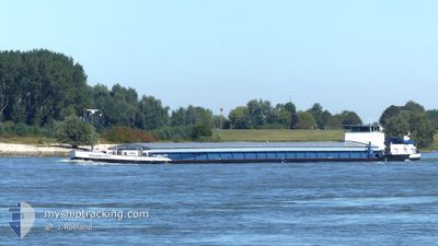
The vessel PANORAMA (MMSI: 244820996) is a Cargo It's sailing under the flag of [NL] Netherlands.
In this page you can find informations about the vessels current position, last detected port calls, and current voyage information. If the vessels is not in coverage by AIS you will find the latest position.
The current position of PANORAMA is detected by our AIS receivers and we are not responsible for the reliability of the data. The last position was recorded while the vessel was in Coverage by the Ais receivers of our vessel tracking app.
The current draught of PANORAMA as reported by AIS is 1 meters
Weather
| Temperature | 21.7°C / 71.06°F |
|---|---|
| Wind Speed | 6 knots |
| Direction | 282° WNW |
| Pressure | 1014.9 hPa |
| Humidity | 29.6 % |
| Cloud Coverage | 78 % |
Featured Company
Last Port Calls
| Port | Arrival | Departure | Time In Port |
|---|---|---|---|
| 2025-05-10 10:01 | |||
| 2025-05-05 14:19 | 2025-05-07 16:47 | 2 d | |
| 2025-04-27 16:32 | 2025-04-28 04:53 | 12 h | |
| 2025-04-27 12:27 | 2025-04-27 12:53 | 25 m | |
| 2025-04-25 12:15 | 2025-04-25 14:56 | 2 h | |
| 2025-04-24 08:27 | 2025-04-24 09:54 | 1 h | |
| 2025-04-22 19:30 | 2025-04-23 09:14 | 13 h | |
| 2025-04-20 15:05 | 2025-04-20 15:51 | 46 m | |
| 2025-04-19 15:39 | 2025-04-20 04:34 | 12 h | |
| 2025-04-13 09:22 | 2025-04-16 10:36 | 3 d |
Most Visited Ports (Last year)
| Port | Arrivals | |
|---|---|---|
| 12 | ||
| 10 | ||
| 6 | ||
| 5 | ||
| 4 | ||
| 4 |
Last Trips
| Origin | Departure | Destination | Arrival | Distance | |
|---|---|---|---|---|---|
| 2025-05-07 18:47 | 2025-05-10 12:01 | 72.60 nm | |||
| 2025-04-28 06:53 | 2025-05-05 16:19 | 260.89 nm | |||
| 2025-04-27 14:53 | 2025-04-27 18:32 | 16.61 nm | |||
| 2025-04-25 16:56 | 2025-04-27 14:27 | 134.95 nm | |||
| 2025-04-24 11:54 | 2025-04-25 14:15 | 2.54 nm | |||
| 2025-04-23 11:14 | 2025-04-24 10:27 | 4.20 nm | |||
| 2025-04-20 17:51 | 2025-04-22 21:30 | 82.34 nm | |||
| 2025-04-20 06:34 | 2025-04-20 17:05 | 43.85 nm | |||
| 2025-04-16 12:36 | 2025-04-19 17:39 | 262.63 nm | |||
| 2025-04-10 06:59 | 2025-04-13 11:22 | 213.12 nm |
Events
| Time | Event | Details | Position / Dest | Info |
|---|---|---|---|---|
| 2025-05-14 12:23 | OUT of Coverage |
49.70146 / 11.05354
North Sea
MEPPEL
|
Speed: 5.8 kn Course: 6.9° |
|
| 2025-05-14 12:11 | START Moving | 13.83 nm, South East of BAMBERG |
49.68706 / 11.04041
MEPPEL
|
Speed: 4.5 kn Course: 43.4° |
| 2025-05-14 11:52 | STOP Moving | 13.89 nm, South East of BAMBERG |
49.68509 / 11.03753
MEPPEL
|
Speed: 0.1 kn Course: 511° |
| 2025-05-14 11:29 | Draught Changed | 1 2.5 |
49.65493 / 11.01315
MEPPEL
|
Speed: 5 kn Course: 20.9° |
| 2025-05-14 11:29 | Destination Changed | MEPPEL DEGGENDORF |
49.65493 / 11.01315
MEPPEL
|
Speed: 5 kn Course: 20.9° |
| 2025-05-14 11:29 | ETA Changed | 2025/05/20 13:01 2025/05/09 08:45 |
49.65493 / 11.01315
MEPPEL
|
Speed: 5 kn Course: 20.9° |
| 2025-05-14 11:12 | START Moving | 14.38 nm, North of NUREMBERG |
49.63671 / 10.99154
DEGGENDORF
|
Speed: 5.6 kn Course: 36.8° |
| 2025-05-14 10:40 | STOP Moving | 13.68 nm, North of NUREMBERG |
49.62271 / 10.97954
DEGGENDORF
|
Speed: 0.2 kn Course: 511° |
| 2025-05-14 10:38 | IN Coverage |
49.62271 / 10.97954
North Sea
|
Speed: 0.2 kn Course: 511° |
|
| 2025-05-10 10:01 | PORT ARRIVAL |
|
48.80833 / 12.97166
[DE] DEGGENDORF
|
Speed: 6 kn Course: 329° |