
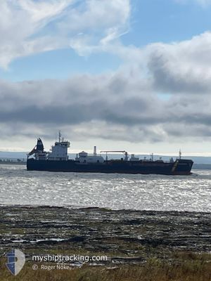
PAUL A. DESGAGNES
Tanker
Current Trip
NEW-YORK
| Time Travelled | 4 days |
|---|---|
| Remaining Time | --- |
| Distance Travelled | 1430.99 nm |
| Remaining Distance | --- |
| AVG Speed | 12.1 Knots |
| MAX Speed | 17.2 Knots |
| AVG Wind | 7.9 knots |
| MAX Wind | 17.3 knots |
| MIN Temp | 7°C / 44.6°F |
| MAX Temp | 23.1°C / 73.58°F |
| Draught | 7.8 m |
| Position Received | 3 m ago |
Current Position
| Longitude | -72.27158° |
|---|---|
| Latitude | 40.51532° |
| Status | Under way using engine |
| Speed | 11.8 Knots |
| Course | 290.7° |
| Area | North Atlantic Ocean |
| Station | T-AIS |
| Position Received | 3 m ago |
Information
The current position of PAUL A. DESGAGNES is in North Atlantic Ocean with coordinates 40.51532° / -72.27158° as reported on 2025-06-10 08:30 by AIS to our vessel tracker app. The vessel's current speed is 11.8 Knots
The vessel PAUL A. DESGAGNES (IMO: 9804423, MMSI: 316033266) is a Tanker It's sailing under the flag of [CA] Canada.
In this page you can find informations about the vessels current position, last detected port calls, and current voyage information. If the vessels is not in coverage by AIS you will find the latest position.
The current position of PAUL A. DESGAGNES is detected by our AIS receivers and we are not responsible for the reliability of the data. The last position was recorded while the vessel was in Coverage by the Ais receivers of our vessel tracking app.
The current draught of PAUL A. DESGAGNES as reported by AIS is 7.8 meters
Weather
| Temperature | 16.7°C / 62.06°F |
|---|---|
| Wind Speed | 4 knots |
| Direction | 209° SSW |
| Pressure | 1010.9 hPa |
| Humidity | 99.2 % |
| Cloud Coverage | 100 % |
Featured Company
Last Port Calls
| Port | Arrival | Departure | Time In Port |
|---|---|---|---|
| 2025-06-05 06:54 | 2025-06-05 09:08 | 2 h | |
| 2025-05-29 03:15 | 2025-06-01 19:27 | 3 d | |
| 2025-05-25 17:39 | 2025-05-27 17:21 | 1 d | |
| 2025-05-22 05:21 | 2025-05-24 16:58 | 2 d | |
| 2025-05-21 04:47 | 2025-05-21 17:30 | 12 h | |
| 2025-05-18 23:41 | 2025-05-20 19:07 | 1 d | |
| 2025-05-17 15:43 | 2025-05-17 18:28 | 2 h | |
| 2025-05-16 03:32 | 2025-05-16 05:19 | 1 h | |
| 2025-05-13 11:04 | 2025-05-15 10:44 | 1 d | |
| 2025-05-12 22:11 | 2025-05-12 22:46 | 34 m |
Most Visited Ports (Last year)
| Port | Arrivals | |
|---|---|---|
| 34 | ||
| 28 | ||
| 16 | ||
| 10 | ||
| 8 | ||
| 6 |
Last Trips
| Origin | Departure | Destination | Arrival | Distance | |
|---|---|---|---|---|---|
| 2025-06-01 15:27 | 2025-06-05 02:54 | 319.09 nm | |||
| 2025-05-27 13:21 | 2025-05-28 23:15 | 314.17 nm | |||
| 2025-05-24 12:58 | 2025-05-25 13:39 | 0.66 nm | |||
| 2025-05-21 13:30 | 2025-05-22 01:21 | 128.46 nm | |||
| 2025-05-20 15:07 | 2025-05-21 00:47 | 127.58 nm | |||
| 2025-05-17 14:28 | 2025-05-18 19:41 | 0.63 nm | |||
| 2025-05-16 01:19 | 2025-05-17 11:43 | 292.48 nm | |||
| 2025-05-15 06:44 | 2025-05-15 23:32 | 65.64 nm | |||
| 2025-05-12 18:46 | 2025-05-13 07:04 | 64.39 nm | |||
| 2025-05-11 08:17 | 2025-05-12 18:11 | 295.10 nm |
Events
| Time | Event | Details | Position / Dest | Info |
|---|---|---|---|---|
| 2025-06-10 07:57 | Draught Changed | 7.8 7.9 |
40.51445 / -72.11112
NEW-YORK
|
Speed: 11.7 kn Course: 268.2° |
| 2025-06-10 07:57 | ETA Changed | 2025/06/10 16:00 2025/06/10 04:00 |
40.51445 / -72.11112
NEW-YORK
|
Speed: 11.7 kn Course: 268.2° |
| 2025-06-10 07:52 | Status Changed | Under way using engine Default |
40.51445 / -72.11112
NEW-YORK
|
Speed: 11.7 kn Course: 269° |
| 2025-06-10 07:45 | Status Changed | Default Under way using engine |
40.51487 / -72.08050
NEW-YORK
|
Speed: 11.8 kn Course: 269° |
| 2025-06-10 07:38 | Detected in Sea | United States part of the North Atlantic Ocean |
40.51522 / -72.04963
North Atlantic Ocean
NEW-YORK
|
Speed: 11.8 kn Course: 269° |
| 2025-06-10 07:38 | IN Coverage |
40.51522 / -72.04963
North Atlantic Ocean
NEW-YORK
|
Speed: 11.8 kn Course: 269° |
|
| 2025-06-05 21:55 | Status Changed | Default Under way using engine |
47.19878 / -70.61014
NEW-YORK
|
Speed: 14.8 kn Course: 38° |
| 2025-06-05 21:43 | OUT of Coverage |
47.16178 / -70.65589
Gulf of St-Lawrence
NEW-YORK
|
Speed: 14.8 kn Course: 38° |
|
| 2025-06-05 19:57 | Status Changed | Under way using engine Default |
46.85234 / -70.99979
NEW-YORK
|
Speed: 11.8 kn Course: 76° |
| 2025-06-05 19:55 | Status Changed | Default Under way using engine |
46.85068 / -71.00915
NEW-YORK
|
Speed: 11.6 kn Course: 75.7° |