

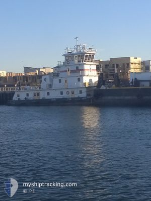
PAULA M SPERRY
Towing

Current Trip
US RCH 22
| Time Travelled | 1 h, 34 mins |
|---|---|
| Remaining Time | --- |
| Distance Travelled | 9.98 nm |
| Remaining Distance | --- |
| AVG Speed | 8 Knots |
| MAX Speed | 9.3 Knots |
| AVG Wind | 13 knots |
| MAX Wind | 16 knots |
| MIN Temp | 13.7°C / 56.66°F |
| MAX Temp | 20°C / 68°F |
| Draught | 0 m |
| Position Received | 21 m ago |
Current Position
| Longitude | -122.36887° |
|---|---|
| Latitude | 37.90364° |
| Status | Under way using engine |
| Speed | 5.3 Knots |
| Course | 94.1° |
| Area | North Pacific Ocean |
| Station | T-AIS |
| Position Received | 21 m ago |
Information
The current position of PAULA M SPERRY is in North Pacific Ocean with coordinates 37.90364° / -122.36887° as reported on 2025-05-25 22:02 by AIS to our vessel tracker app. The vessel's current speed is 5.3 Knots
The vessel PAULA M SPERRY (MMSI: 368144290) is a Towing It's sailing under the flag of [US] USA.
In this page you can find informations about the vessels current position, last detected port calls, and current voyage information. If the vessels is not in coverage by AIS you will find the latest position.
The current position of PAULA M SPERRY is detected by our AIS receivers and we are not responsible for the reliability of the data. The last position was recorded while the vessel was in Coverage by the Ais receivers of our vessel tracking app.
Weather
| Temperature | 20.1°C / 68.18°F |
|---|---|
| Wind Speed | 12 knots |
| Direction | 238° WSW |
| Pressure | 1016 hPa |
| Humidity | 40.3 % |
| Cloud Coverage | 53 % |


Featured Company
Last Port Calls
| Port | Arrival | Departure | Time In Port |
|---|---|---|---|
| 2025-05-25 07:51 | 2025-05-25 13:50 | 5 h | |
| 2025-05-23 08:30 | 2025-05-24 18:52 | 1 d | |
| 2025-05-21 17:18 | 2025-05-21 23:05 | 5 h | |
| 2025-05-20 23:48 | 2025-05-21 16:01 | 16 h | |
| 2025-05-20 04:19 | 2025-05-20 06:48 | 2 h | |
| 2025-05-18 10:00 | 2025-05-19 17:54 | 1 d | |
| 2025-05-16 11:05 | 2025-05-17 08:30 | 21 h | |
| 2025-05-15 07:00 | 2025-05-15 14:35 | 7 h | |
| 2025-05-12 05:42 | 2025-05-13 00:01 | 18 h | |
| 2025-05-11 12:32 | 2025-05-11 23:03 | 10 h |
Most Visited Ports (Last year)
| Port | Arrivals | |
|---|---|---|
| 213 | ||
| 50 | ||
| 30 | ||
| 3 | ||
| 2 |
Last Trips
| Origin | Departure | Destination | Arrival | Distance | |
|---|---|---|---|---|---|
| 2025-05-24 18:52 | 2025-05-25 07:51 | 10.58 nm | |||
| 2025-05-21 23:05 | 2025-05-23 08:30 | 25.55 nm | |||
| 2025-05-21 16:01 | 2025-05-21 17:18 | 8.42 nm | |||
| 2025-05-20 06:48 | 2025-05-20 23:48 | 37.05 nm | |||
| 2025-05-19 17:54 | 2025-05-20 04:19 | 11.29 nm | |||
| 2025-05-17 08:30 | 2025-05-18 10:00 | 21.88 nm | |||
| 2025-05-15 14:35 | 2025-05-16 11:05 | 19.77 nm | |||
| 2025-05-13 00:01 | 2025-05-15 07:00 | 62.97 nm | |||
| 2025-05-11 23:03 | 2025-05-12 05:42 | 7.33 nm | |||
| 2025-05-10 05:43 | 2025-05-11 12:32 | 21.77 nm |
Events
| Time | Event | Details | Position / Dest | Info |
|---|---|---|---|---|
| 2025-05-25 22:08 | Status Changed | Default Under way using engine |
37.90442 / -122.36304
US RCH 22
|
Speed: 5.3 kn Course: 94.1° |
| 2025-05-25 21:59 | Status Changed | Under way using engine Default |
37.90426 / -122.37535
US RCH 22
|
Speed: 4.8 kn Course: 98° |
| 2025-05-25 21:48 | Status Changed | Default Under way using engine |
37.90619 / -122.39087
US RCH 22
|
Speed: 5.6 kn Course: 103.1° |
| 2025-05-25 21:47 | Status Changed | Under way using engine Default |
37.90644 / -122.39263
US RCH 22
|
Speed: 8.7 kn Course: 95° |
| 2025-05-25 21:40 | Status Changed | Default Under way using engine |
37.90607 / -122.41167
US RCH 22
|
Speed: 8.2 kn Course: 348° |
| 2025-05-25 20:50 | PORT DEPARTURE |
|
37.80300 / -122.34441
US RCH 22
|
Speed: 9.1 kn Course: 294° |
| 2025-05-25 20:27 | START Moving |
37.79267 / -122.28543
[US] OAKLAND
|
Speed: 3.5 kn Course: 94° |
|
| 2025-05-25 20:19 | ETA Changed | 2025/05/25 22:30 2025/05/25 15:30 |
37.79252 / -122.28404
[US] OAKLAND
|
Speed: 0.1 kn Course: 88° |
| 2025-05-25 20:19 | Destination Changed | US RCH 22 US NGZ 4 |
37.79252 / -122.28404
[US] OAKLAND
|
Speed: 0.1 kn Course: 88° |
| 2025-05-25 15:13 | Status Changed | Under way using engine Moored |
37.79319 / -122.28754
[US] OAKLAND
|
Speed: 0.5 kn Course: 95° |