
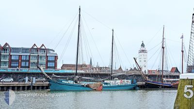
PELIKAAN
Passenger
Current Trip
Current Position
| Longitude | 6.02308° |
|---|---|
| Latitude | 53.32573° |
| Status | Under way sailing |
| Speed | |
| Course | --- |
| Area | North Sea |
| Station | T-AIS |
| Position Received | Now |
Info
Information
The current position of PELIKAAN is in North Sea with coordinates 53.32573° / 6.02308° as reported on 2025-03-17 22:58 by AIS to our vessel tracker app. The vessel's current speed is 0 Knots and is currently inside the port of DOKKUM.
The vessel PELIKAAN (MMSI: 244670757) is a Passenger It's sailing under the flag of [NL] Netherlands.
In this page you can find informations about the vessels current position, last detected port calls, and current voyage information. If the vessels is not in coverage by AIS you will find the latest position.
The current position of PELIKAAN is detected by our AIS receivers and we are not responsible for the reliability of the data. The last position was recorded while the vessel was in Coverage by the Ais receivers of our vessel tracking app.
The current draught of PELIKAAN as reported by AIS is 1.2 meters
Weather
| Temperature | -0.2°C / 31.64°F |
|---|---|
| Wind Speed | 7 knots |
| Direction | 89° E |
| Pressure | 1032.6 hPa |
| Humidity | 58.6 % |
| Cloud Coverage | 1 % |
Featured Company
Events
| Time | Event | Details | Position / Dest | Info |
|---|---|---|---|---|
| 2025-03-17 16:30 | STOP Moving |
53.32568 / 6.02309
[NL] DOKKUM
|
Speed: 0.1 kn Course: 511° |
|
| 2025-03-17 16:30 | PORT ARRIVAL |
|
53.32568 / 6.02309
[NL] DOKKUM
|
Speed: 2.3 kn Course: 511° |
| 2025-03-17 16:26 | Status Changed | Under way sailing Default |
53.32460 / 6.02479
HARLINGEN
|
Speed: 1.3 kn Course: -1° |
| 2025-03-17 16:20 | Status Changed | Default Under way sailing |
53.32564 / 6.03221
HARLINGEN
|
Speed: 4.3 kn Course: 288.9° |
| 2025-03-17 15:08 | START Moving | 0.46 nm, West of LUNEGAT |
53.31613 / 6.15592
HARLINGEN
|
Speed: 5.4 kn Course: 258.2° |
| 2025-03-17 14:59 | STOP Moving | 0.34 nm, West of LUNEGAT |
53.31678 / 6.15904
HARLINGEN
|
Speed: 0.3 kn Course: 511° |
| 2025-03-17 10:17 | START Moving | 2.76 nm, South of GARNWERD |
53.25870 / 6.50811
HARLINGEN
|
Speed: 3.8 kn Course: 356.8° |
| 2025-03-17 09:57 | STOP Moving | 2.93 nm, South of GARNWERD |
53.25597 / 6.50954
HARLINGEN
|
Speed: 0.1 kn Course: 511° |
| 2025-03-17 09:52 | PORT DEPARTURE |
|
53.25509 / 6.51032
HARLINGEN
|
Speed: 4.1 kn Course: 304.9° |
| 2025-03-17 09:04 | START Moving |
53.21944 / 6.55057
[NL] GRONINGEN
|
Speed: 3.4 kn Course: 259.5° |