
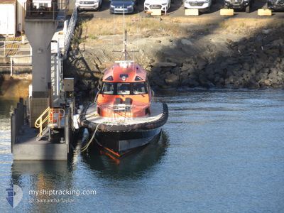
PILOT VESSEL HELLYER
Spare - Local Vessel
Current Trip
Unknown
| Time Travelled | 1 day |
|---|---|
| Remaining Time | --- |
| Distance Travelled | 9.67 nm |
| Remaining Distance | --- |
| AVG Speed | 17.4 Knots |
| MAX Speed | 24.4 Knots |
| AVG Wind | 10.6 knots |
| MAX Wind | 12 knots |
| MIN Temp | 16.3°C / 61.34°F |
| MAX Temp | 19°C / 66.2°F |
| Draught | --- |
| Position Received | 22 h, 26 m ago |
Current Position
| Longitude | 145.93109° |
|---|---|
| Latitude | -41.04722° |
| Status | Default |
| Speed | 24.1 Knots |
| Course | 231.7° |
| Area | Bass Strait |
| Station | T-AIS |
| Position Received | 22 h, 26 m ago |
Info
Information
The current position of PILOT VESSEL HELLYER is in Bass Strait with coordinates -41.04722° / 145.93109° as reported on 2025-02-27 10:06 by AIS to our vessel tracker app. The vessel's current speed is 24.1 Knots
The vessel PILOT VESSEL HELLYER (MMSI: 503050680) is a Spare - Local Vessel It's sailing under the flag of [AU] Australia.
In this page you can find informations about the vessels current position, last detected port calls, and current voyage information. If the vessels is not in coverage by AIS you will find the latest position.
The current position of PILOT VESSEL HELLYER is detected by our AIS receivers and we are not responsible for the reliability of the data. The last position was recorded while the vessel was in Coverage by the Ais receivers of our vessel tracking app.
Weather
| Temperature | 16.3°C / 61.34°F |
|---|---|
| Wind Speed | 9 knots |
| Direction | 301° WNW |
| Pressure | 1013.7 hPa |
| Humidity | 70.1 % |
| Cloud Coverage | 99 % |
Featured Company
Last Port Calls
| Port | Arrival | Departure | Time In Port |
|---|---|---|---|
| 2025-02-26 15:38 | 2025-02-26 20:05 | 4 h | |
| 2025-02-25 16:33 | 2025-02-26 15:22 | 22 h | |
| 2025-02-25 12:43 | 2025-02-25 16:04 | 3 h | |
| 2025-02-24 21:30 | 2025-02-25 12:08 | 14 h | |
| 2025-02-24 21:11 | |||
| 2025-02-20 16:40 | 2025-02-20 22:31 | 5 h | |
| 2025-02-20 05:07 | 2025-02-20 16:22 | 11 h | |
| 2025-02-17 06:34 | 2025-02-17 06:38 | 4 m | |
| 2025-02-16 18:22 | 2025-02-17 06:03 | 11 h | |
| 2025-02-15 12:16 | 2025-02-16 18:02 | 1 d |
Last Trips
| Origin | Departure | Destination | Arrival | Distance | |
|---|---|---|---|---|---|
| 2025-02-26 15:22 | 2025-02-26 15:38 | 3.32 nm | |||
| 2025-02-25 16:04 | 2025-02-25 16:33 | 10.48 nm | |||
| 2025-02-25 12:08 | 2025-02-25 12:43 | 10.89 nm | |||
| 2025-02-24 21:11 | 2025-02-24 21:30 | 3.00 nm | |||
| 2025-02-20 16:22 | 2025-02-20 16:40 | 4.44 nm | |||
| 2025-02-17 06:38 | 2025-02-20 05:07 | 22.91 nm | |||
| 2025-02-17 06:03 | 2025-02-17 06:34 | 1.20 nm | |||
| 2025-02-16 18:02 | 2025-02-16 18:22 | 1.70 nm | |||
| 2025-02-15 11:31 | 2025-02-15 12:16 | 8.84 nm | |||
| 2025-02-09 11:43 | 2025-02-09 12:13 | 7.73 nm |
Events
| Time | Event | Details | Position / Dest | Info |
|---|---|---|---|---|
| 2025-02-27 10:06 | OUT of Coverage |
-41.04722 / 145.93109
Bass Strait
|
Speed: 24.1 kn Course: 231.7° |
|
| 2025-02-27 09:57 | IN Coverage |
-41.05174 / 145.92779
Bass Strait
|
Speed: 11.9 kn Course: 62.6° |
|
| 2025-02-26 09:31 | OUT of Coverage |
-41.04714 / 145.92936
Bass Strait
|
Speed: 24.4 kn Course: 228.1° |
|
| 2025-02-26 09:08 | START Moving | 0.77 nm, North East of BURNIE |
-41.04736 / 145.93057
|
Speed: 21.2 kn Course: 35° |
| 2025-02-26 09:05 | PORT DEPARTURE |
|
-41.04736 / 145.93057
|
Speed: Course: 74° |
| 2025-02-26 08:41 | IN Coverage |
-41.05439 / 145.90987
Bass Strait
[AU] BURNIE
|
Speed: 0.1 kn Course: 244.1° |
|
| 2025-02-26 04:38 | PORT ARRIVAL |
|
-41.05439 / 145.90987
[AU] BURNIE
|
Speed: 25 kn Course: 235° |
| 2025-02-26 04:35 | OUT of Coverage |
-41.04711 / 145.93257
Bass Strait
|
Speed: 25 kn Course: 235° |
|
| 2025-02-26 04:22 | PORT DEPARTURE |
|
-41.04996 / 145.92902
|
Speed: 4.7 kn Course: 81° |
| 2025-02-26 04:12 | IN Coverage |
-41.05366 / 145.91140
Bass Strait
[AU] BURNIE
|
Speed: 5.5 kn Course: 76.5° |