
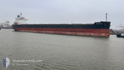
PLAINPALAIS
Cargo
Current Trip
| Time Travelled | 7 days |
|---|---|
| Remaining Time | --- |
| Distance Travelled | 1619.75 nm |
| Remaining Distance | --- |
| AVG Speed | 10.8 Knots |
| MAX Speed | 13.7 Knots |
| AVG Wind | 19.7 knots |
| MAX Wind | 30.2 knots |
| MIN Temp | 7.6°C / 45.68°F |
| MAX Temp | 15.8°C / 60.44°F |
| Draught | 7.3 m |
| Position Received | 25 m ago |
Current Position
| Longitude | -29.00393° |
|---|---|
| Latitude | 40.71663° |
| Status | Under way using engine |
| Speed | 10.4 Knots |
| Course | 279.5° |
| Area | North Atlantic Ocean |
| Station | T-AIS |
| Position Received | 25 m ago |
Info
Information
The current position of PLAINPALAIS is in North Atlantic Ocean with coordinates 40.71663° / -29.00393° as reported on 2025-12-21 11:26 by AIS to our vessel tracker app. The vessel's current speed is 10.4 Knots and is heading at the port of QUEBEC. The estimated time of arrival as calculated by MyShipTracking vessel tracking app is 2025-12-25 15:00 LT
The vessel PLAINPALAIS (IMO: 9739032, MMSI: 538010759) is a Cargo It's sailing under the flag of [MH] Marshall Is.
In this page you can find informations about the vessels current position, last detected port calls, and current voyage information. If the vessels is not in coverage by AIS you will find the latest position.
The current position of PLAINPALAIS is detected by our AIS receivers and we are not responsible for the reliability of the data. The last position was recorded while the vessel was in Coverage by the Ais receivers of our vessel tracking app.
The current draught of PLAINPALAIS as reported by AIS is 7.3 meters
Weather
| Temperature | 13.8°C / 56.84°F |
|---|---|
| Wind Speed | 5 knots |
| Direction | 272° W |
| Pressure | 1028.3 hPa |
| Humidity | 69.4 % |
| Cloud Coverage | 56 % |
Featured Company
Last Trips
| Origin | Departure | Destination | Arrival | Distance | |
|---|---|---|---|---|---|
| 2025-12-07 15:57 | 2025-12-11 05:23 | 685.98 nm | |||
| 2025-12-02 00:31 | 2025-12-05 13:21 | 648.91 nm | |||
| 2025-11-21 13:30 | 2025-11-30 00:05 | 1548.93 nm | |||
| 2025-11-09 10:11 | 2025-11-20 09:49 | 63.28 nm | |||
| 2025-08-31 23:08 | 2025-11-05 08:46 | 8420.55 nm |
Events
| Time | Event | Details | Position / Dest | Info |
|---|---|---|---|---|
| 2025-12-21 11:19 | Status Changed | Under way using engine Default |
40.71382 / -28.97643
CA QUE
|
Speed: 10.2 kn Course: 274° |
| 2025-12-21 11:06 | IN Coverage |
40.71482 / -28.98723
North Atlantic Ocean
CA QUE
|
Speed: 9.8 kn Course: 269.2° |
|
| 2025-12-21 10:34 | Status Changed | Default Under way using engine |
40.69828 / -28.81986
CA QUE
|
Speed: 9.1 kn Course: 277.9° |
| 2025-12-21 09:47 | OUT of Coverage |
40.67977 / -28.66302
North Atlantic Ocean
CA QUE
|
Speed: 9.1 kn Course: 277.9° |
|
| 2025-12-21 09:40 | Detected in Sea | Portuguese (Azores) part of the North Atlantic Ocean |
40.67739 / -28.64080
North Atlantic Ocean
CA QUE
|
Speed: 9.2 kn Course: 279.9° |
| 2025-12-21 09:33 | Status Changed | Under way using engine Default |
40.67495 / -28.61961
CA QUE
|
Speed: 8.6 kn Course: 278° |
| 2025-12-21 09:24 | IN Coverage |
40.67495 / -28.61961
English Channel
CA QUE
|
Speed: 8.5 kn Course: 276.8° |
|
| 2025-12-15 07:04 | Status Changed | Default Under way using engine |
50.24696 / -1.39025
CA QUE
|
Speed: 10.9 kn Course: 259.1° |
| 2025-12-15 06:58 | OUT of Coverage |
50.25045 / -1.36118
English Channel
CA QUE
|
Speed: 10.9 kn Course: 259.1° |
|
| 2025-12-15 06:54 | Status Changed | Under way using engine Default |
50.25251 / -1.34416
CA QUE
|
Speed: 10.9 kn Course: 257° |