
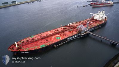
PLATA NORTH
Crude Oil Tanker
Current Trip
EAST OPL
| Time Travelled | 39 days |
|---|---|
| Remaining Time | --- |
| Distance Travelled | 6914.42 nm |
| Remaining Distance | --- |
| AVG Speed | 11.9 Knots |
| MAX Speed | 15.9 Knots |
| AVG Wind | 9.2 knots |
| MAX Wind | 20 knots |
| MIN Temp | 18.2°C / 64.76°F |
| MAX Temp | 30.9°C / 87.62°F |
| Draught | 11.6 m |
| Position Received | 1 d ago |
Current Position
| Longitude | 104.15175° |
|---|---|
| Latitude | 1.25550° |
| Status | Under way using engine |
| Speed | 12.9 Knots |
| Course | 85.6° |
| Area | Singapore Strait |
| Station | T-AIS |
| Position Received | 1 d ago |
Information
The current position of PLATA NORTH is in Singapore Strait with coordinates 1.25550° / 104.15175° as reported on 2025-06-02 23:11 by AIS to our vessel tracker app. The vessel's current speed is 12.9 Knots
The vessel PLATA NORTH (IMO: 9384605, MMSI: 538003542) is a Crude Oil Tanker that was built in 2009 ( 16 years old ). It's sailing under the flag of [MH] Marshall Is.
In this page you can find informations about the vessels current position, last detected port calls, and current voyage information. If the vessels is not in coverage by AIS you will find the latest position.
The current position of PLATA NORTH is detected by our AIS receivers and we are not responsible for the reliability of the data. The last position was recorded while the vessel was in Coverage by the Ais receivers of our vessel tracking app.
The current draught of PLATA NORTH as reported by AIS is 11.6 meters
Weather
| Temperature | 29.4°C / 84.92°F |
|---|---|
| Wind Speed | 9 knots |
| Direction | 137° SE |
| Pressure | 1011.3 hPa |
| Humidity | 79.1 % |
| Cloud Coverage | 80 % |
Featured Company
Last Port Calls
| Port | Arrival | Departure | Time In Port |
|---|---|---|---|
| 2025-04-22 13:33 | 2025-04-26 09:49 | 3 d |
Most Visited Ports (Last year)
| Port | Arrivals | |
|---|---|---|
| 1 | ||
| 1 |
Last Trips
| Origin | Departure | Destination | Arrival | Distance |
|---|
Events
| Time | Event | Details | Position / Dest | Info |
|---|---|---|---|---|
| 2025-06-03 03:21 | STOP Moving |
1.54989 / 104.77510
EAST OPL
|
Speed: 0.3 kn Course: 166° |
|
| 2025-06-02 23:19 | Status Changed | Default Under way using engine |
1.25818 / 104.17839
EAST OPL
|
Speed: 12.9 kn Course: 85.6° |
| 2025-06-02 23:11 | OUT of Coverage |
1.25550 / 104.15175
Singapore Strait
EAST OPL
|
Speed: 12.9 kn Course: 85.6° |
|
| 2025-06-02 23:07 | Status Changed | Under way using engine Default |
1.25455 / 104.13872
EAST OPL
|
Speed: 13.3 kn Course: 86° |
| 2025-06-02 23:07 | Status Changed | Default Under way using engine |
1.25435 / 104.13615
EAST OPL
|
Speed: 13.3 kn Course: 85.4° |
| 2025-06-02 22:52 | Status Changed | Under way using engine Default |
1.25001 / 104.07779
EAST OPL
|
Speed: 13.3 kn Course: 111° |
| 2025-06-02 22:47 | Status Changed | Default Under way using engine |
1.25839 / 104.06105
EAST OPL
|
Speed: 9.5 kn Course: 170.6° |
| 2025-06-02 22:42 | Change Sea Area | Indonesian part of the Singapore Strait Singaporean part of the Singapore Strait |
1.26965 / 104.05061
Singapore Strait
EAST OPL
|
Speed: 9.5 kn Course: 170.6° |
| 2025-06-02 22:31 | Change Sea Area | Singaporean part of the Singapore Strait Malaysian part of the Singapore Strait |
1.29041 / 104.05744
Singapore Strait
EAST OPL
|
Speed: 5.7 kn Course: 212.2° |
| 2025-06-02 22:22 | START Moving | 3.11 nm, East of TANAH MERAH |
1.29841 / 104.06773
EAST OPL
|
Speed: 3.2 kn Course: 245° |