
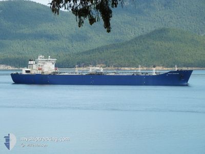
POLAR ADVENTURE
Crude Oil Tanker
Current Trip
| Time Travelled | 4 days |
|---|---|
| Remaining Time | 1 day |
| Distance Travelled | 1230.80 nm |
| Remaining Distance | 537.65 nm |
| AVG Speed | 11.6 Knots |
| MAX Speed | 15.2 Knots |
| AVG Wind | 12.1 knots |
| MAX Wind | 23.3 knots |
| MIN Temp | 8.6°C / 47.48°F |
| MAX Temp | 14.5°C / 58.1°F |
| Draught | 17.5 m |
| Position Received | 2 d ago |
Current Position
| Longitude | -129.04133° |
|---|---|
| Latitude | 44.97383° |
| Status | Under way using engine |
| Speed | 10.4 Knots |
| Course | 330.8° |
| Area | North Pacific Ocean |
| Station | T-AIS |
| Position Received | 2 d ago |
Information
The current position of POLAR ADVENTURE is in North Pacific Ocean with coordinates 44.97383° / -129.04133° as reported on 2025-06-09 14:30 by AIS to our vessel tracker app. The vessel's current speed is 10.4 Knots and is heading at the port of VALDEZ. The estimated time of arrival as calculated by MyShipTracking vessel tracking app is 2025-06-13 19:30 LT
The vessel POLAR ADVENTURE (IMO: 9244063, MMSI: 303031000) is a Crude Oil Tanker that was built in 2004 ( 21 years old ). It's sailing under the flag of [US] USA.
In this page you can find informations about the vessels current position, last detected port calls, and current voyage information. If the vessels is not in coverage by AIS you will find the latest position.
The current position of POLAR ADVENTURE is detected by our AIS receivers and we are not responsible for the reliability of the data. The last position was recorded while the vessel was in Coverage by the Ais receivers of our vessel tracking app.
The current draught of POLAR ADVENTURE as reported by AIS is 17.5 meters
Weather
| Temperature | 8.6°C / 47.48°F |
|---|---|
| Wind Speed | 14 knots |
| Direction | 260° W |
| Pressure | 1023 hPa |
| Humidity | 75.7 % |
| Cloud Coverage | 15 % |
Featured Company
Last Port Calls
| Port | Arrival | Departure | Time In Port |
|---|---|---|---|
| 2025-06-06 15:29 | 2025-06-07 13:28 | 21 h | |
| 2025-06-03 05:04 | 2025-06-05 00:17 | 1 d | |
| 2025-05-25 12:56 | 2025-05-26 05:32 | 16 h | |
| 2025-05-19 13:08 | 2025-05-20 13:28 | 1 d | |
| 2025-05-16 03:31 | 2025-05-16 23:29 | 19 h | |
| 2025-05-10 00:52 | 2025-05-10 17:28 | 16 h | |
| 2025-05-01 06:42 | 2025-05-02 09:41 | 1 d | |
| 2025-04-29 07:05 | 2025-04-29 23:59 | 16 h | |
| 2025-04-24 20:16 | 2025-04-25 13:36 | 17 h | |
| 2025-04-14 01:18 | 2025-04-15 03:37 | 1 d |
Most Visited Ports (Last year)
| Port | Arrivals | |
|---|---|---|
| 15 | ||
| 15 | ||
| 6 | ||
| 5 | ||
| 3 | ||
| 3 |
Last Trips
| Origin | Departure | Destination | Arrival | Distance | |
|---|---|---|---|---|---|
| 2025-06-04 17:17 | 2025-06-06 08:29 | 460.86 nm | |||
| 2025-05-25 21:32 | 2025-06-02 22:04 | 2112.28 nm | |||
| 2025-05-20 06:28 | 2025-05-25 04:56 | 1774.85 nm | |||
| 2025-05-16 16:29 | 2025-05-19 06:08 | 909.40 nm | |||
| 2025-05-10 09:28 | 2025-05-15 20:31 | 1259.43 nm | |||
| 2025-05-02 02:41 | 2025-05-09 16:52 | 1250.39 nm | |||
| 2025-04-29 16:59 | 2025-04-30 23:42 | 22.49 nm | |||
| 2025-04-25 05:36 | 2025-04-29 00:05 | 1268.99 nm | |||
| 2025-04-14 20:37 | 2025-04-24 12:16 | 1250.32 nm | |||
| 2025-04-13 15:40 | 2025-04-13 18:18 | 23.33 nm |
Events
| Time | Event | Details | Position / Dest | Info |
|---|---|---|---|---|
| 2025-06-09 14:52 | Status Changed | Default Under way using engine |
45.03170 / -129.08405
US VDZ
|
Speed: 10.4 kn Course: 330.8° |
| 2025-06-09 14:30 | OUT of Coverage |
44.97383 / -129.04133
North Pacific Ocean
US VDZ
|
Speed: 10.4 kn Course: 330.8° |
|
| 2025-06-09 13:52 | Status Changed | Under way using engine Default |
44.87317 / -128.96702
US VDZ
|
Speed: 10.8 kn Course: 332° |
| 2025-06-09 13:48 | Status Changed | Default Under way using engine |
44.86282 / -128.95970
US VDZ
|
Speed: 11.1 kn Course: 331.6° |
| 2025-06-09 13:34 | Change Sea Area | High seas of the North Pacific Ocean United States part of the North Pacific Ocean |
44.82592 / -128.93235
North Pacific Ocean
US VDZ
|
Speed: 11 kn Course: 332.3° |
| 2025-06-09 13:32 | Status Changed | Under way using engine Default |
44.82042 / -128.92835
US VDZ
|
Speed: 10.9 kn Course: 331° |
| 2025-06-09 13:32 | IN Coverage |
44.82592 / -128.93235
North Pacific Ocean
US VDZ
|
Speed: 11 kn Course: 332.3° |
|
| 2025-06-09 12:05 | Status Changed | Default Under way using engine |
44.58575 / -128.75603
US VDZ
|
Speed: 10.9 kn Course: 332° |
| 2025-06-09 12:02 | Status Changed | Under way using engine Default |
44.57680 / -128.74933
US VDZ
|
Speed: 11 kn Course: 332° |
| 2025-06-09 12:02 | OUT of Coverage |
44.57680 / -128.74933
North Pacific Ocean
US VDZ
|
Speed: 10.9 kn Course: 332° |