
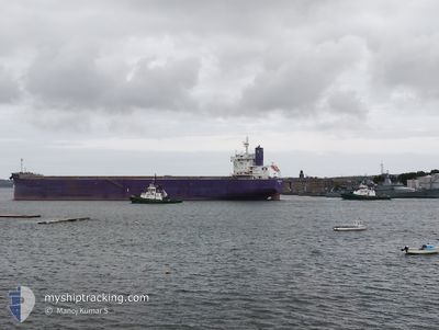
PRESTIGE DIVA
Cargo
Current Trip
EG EDK
| Time Travelled | 2 days |
|---|---|
| Remaining Time | --- |
| Distance Travelled | 72.61 nm |
| Remaining Distance | --- |
| AVG Speed | 5.7 Knots |
| MAX Speed | 8.9 Knots |
| AVG Wind | 24.5 knots |
| MAX Wind | 33 knots |
| MIN Temp | 12.9°C / 55.22°F |
| MAX Temp | 17.2°C / 62.96°F |
| Draught | 11.6 m |
| Position Received | 8 d ago |
Current Position
| Longitude | 16.43962° |
|---|---|
| Latitude | 35.65479° |
| Status | Under way using engine |
| Speed | 12.3 Knots |
| Course | 112° |
| Area | Mediterranean Sea - Eastern Basin |
| Station | T-AIS |
| Position Received | 8 d ago |
Info
Information
The current position of PRESTIGE DIVA is in Mediterranean Sea - Eastern Basin with coordinates 35.65479° / 16.43962° as reported on 2025-01-29 01:10 by AIS to our vessel tracker app. The vessel's current speed is 12.3 Knots
The vessel PRESTIGE DIVA (IMO: 9922287, MMSI: 352001037) is a Cargo It's sailing under the flag of [PA] Panama.
In this page you can find informations about the vessels current position, last detected port calls, and current voyage information. If the vessels is not in coverage by AIS you will find the latest position.
The current position of PRESTIGE DIVA is detected by our AIS receivers and we are not responsible for the reliability of the data. The last position was recorded while the vessel was in Coverage by the Ais receivers of our vessel tracking app.
The current draught of PRESTIGE DIVA as reported by AIS is 11.6 meters
Weather
| Temperature | 13.9°C / 57.02°F |
|---|---|
| Wind Speed | 18 knots |
| Direction | 339° NNW |
| Pressure | 1021.1 hPa |
| Humidity | 56.7 % |
| Cloud Coverage | 92 % |
Featured Company
Last Port Calls
| Port | Arrival | Departure | Time In Port |
|---|---|---|---|
| 2025-02-03 15:37 | 2025-02-04 14:49 | 23 h | |
| 2024-12-17 23:14 | 2024-12-31 04:26 | 13 d |
Last Trips
| Origin | Departure | Destination | Arrival | Distance | |
|---|---|---|---|---|---|
| 2024-12-31 01:26 | 2025-02-03 17:37 | 6951.09 nm | |||
| 2024-10-10 19:20 | 2024-12-17 20:14 | 6991.99 nm |
Events
| Time | Event | Details | Position / Dest | Info |
|---|---|---|---|---|
| 2025-02-06 15:38 | STOP Moving | 5.23 nm, North West of EL DEKHEILA |
31.21669 / 29.74566
EG EDK
|
Speed: 0.2 kn Course: 339° |
| 2025-02-05 13:57 | START Moving | 6.73 nm, North West of EL DEKHEILA |
31.24394 / 29.74103
EG EDK
|
Speed: 3.1 kn Course: 6° |
| 2025-02-04 16:38 | STOP Moving | 6.74 nm, North West of EL DEKHEILA |
31.24155 / 29.73614
EG EDK
|
Speed: 0.2 kn Course: 68° |
| 2025-02-04 14:49 | PORT DEPARTURE |
|
31.15907 / 29.80747
EG EDK
|
Speed: 5 kn Course: 352° |
| 2025-02-04 14:41 | START Moving |
31.14866 / 29.80902
[EG] EL DEKHEILA
|
Speed: 4.4 kn Course: 350° |
|
| 2025-02-03 16:13 | STOP Moving |
31.13668 / 29.80861
[EG] EL DEKHEILA
|
Speed: 0.1 kn Course: 164° |
|
| 2025-02-03 15:37 | PORT ARRIVAL |
|
31.15371 / 29.80793
[EG] EL DEKHEILA
|
Speed: 4.8 kn Course: 172° |
| 2025-02-03 13:50 | START Moving | 5.83 nm, North West of EL DEKHEILA |
31.21065 / 29.72090
EG EDK
|
Speed: 4 kn Course: 185° |
| 2025-01-31 12:17 | STOP Moving | 6.01 nm, North West of EL DEKHEILA |
31.21402 / 29.71983
EG EDK
|
Speed: 0.3 kn Course: 323° |
| 2025-01-29 01:10 | OUT of Coverage |
35.65479 / 16.43962
Mediterranean Sea - Eastern Basin
EG EDK
|
Speed: 12.3 kn Course: 112° |