
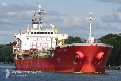
PVT CLARA
Oil/Chemical Tanker
Current Trip
| Time Travelled | 1 day |
|---|---|
| Remaining Time | --- |
| Distance Travelled | 364.22 nm |
| Remaining Distance | --- |
| AVG Speed | 11.3 Knots |
| MAX Speed | 13.7 Knots |
| AVG Wind | 18.9 knots |
| MAX Wind | 35 knots |
| MIN Temp | -0.8°C / 30.56°F |
| MAX Temp | 10.5°C / 50.9°F |
| Draught | 8.7 m |
| Position Received | 5 h, 47 m ago |
Current Position
| Longitude | 16.43736° |
|---|---|
| Latitude | 42.01770° |
| Status | Under way using engine |
| Speed | 13.4 Knots |
| Course | 135.3° |
| Area | Adriatic Sea |
| Station | T-AIS |
| Position Received | 5 h, 47 m ago |
Info
Information
The current position of PVT CLARA is in Adriatic Sea with coordinates 42.01770° / 16.43736° as reported on 2026-01-07 15:33 by AIS to our vessel tracker app. The vessel's current speed is 13.4 Knots and is heading at the port of CONSTANTA. The estimated time of arrival as calculated by MyShipTracking vessel tracking app is 2026-01-12 10:00 LT
The vessel PVT CLARA (IMO: 9442548, MMSI: 352002508) is a Oil/Chemical Tanker that was built in 2009 ( 17 years old ). It's sailing under the flag of [PA] Panama.
In this page you can find informations about the vessels current position, last detected port calls, and current voyage information. If the vessels is not in coverage by AIS you will find the latest position.
The current position of PVT CLARA is detected by our AIS receivers and we are not responsible for the reliability of the data. The last position was recorded while the vessel was in Coverage by the Ais receivers of our vessel tracking app.
The current draught of PVT CLARA as reported by AIS is 8.7 meters
Weather
| Temperature | 10.5°C / 50.9°F |
|---|---|
| Wind Speed | 18 knots |
| Direction | 314° NW |
| Pressure | 1004.8 hPa |
| Humidity | 76.3 % |
| Cloud Coverage | 100 % |
Featured Company
Last Port Calls
| Port | Arrival | Departure | Time In Port |
|---|---|---|---|
| 2026-01-05 16:31 | 2026-01-06 16:33 | 1 d | |
| 2025-12-15 21:15 | 2025-12-15 22:26 | 1 h | |
| 2025-12-14 06:19 | 2025-12-15 20:57 | 1 d | |
| 2025-12-09 21:57 | 2025-12-11 02:54 | 1 d | |
| 2025-12-09 16:42 | 2025-12-09 21:54 | 5 h | |
| 2025-11-18 21:25 | 2025-11-20 16:45 | 1 d |
Most Visited Ports (Last year)
| Port | Arrivals | |
|---|---|---|
| 6 | ||
| 3 | ||
| 3 | ||
| 2 | ||
| 2 | ||
| 2 |
Last Trips
| Origin | Departure | Destination | Arrival | Distance | |
|---|---|---|---|---|---|
| 2025-12-15 22:26 | 2026-01-05 16:31 | 5359.40 nm | |||
| 2025-12-15 20:57 | 2025-12-15 21:15 | 0.61 nm | |||
| 2025-12-11 02:54 | 2025-12-14 06:19 | 415.23 nm | |||
| 2025-12-09 21:54 | 2025-12-09 21:57 | 0.91 nm | |||
| 2025-11-20 16:45 | 2025-12-09 16:42 | 4885.24 nm | |||
| 2025-10-28 20:09 | 2025-11-18 21:25 | 1495.13 nm |
Events
| Time | Event | Details | Position / Dest | Info |
|---|---|---|---|---|
| 2026-01-07 15:37 | Status Changed | Default Under way using engine |
42.00500 / 16.45167
ROCND
|
Speed: 13.4 kn Course: 135.3° |
| 2026-01-07 15:33 | OUT of Coverage |
42.01770 / 16.43736
Adriatic Sea
ROCND
|
Speed: 13.4 kn Course: 135.3° |
|
| 2026-01-07 15:21 | Status Changed | Under way using engine Default |
42.04855 / 16.39486
ROCND
|
Speed: 13.2 kn Course: 134° |
| 2026-01-07 14:43 | Status Changed | Default Under way using engine |
42.14333 / 16.26167
ROCND
|
Speed: 13.1 kn Course: 134.7° |
| 2026-01-07 14:24 | Change Sea Area | Italian part of the Adriatic Sea Croatian part of the Adriatic Sea |
42.19078 / 16.19755
Adriatic Sea
ROCND
|
Speed: 12.9 kn Course: 134.1° |
| 2026-01-07 13:25 | Change Sea Area | Croatian part of the Adriatic Sea Italian part of the Adriatic Sea |
42.33612 / 15.98916
Adriatic Sea
ROCND
|
Speed: 12.5 kn Course: 133° |
| 2026-01-07 12:25 | Change Sea Area | Italian part of the Adriatic Sea Croatian part of the Adriatic Sea |
42.47921 / 15.78828
Adriatic Sea
ROCND
|
Speed: 12.4 kn Course: 135° |
| 2026-01-07 12:05 | Status Changed | Under way using engine Default |
42.52884 / 15.72391
ROCND
|
Speed: 12.4 kn Course: 137° |
| 2026-01-07 12:05 | IN Coverage |
42.52679 / 15.72647
Adriatic Sea
ROCND
|
Speed: 12.5 kn Course: 137.4° |
|
| 2026-01-06 23:00 | OUT of Coverage |
44.66107 / 13.51266
Adriatic Sea
ROCND
|
Speed: 12 kn Course: 145.8° |