
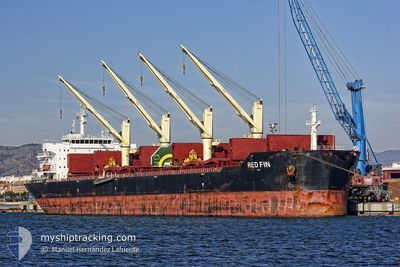
RED FIN
Bulk Carrier
Current Trip
| Time Travelled | 16 days |
|---|---|
| Remaining Time | 1 h, 35 mins |
| Distance Travelled | 4272.69 nm |
| Remaining Distance | 104.76 nm |
| AVG Speed | 10.4 Knots |
| MAX Speed | 14.2 Knots |
| AVG Wind | 15.7 knots |
| MAX Wind | 29 knots |
| MIN Temp | 1.5°C / 34.7°F |
| MAX Temp | 19.2°C / 66.56°F |
| Draught | 6.7 m |
| Position Received | 5 m ago |
Current Position
| Longitude | 25.82520° |
|---|---|
| Latitude | 59.84367° |
| Status | At anchor |
| Speed | 0.3 Knots |
| Course | 278° |
| Area | Gulf of Finland |
| Station | T-AIS |
| Position Received | 5 m ago |
Info
Information
The current position of RED FIN is in Gulf of Finland with coordinates 59.84367° / 25.82520° as reported on 2025-03-20 14:36 by AIS to our vessel tracker app. The vessel's current speed is 0.3 Knots and is heading at the port of UST-LUGA. The estimated time of arrival as calculated by MyShipTracking vessel tracking app is 2025-03-20 19:16 LT
The vessel RED FIN (IMO: 9607306, MMSI: 256610000) is a Bulk Carrier that was built in 2011 ( 14 years old ). It's sailing under the flag of [MT] Malta.
In this page you can find informations about the vessels current position, last detected port calls, and current voyage information. If the vessels is not in coverage by AIS you will find the latest position.
The current position of RED FIN is detected by our AIS receivers and we are not responsible for the reliability of the data. The last position was recorded while the vessel was in Coverage by the Ais receivers of our vessel tracking app.
The current draught of RED FIN as reported by AIS is 6.7 meters
Weather
| Temperature | 3.6°C / 38.48°F |
|---|---|
| Wind Speed | 8 knots |
| Direction | 227° SW |
| Pressure | 1015.9 hPa |
| Humidity | 78.8 % |
| Cloud Coverage | 100 % |
Featured Company
Most Visited Ports (Last year)
| Port | Arrivals | |
|---|---|---|
| 6 | ||
| 3 | ||
| 1 | ||
| 1 | ||
| 1 | ||
| 1 |
Last Trips
| Origin | Departure | Destination | Arrival | Distance |
|---|
Events
| Time | Event | Details | Position / Dest | Info |
|---|---|---|---|---|
| 2025-03-20 14:36 | Status Changed | At anchor Default |
59.84367 / 25.82520
RU ULU
|
Speed: 0.1 kn Course: 277° |
| 2025-03-20 14:24 | Status Changed | Default At anchor |
59.84430 / 25.82491
RU ULU
|
Speed: 0.1 kn Course: 250° |
| 2025-03-20 14:21 | Status Changed | At anchor Default |
59.84432 / 25.82494
RU ULU
|
Speed: 0.2 kn Course: 285° |
| 2025-03-20 13:54 | Status Changed | Default At anchor |
59.84428 / 25.82495
RU ULU
|
Speed: 0.2 kn Course: 290° |
| 2025-03-20 13:42 | Status Changed | At anchor Default |
59.84335 / 25.82535
RU ULU
|
Speed: 0.2 kn Course: 279° |
| 2025-03-20 13:24 | Status Changed | Default At anchor |
59.84363 / 25.82521
RU ULU
|
Speed: 0.2 kn Course: 270° |
| 2025-03-20 13:18 | Status Changed | At anchor Default |
59.84365 / 25.82515
RU ULU
|
Speed: 0.2 kn Course: 249° |
| 2025-03-20 13:12 | Status Changed | Default At anchor |
59.84424 / 25.82512
RU ULU
|
Speed: 0.1 kn Course: 251° |
| 2025-03-20 13:09 | Status Changed | At anchor Default |
59.84434 / 25.82493
RU ULU
|
Speed: 0.1 kn Course: 263° |
| 2025-03-20 13:03 | IN Coverage |
59.84434 / 25.82493
Gulf of Finland
|
Speed: 0.1 kn Course: 46° |